

September 2025
Event details




Event Description
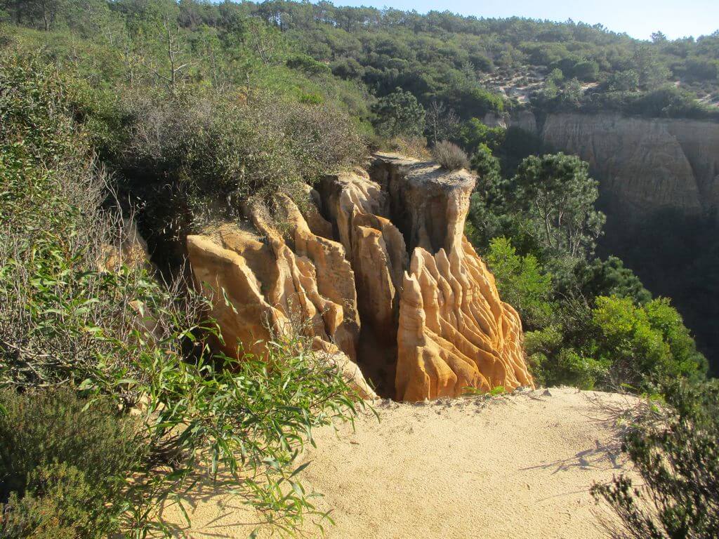
This proposed walk starts at Fonte da Telha, in the Mata dos Medos area, and from there goes along various cliffs, trails and sandy beaches until we reach the Albufeira Lagoon. The route puts before our eyes the beautiful formations of the Arrábida Fossil mountain range of Costa da Caparica, which take on different shades of gold depending on the time of day, as well as the characteristic vegetation of the dunes by the sea. Another event not to be missed!
Albufeira Lagoon
Lagoa de Albufeira is located on the western edge of the Setúbal Peninsula, in the Caparica - Espichel coastal arc, about 20 kilometres south of Lisbon. It is a place of unusual beauty, where the sea, the lagoon and extensive pine forests come together. The lagoon has unusual characteristics and is ideal for sport fishing, sailing and windsurfing.
It is made up of two main lagoon bodies connected by a narrow, sinuous and shallow channel: Lagoa Pequena, which is more inland and shallower, and Lagoa Grande, with maximum depths of around 15 metres.
The Fossil Plain of Costa da Caparica
The Fossil Cliff is made up of a succession of sedimentary rock strata, some of the most important in Western Europe, whose origin dates back to the Pliocene period, around 10 million years ago. At that time, the sea reached the base of the cliff, but over time it receded due to the movement of the tectonic plates of the earth's crust and the action of the 1755 earthquake, which gave rise to the coastal plain on which the dunes predominate. As they threatened to advance inland towards the farmland, in the 18th century King João V ordered the Mata dos Medos to be planted, which was so named not because it was a dangerous place, but because médão or medo also means dune.
Some of the points of interest on the walk
- Praia da Fonte da Telha - Mata dos Medos - Pinheiro-Manso and Aroeira Forest - Costa da Caparica Fossil Arriba - Albufeira Lagoon - Natural landscapes -
Location
Meeting Point
Car park on the dead-end access road to the NATO Iberia Station premises
At the end of Avenida do Mar, turn left (after passing Aroeira).
Fonte da Telha
2825 Costa da Caparica
Latitude: 38°33’38.56″N
Longitude: 9°11’8.23″W
Meeting time: 9.30am
Estimated final time: 13h45
Route Features and Equipment
Circular
Circuit
Equipment
Suitable footwear, boots or shoes with good grip
Suitable clothing for hiking
Take at least 1.5 litres of water
Hat
Sunscreen