

January 2021
Event details



Event Description
In this proposed event, we're going to take a long walk through 3 municipalities (Arruda dos Vinhos, Sobral de Monte Agraço and Loures), passing 3 important forts of the Lines of Defence of Torres Vedras, namely Forte do Alqueidão, Forte da Carvalha and Forte da Ajuda, with the opportunity to see excellent panoramic views of the whole region, we'll walk along rural paths and trails, and we'll also pass by some of the mills that are so characteristic of this area. Another event not to be missed, well suited to keen walkers!
Alqueidão Fort
At an altitude of 439 metres, let yourself be enveloped by the majestic landscape. Your gaze crosses the 1st and 2nd Lines of Defence. From the Tagus to the Atlantic, you can see several fortifications whose information panels will help you interpret them. The visitor is now at the heart of a military architectural complex that is unrivalled in Europe. You'll easily understand why the geographical position of Alqueidão was the centre of Wellesley's defensive strategy, making it the Command Post of the Lines.
Its construction, which began on 4 November 1809, covered an area of 3.5 hectares and included a wide variety of military structures (armouries, fire hydrants, small redoubts and beams). Given its mission, it was the only one garrisoned with line troops, with General Pack's brigade in October 1810 and, by decision of William Beresford, it had the exceptional creation of two artillery companies of orderlies - the Artillery Companies of the Village of Sobral.
Carvalha Fort
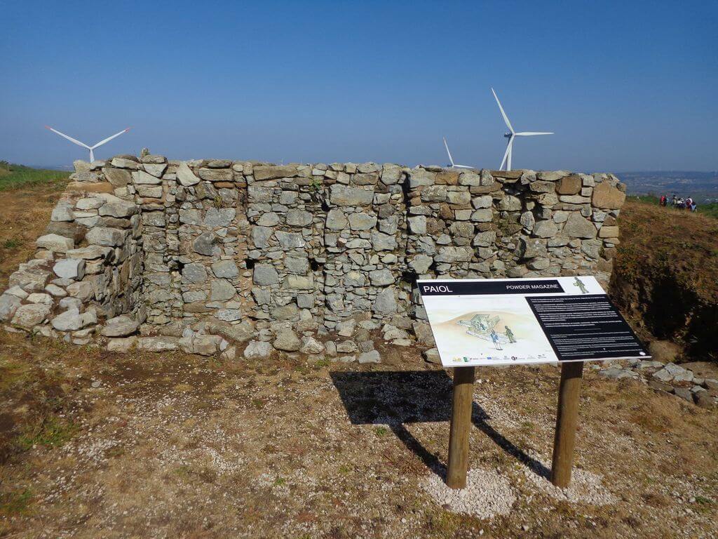
The Carvalha Fort is the highest point in the entire municipality of Arruda dos Vinhos, and the various gunboats that housed heavy artillery pieces have been preserved. Located next to the town of Carvalha, at the highest point in the municipality, it protected the Arruda Valley along with the Cego Fort, allowing crossfire on the enemy in the event of an attempt to break through. In defensive terms, the gunboats had a slabbed floor, with the ground previously prepared by filling in stones with mortar. They also had a traverse built into the ground, which served as protection against enemy fire.
Ajuda Grande Fort/Redoubt
The Ajuda Grande Redoubt is located to the north of the parish of Bucelas, near the village of Alrota, on a platform that allows you to visualise a vast area. It's an excellent scenic spot and, at the same time, provides an insight into the strategy behind the construction of this defensive system. This military field work was part of the 2nd Defence Line and was part of a group of fortifications that protected the territory between the Tagus and the Bucelas Gorge, crossed by the road from Vila Franca to Alverca and the road from Sobral to Tojal, passing through Arranhó and Bucelas. This Redoubt has a composite plan, consisting of two coupled bastions, with three entrances. It is surrounded by a moat carved out of the rock at some points. Outside, it has an elbowed traverse that defends one of the north-facing entrances. Inside there is an armoury, a total of five gunboats and two beams, one of them also in an elbow, which reinforces the defensive dynamics of the entrances
Some of the points of interest on the walk
- Fort of Alqueidão - Fort of Ajuda Grande - Fort of Ajuda Pequeno - Fort of Carvalha - Arranhó - Chapel of Carvalha - Parish Church of S. Lourenço - Louriceira de Baixo - Natural landscapes -
Location
Meeting Point
Next to the headquarters of the Arranhó Recreational and Sports Union
Rua União Recreativa e Desportiva de Arranhó
2630-030 Scratch
Latitude: 38°57'11.82″N
Longitude: 9° 8'6.20″W
Meeting time: 9h30
Estimated end time: 16h30
Route Features and Equipment
Circular
Circuit
Equipment
Footwear and clothing suitable for hiking