

Location Arrábida
October
Timetable
(Sunday) 9:50 - 13:30
Meeting Point
Arrábida Convent
Event details
[fusion_builder_container admin_label="" hundred_percent="no" equal_height_columns="no" menu_anchor="" hide_on_mobile="small-visibility,medium-visibility,large-visibility" class="" id="" background_color="" background_image="" background_position="center center" background_repeat="no-repeat" fade="no" background_parallax="none" enable_mobile="no" parallax_speed="0.3" video_mp4="" video_webm="" video_ogv="" video_url="" video_aspect_ratio="16:9" video_loop="yes" video_mute="yes" video_preview_image="" border_color="#ea1717" border_style="solid" margin_top="10px" margin_bottom="10px" padding_top="25px"
Event details




Event Description
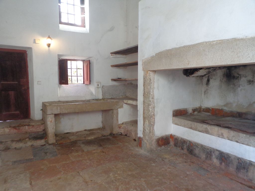
On this event, we'll take a guided tour of the Arrábida Convent. We'll also use the morning to visit the Lapa da Gruta de Santa Margarida and take a short walk to one of the nearby beaches.
Arrábida Convent:
The Arrábida Convent, built in the 16th century, covers 25 hectares, including the Old Convent, located on the highest part of the mountain, the New Convent, located halfway up the slope, the Garden and the Bom Jesus Sanctuary.
At the top of the mountain, the four chapels, the set of guardhouses for venerating the mysteries of the Passion and some cells carved into the rocks form what is known as the Old Convent.
The convent was founded in 1542 by Friar Martinho de Santa Maria, a Castilian Franciscan to whom João de Lencastre (1501-1571), the first Duke of Aveiro, ceded the land on the mountainside.
Prior to construction, the Ermida da Memória existed where the Old Convent is today, a place of great pilgrimages, where the first four Arrábidos friars lived for two years in cells carved out of the rocks: Martinho de Santa Maria, Diogo de Lisboa, Francisco Pedraita and São Pedro de Alcântara. D. Jorge de Lencastre, son of the 1st Duke of Aveiro, continued the work by having a fence built to enclose the convent area. Later, his cousin D. Álvaro had the guesthouse built and designed the guardhouses on the crest of the hill that connect the convent to the foot of the mountain, leaving three unfinished. Ana Manique de Lara, Álvaro's daughter-in-law, had two chapels built, while Álvaro's son, António de Lencastre, had the Sanctuary of Bom Jesus built in 1650.
With the extinction of the religious orders in 1834, the convent, the cells and the chapels scattered throughout the mountains were plundered and badly damaged as a result of abandonment.
In 1863, the Casa de Palmela acquired the convent, but work didn't begin until the 40s and 50s of the following century. Forty years later, in 1990, its then owner, Manuel de Souza Holstein Beck, sold the convent and the surrounding area, totalling 25 hectares, to the Fundação Oriente, the only institution that, in his opinion, gave guarantees of maintaining the same values with which, in the 16th century, his ancestors handed it over to the Arrábidos.
Lapa da Gruta de Santa Margarida:
Located at the foot of the Serra da Arrábida, by the sea, which can be reached by boat or by land via a path built there by a hermit, descending some 200 stone steps to the site, the Lapa de Stª Margarida cave is an unusual place that is still visited today, where there is a dilapidated chapel built there in the 17th century. There used to be three images there (of Our Lady of the Conception, St Anthony and St Margaret) but they have disappeared over time and one of them is kept in the Arrábida Convent.
There were many pilgrimages to this place in past centuries, especially the Syrian fishermen who came in their boats decked out from all over, and the atmosphere became festive but one of authentic spiritual recollection, where people prayed and sang united by the same feeling of faith regardless of their personal convictions. This is no longer the case today, and the place is somewhat neglected.
The cave measures around 22 metres in length (the number of Elders or Wise Men) but as it connects in some parts with other smaller parts, it measures a total of 40 metres (a number referred to several times in the Bible as a marker of important events. For example: the 40 days and 40 nights of rain in the Flood, the 40 days that Moses spent on Mount Sinai, the 40 days that Jesus spent in the desert, etc.), and it can hold up to 400 or 500 people who, in the past, during the liturgical act in praise of the Saint venerated there, in Sung Mass, with torches in hand, gave the ceiling (made of stalactites) surprising effects that impressed our vision. In this cave, the most beautiful and fine water also flowed from a fountain that has since stopped flowing for reasons that may have to do with obstructions from rocks or dry branches in the water's path through the mountains, as happened in a fountain at the Arrábida Convent that has since been cleared.
Note: In the summer months when the dates of the visit coincide with traffic restrictions on the Arrábida beaches, the visit to Lapa de Santa Margarida will not take place and will be replaced by another point of interest in the Serra da Arrábida.
Location
Meeting Point
Arrábida Convent
Apartado 28 - EN 379-1
2925 Azeitão
Latitude: 38º 28'' 27.34N
Longitude: 8º 59'' 45.05W
Meeting time: 9h 50m
Estimated end time: 13h30
Route Features and Equipment
Circular
Circuit
Equipment
Footwear and clothing suitable for hiking
RESERVE
CLOSED EVENT
REGISTER NOW
25€ per person
- Free - 6 to 12 years old
Includes:
- Guidance and support
- Personal accident insurance
- Civil liability insurance
Not included:
- All items not mentioned.
Comments:
- Only registrations made by 4.30pm on the day before the event will be eligible for Personal Accident Insurance.
- PLACES WILL BE FILLED WHEN PROOF OF PAYMENT IS RECEIVED
Data collection:
Personal information Name, date of birth and VAT number are required for personal accident insurance purposes.
Book:
After successfully submitting the bookingYou will be redirected to a confirmation page. If you have any difficulties making a booking, please contact contact us.
Registration Form
"*" indicates required fields
24out9:3014:30Walking on the Arrábida coast9:30 - 14:30 Rua do Portinho da ArrábidaEvent type:Hiking
Timetable
(Saturday) 9:30 - 14:30
Meeting Point
Rua do Portinho da Arrábida
Event details
[fusion_builder_container admin_label="" hundred_percent="no" equal_height_columns="no" menu_anchor="" hide_on_mobile="small-visibility,medium-visibility,large-visibility" class="" id="" background_color="" background_image="" background_position="center center" background_repeat="no-repeat" fade="no" background_parallax="none" enable_mobile="no" parallax_speed="0.3" video_mp4="" video_webm="" video_ogv="" video_url="" video_aspect_ratio="16:9" video_loop="yes" video_mute="yes" video_preview_image="" border_color="#ea1717" border_style="solid" margin_top="10px" margin_bottom="10px" padding_top="25px"
Event details






Event Description
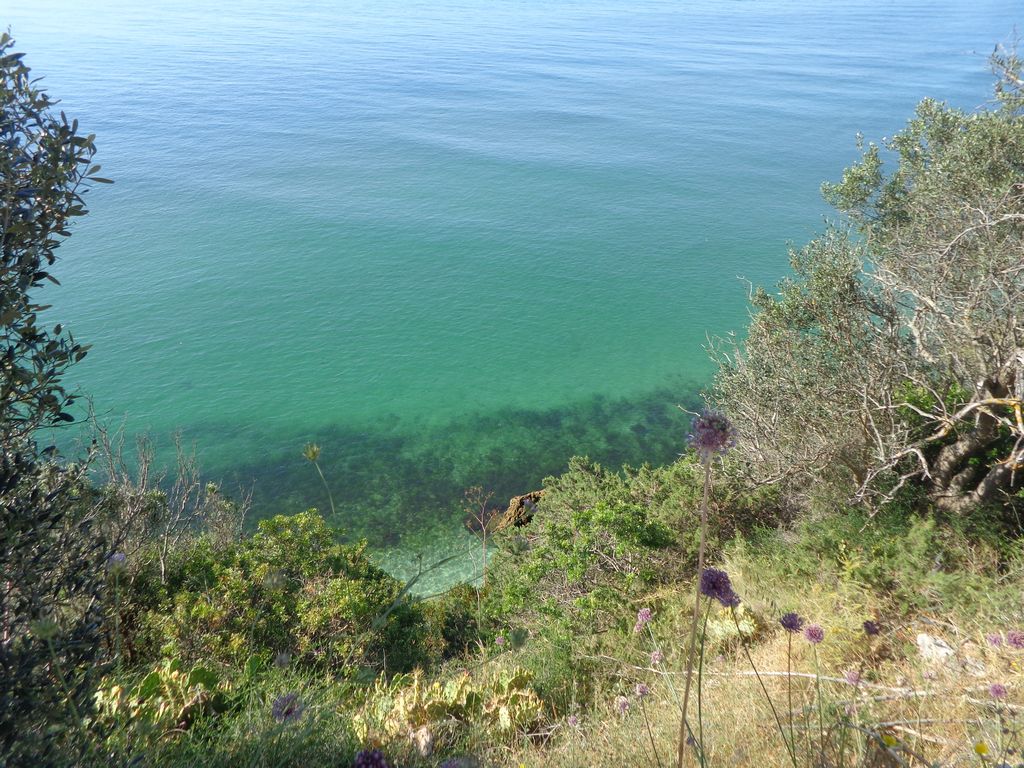
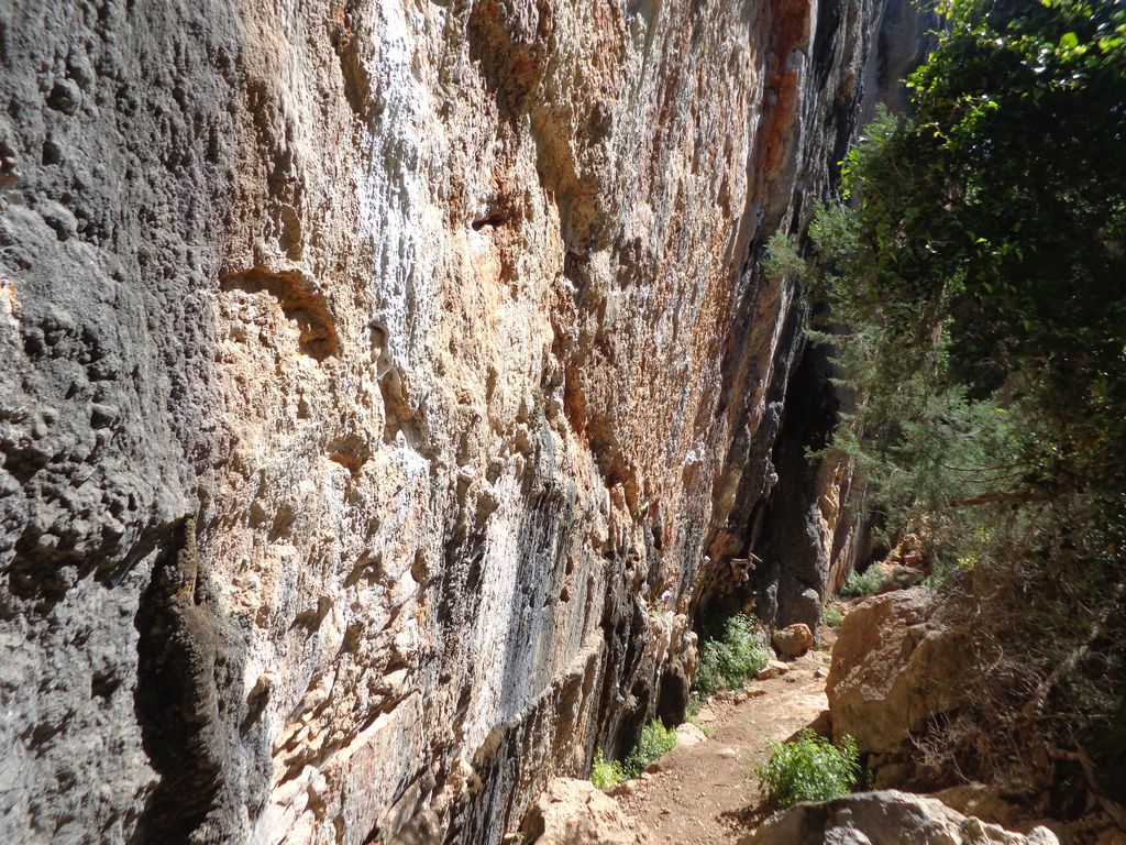
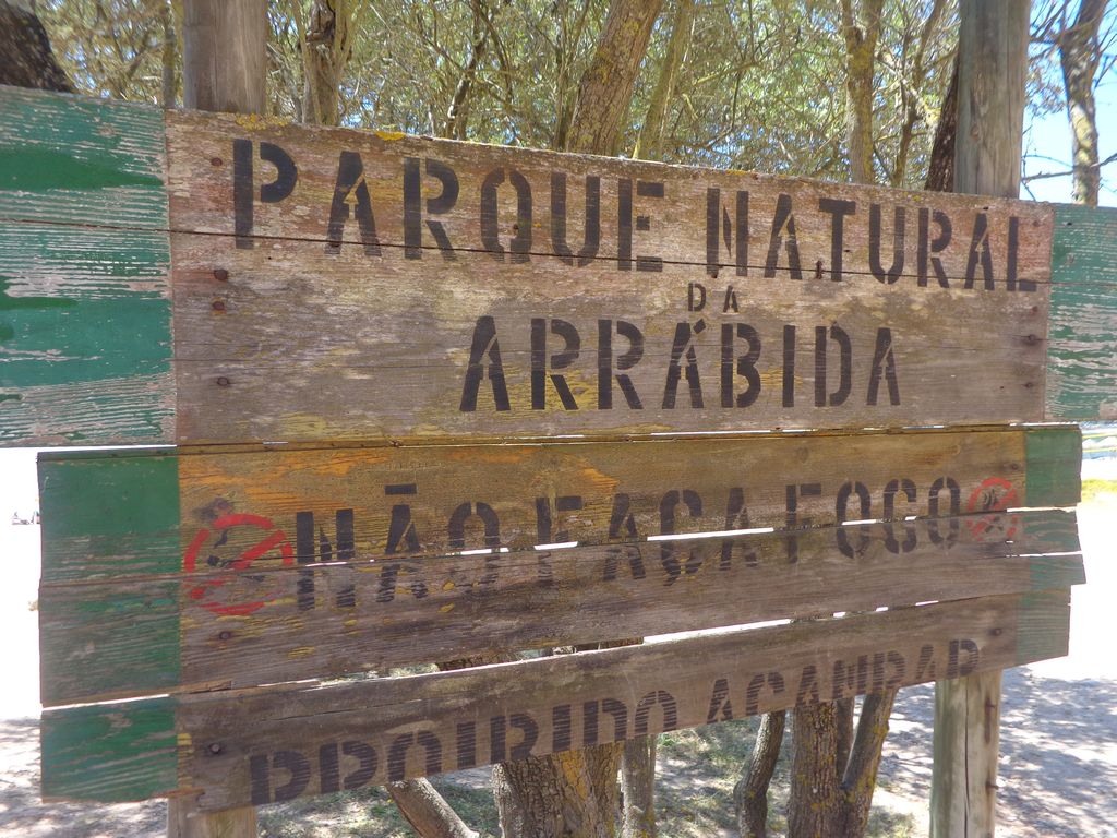
This proposed walk starts next to Casa do Gaiato, on the access road to Portinho da Arrábida, and goes along a succession of beaches, all of them of enormous beauty, integrated into the landscape of the Arrábida Natural Park. We'll pass through places of great natural beauty, with very pleasant scenery, from Praia de Alpertuche to Praia de Galápos, not forgetting the emblematic Gruta da Lapa de Santa Margarida.
Ruins of Creiro:
In the Serra da Arrábida, next to Praia do Creiro, are the ruins of a Roman fish-salting factory and a bathhouse. In Roman times, the wealth of fish and salt at the mouth of the River Sado led to the creation of an industrial complex for the production of salted fish, centred on the cities of Cetóbriga and Tróia, but with small production units elsewhere, such as Creiro. This production of sauces and salting was large enough to be exported to other regions of the Empire.
Alpertuche Beach:
Alpertuche beach is a small, little-known beach with lots of rocks and clear waters that mainly serves the local residents. It is an unsupervised beach and can be accessed by a sandy road about 100 metres from the junction with Portinho da Arrábida.
Pilots Beach:
A Pilots Beach has a small sandy beach that is completely submerged at high tide. The waters are calm and crystal clear. In the bathing area, there is a large rock that stands out.
Some of the points of interest on the walk
- Praia de Alpertuche - Praia dos Pilotos - Praia do Portinho da Arrábida - Praia do Creiro - Praia dos Coelhos - Praia de Galapinhos - Praia de Galápos - Ruínas do Creiro - Gruta da Lapa de Santa Margarida - Forte de Santa Maria (visit to the museum not included) - Fenda da Arrábida - Natural landscapes -
Location
Meeting Point
In front of the Casa do Gaiato holiday camp, on the access road to Portinho da Arrábida
Latitude: 38°28'15.12″N
Longitude: 8°59'16.69″W
Meeting time: 9.20am
Estimated final time: 14h30
Route Features and Equipment
Circular
Circuit
Equipment
Suitable footwear, boots or shoes with good grip
Suitable clothing for hiking
Take at least 1.5 litres of water
Hat
Sunscreen
Swimsuit if the weather permits
RESERVE
CLOSED EVENT
REGISTER NOW
25€ per person
- Free - 6 to 12 years old
Includes:
- Guidance and support
- Personal accident insurance
- Civil liability insurance
Not included:
- All items not mentioned.
Comments:
- Only registrations made by 4.30pm on the day before the event will be eligible for Personal Accident Insurance.
- PLACES WILL BE FILLED WHEN PROOF OF PAYMENT IS RECEIVED
Data collection:
Personal information Name, date of birth and VAT number are required for personal accident insurance purposes.
Book:
After successfully submitting the bookingYou will be redirected to a confirmation page. If you have any difficulties making a booking, please contact contact us.
Registration Form
"*" indicates required fields
Timetable
(Sunday) 9:30 - 14:00
Meeting Point
Cafeteria Casa da Ti Alice, EM545 . Pedreiras, Sesimbra
Event details
[fusion_builder_container admin_label="" hundred_percent="no" equal_height_columns="no" menu_anchor="" hide_on_mobile="small-visibility,medium-visibility,large-visibility" class="" id="" background_color="" background_image="" background_position="center center" background_repeat="no-repeat" fade="no" background_parallax="none" enable_mobile="no" parallax_speed="0.3" video_mp4="" video_webm="" video_ogv="" video_url="" video_aspect_ratio="16:9" video_loop="yes" video_mute="yes" video_preview_image="" border_color="#ea1717" border_style="solid" margin_top="10px" margin_bottom="10px" padding_top="25px"
Event details




Event Description
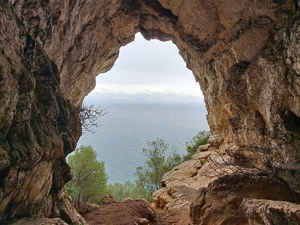
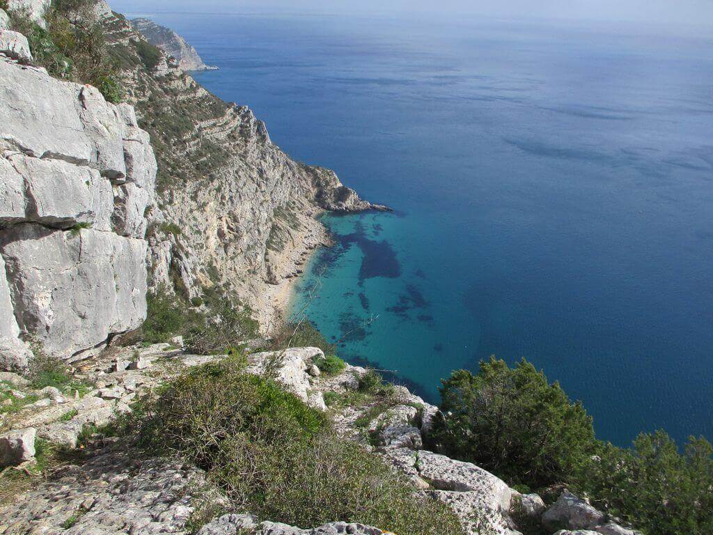
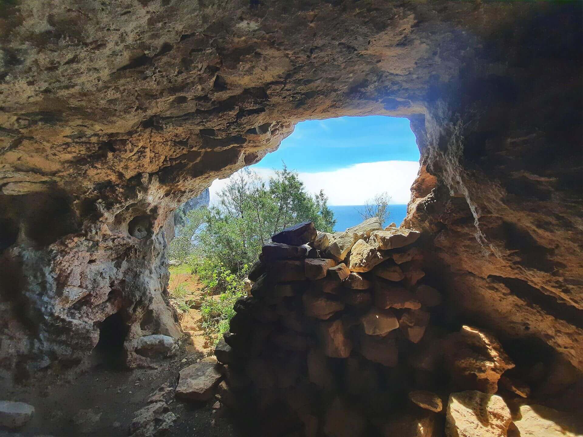
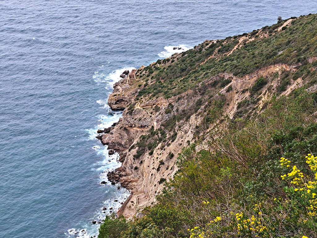
Join us on a unique walk along Sesimbra's enigmatic coastline, where the sea kisses the cliffs and nature hides magical corners. We'll explore two mysterious and symbolic places: Lapa da Cova and Lapa da Santinha.
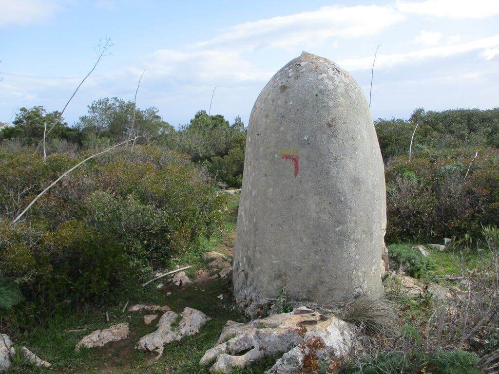
Between coastal trails, impressive rock formations and a constant view of the ocean, this walk takes us along lesser-known paths, where the landscape surprises us at every step.
First the Lapa da Cova, a sanctuary cave with roots in the Iron Age, used by Phoenician peoples, then the Lapa da Santinha, the silent guardian of a sacred place, discreet and enveloping, as if it were hiding secrets from the sea.
These are the highlights of a route where every step is a discovery. Another walk not to be missed|
Lapa da Cova
Lapa da Cova is located on the escarpment corresponding to the southern slope of the Achada mountain range in Sesimbra, near the village of Pedreiras, at an altitude of around 260 metres, clearly visible from a long distance from the sea.
The location of the cave and the artefacts collected during the archaeological work carried out in 2010 - bronze objects associated with rituals, gold jewellery, glass paste adornments, amber and various stones and amphorae - have made it possible to document an occupation during the "Iron Age I" and to propose a cultic use of this site during the Phoenician and Punic colonisation periods.
Located on the western edge of the territories explored by the Phoenicians, with Cape Espichel as a reference point, the sanctuary was in an area of intense maritime traffic associated with commercial traffic, travelled by the vessels that travelled between the estuarine areas of the Sado and Tagus rivers and the Mediterranean.
Some of the points of interest on the walk
- Aldeia das Pedreiras - Lapa da Cova - Serra da Achada - Views and panoramic balconies over Sesimbra - Lapa da Santinha - Natural landscapes -
Location
Meeting Point
Casa da Ti Alice Cafeteria
Quarries - Sesimbra
EM525 43-51,
2970-546 Setúbal
Latitude: 38°27'36.06″N
Longitude: 9° 4'29.15″W
Meeting time: 9.30am
Estimated end time: 14h
Route Features and Equipment
Circular
Circuit
Equipment
Shoes with good grip
Suitable clothing for hiking
Minimum 1.5 litres of water
Sunscreen
Hat
RESERVE
CLOSED EVENT
REGISTER NOW
25€ per person
- Free - 6 to 12 years old
Includes:
- Guidance and support
- Personal accident insurance
- Civil liability insurance
Not included:
- All items not mentioned.
Comments:
- Only registrations made by 4.30pm on the day before the event will be eligible for Personal Accident Insurance.
- PLACES WILL BE FILLED WHEN PROOF OF PAYMENT IS RECEIVED
Data collection:
Personal information Name, date of birth and VAT number are required for personal accident insurance purposes.
Book:
After successfully submitting the bookingYou will be redirected to a confirmation page. If you have any difficulties making a booking, please contact contact us.
Registration Form
"*" indicates required fields
Timetable
(Saturday) 9:30 - 14:00
Meeting Point
Cafeteria Casa da Ti Alice, EM545 . Pedreiras, Sesimbra
Event details
[fusion_builder_container admin_label="" hundred_percent="no" equal_height_columns="no" menu_anchor="" hide_on_mobile="small-visibility,medium-visibility,large-visibility" class="" id="" background_color="" background_image="" background_position="center center" background_repeat="no-repeat" fade="no" background_parallax="none" enable_mobile="no" parallax_speed="0.3" video_mp4="" video_webm="" video_ogv="" video_url="" video_aspect_ratio="16:9" video_loop="yes" video_mute="yes" video_preview_image="" border_color="#ea1717" border_style="solid" margin_top="10px" margin_bottom="10px" padding_top="25px"
Event details


Event Description
This proposed walk starts near the Casa da Ti Alice cafeteria, in the town of Pedreiras. The route follows trails and some rural paths towards the Atlantic Ocean, in perfect communion with nature. We'll also have a fantastic view of the Serra do Risco cliffs, the highest in continental Europe with a height of 381 metres. A breathtaking view of Mother Nature's magnificence. From there we set off on our return journey, passing through Quinta do Calhariz to our starting point. Another event not to be missed!
Arrábida Natural Park:
The Arrábida Natural Park owes its name to the main geomorphological unit of the whole area, the so-called Arrábida mountain range, made up of 3 axes:
- The 1st is made up of small elevations on the outskirts of Sesimbra, the Risco and Arrábida mountains and the hills between Outão and Setúbal;
- the 2nd is formed by the Sierras de S. Luís and dos Gaiteiros; and
- the 3rd formed by the Serra do Louro and Serra de São Francisco.
The orientation of the mountain range is ENE-OSO (alpine orientation) with a length of around 35 kilometres and an average width of 6 kilometres. The maximum altitude is 501 metres at the Formosinho anticline.
The Arrábida mountain range, and the area of plain that surrounds it, has a great diversity of soils, due to the multivariate constitution of the rocky materials that make up the parent rock. The vast majority of the soils are of sedimentary origin, although there are some eruptive intrusions. All the modelling visible in Arrábida today depends not only on aspects linked to tectonics and erosion, but also on the geology of the area, which is largely made up of limestone and dolomitic or detrital rocks.
As is characteristic of regions whose geology is predominantly made up of limestone, the hydrography has aspects specific to this type of constitution, such as the non-perenniality and smallness of the watercourses.
Serra do Risco and Terras do Risco
Legend has it that it was in this Vale do Risco that King Afonso Henriques "risked" dividing his troops, thus creating a death trap for the Moorish troops based at Sesimbra Castle. On the other hand, the presence of the skyline of the highest cliff above the sea on the Portuguese mainland presents itself as a perfect "risk" on the horizon. What is the reason for this name? We may not have an answer on this tour of a mysterious, unexplored area with unique treasures and views, accessing balconies overlooking the sea and travelling along old paths used by smugglers, climbers and, for a long time, the training ground for Portuguese soldiers going off to war overseas.
Some of the points of interest on the walk
- Terras do Risco - Varandas do Risco - Quinta do Calhariz - Natural landscapes -
Location
Meeting Point
Casa da Ti Alice Cafeteria
Quarries - Sesimbra
EM525 43-51,
2970-546 Setúbal
Latitude: 38°27'36.06″N
Longitude: 9° 4'29.15″W
Meeting time: 9.30am
Estimated end time: 14h
Route Features and Equipment
Circular
Circuit
Equipment
Shoes with good grip
Suitable clothing for hiking
Minimum 1.5 litres of water
Sunscreen
Hat
RESERVE
CLOSED EVENT
REGISTER NOW
25€ per person
- Free - 6 to 12 years old
Includes:
- Guidance and support
- Personal accident insurance
- Civil liability insurance
Not included:
- All items not mentioned.
Comments:
- Only registrations made by 4.30pm on the day before the event will be eligible for Personal Accident Insurance.
- PLACES WILL BE FILLED WHEN PROOF OF PAYMENT IS RECEIVED
Data collection:
Personal information Name, date of birth and VAT number are required for personal accident insurance purposes.
Book:
After successfully submitting the bookingYou will be redirected to a confirmation page. If you have any difficulties making a booking, please contact contact us.
Registration Form
"*" indicates required fields
Timetable
(Saturday) 20:30 - 23:30
Meeting Point
Wine Love - Rua D. Maria I, Jardim da Alameda, 2950-772 Palmela
Event details
[fusion_builder_container admin_label="" hundred_percent="no" equal_height_columns="no" menu_anchor="" hide_on_mobile="small-visibility,medium-visibility,large-visibility" class="" id="" background_color="" background_image="" background_position="center center" background_repeat="no-repeat" fade="no" background_parallax="none" enable_mobile="no" parallax_speed="0.3" video_mp4="" video_webm="" video_ogv="" video_url="" video_aspect_ratio="16:9" video_loop="yes" video_mute="yes" video_preview_image="" border_color="#ea1717" border_style="solid" margin_top="10px" margin_bottom="10px" padding_top="25px"
Event details


Event Description
On Halloween night, you're invited to walk with us through the shadows of the Serra do Louro, where the wind whispers ancient secrets and reveals what the day hides.
With the castle of Palmela watching us in the distance, we'll dive into a walk where every breath of wind can be a warning, and every shadow... a companion.
Are they echoes from the past? Or presences that still roam the hillsides?
The walk takes us towards Serra do Louro, past the Windmills and the Chibanes Hillfort - a fortified settlement that dates back to the 3rd millennium BC and was occupied by the Romans. Then we'll head to the tombs of Quinta do Anjo, where it is said that souls have never ceased to watch over their own graves. At night, when the mountains fall silent, some people swear they hear chanting in the distance... and footsteps that follow the group in silence.
Between trails, farms and silent pine forests, you'll feel the pulse of Palmela's forgotten stories. Bring your torch, your courage... and watch out for those walking beside you. Another event not to be missed!
Some of the points of interest on the walk
- Serra do Louro - Castro de Chibanes - Sepulchres of Quinta do Anjo - Panoramic views and balconies - Windmills - Natural landscapes -
Location
Meeting Point
2950-772 Palmela
Latitude: 38° 34′ 14.492″ N
Longitude: 8° 54′ 21.493″ W
Meeting time: 20.30pm
Estimated end time: 23h30
Route Features and Equipment
Circular
Circuit
Equipment
Shoes with good grip
Suitable clothing for hiking
Minimum 1.5 litres of water
Lantern or front
RESERVE
CLOSED EVENT
REGISTER NOW
25€ per person
- Free - 6 to 12 years old
Includes:
- Guidance and support
- Personal accident insurance
- Civil liability insurance
Not included:
- All items not mentioned.
Comments:
- Only registrations made by 4.30pm on the day before the event will be eligible for Personal Accident Insurance.
- PLACES WILL BE FILLED WHEN PROOF OF PAYMENT IS RECEIVED
Data collection:
Personal information Name, date of birth and VAT number are required for personal accident insurance purposes.
Book:
After successfully submitting the bookingYou will be redirected to a confirmation page. If you have any difficulties making a booking, please contact contact us.
Registration Form
"*" indicates required fields
November
Timetable
(Sunday) 9:30 - 13:30
Meeting Point
Praça da Cultura 87 2890-510 Alcochete
Event details
[fusion_builder_container admin_label="" hundred_percent="no" equal_height_columns="no" menu_anchor="" hide_on_mobile="small-visibility,medium-visibility,large-visibility" class="" id="" background_color="" background_image="" background_position="center center" background_repeat="no-repeat" fade="no" background_parallax="none" enable_mobile="no" parallax_speed="0.3" video_mp4="" video_webm="" video_ogv="" video_url="" video_aspect_ratio="16:9" video_loop="yes" video_mute="yes" video_preview_image="" border_color="#ea1717" border_style="solid" margin_top="10px" margin_bottom="10px" padding_top="25px"
Event details


Event Description
Get ready for a walk through the charming town of Alcochete, where every step is a discovery and every corner tells a story. On this walk, we'll explore the hidden treasures of this riverside pearl by the Tagus. Another event not to be missed!
Alcochete's charms
We start with a walk on the beach by the Tagus and move on to the Tagus promenade with viewpoints offering breathtaking views of the surrounding countryside. Here, we can appreciate the natural beauty that surrounds this picturesque village.
But the walk isn't limited to Alcochete's waterfront, as we make our way through the narrow cobbled streets, we'll reach monuments that tell the story of Alcochete, revealing secrets that have stood the test of time. Each stone and ancient façade shows the glorious past of this town by the river. Already in the heart of the town, where Alcochete's historic churches rise with a quiet majesty, you'll be amazed by the architecture and rich details of these churches, witnesses to the community's past and devotion.
We'll also walk through Sítio das Hortas and Pinhal da Areia, where you'll be immersed in a peaceful and serene atmosphere. Nature will reign, and the tranquillity of this environment will provide a perfect contrast to the hustle and bustle of modern life.
Some of the points of interest on the walk
- Riverside Area - Sítio das Hortas Environmental Centre - Pinhal da Areia - Barrocas Neighbourhood - Nossa Senhora da Vida Church - Viewpoints - Pelourinho - Moinhos Beach - Alcochete Lighthouse - Natural landscapes -
Location
Meeting Point
Latitude: 38°44’48.19″N
Longitude: 8°58’20.88″W
Meeting time: 9.20am
Departure time: 9.30am
Estimated end time: 13.30
Route Features and Equipment
Circular
Circuit
Equipment
Footwear and clothing suitable for hiking
RESERVE
CLOSED EVENT
REGISTER NOW
25€ per person
- Free - 6 to 12 years old
Includes:
- Guidance and support
- Personal accident insurance
- Civil liability insurance
Not included:
- All items not mentioned.
Comments:
- Only registrations made by 4.30pm on the day before the event will be eligible for Personal Accident Insurance.
- PLACES WILL BE FILLED WHEN PROOF OF PAYMENT IS RECEIVED
Data collection:
Personal information Name, date of birth and VAT number are required for personal accident insurance purposes.
Book:
After successfully submitting the bookingYou will be redirected to a confirmation page. If you have any difficulties making a booking, please contact contact us.
Registration Form
"*" indicates required fields
Timetable
(Saturday) 9:30 - 14:00
Meeting Point
Av. José Mourinho 90, 2900-633 Setúbal
Event details
[fusion_builder_container admin_label="" hundred_percent="no" equal_height_columns="no" menu_anchor="" hide_on_mobile="small-visibility,medium-visibility,large-visibility" class="" id="" background_color="" background_image="" background_position="center center" background_repeat="no-repeat" fade="no" background_parallax="none" enable_mobile="no" parallax_speed="0.3" video_mp4="" video_webm="" video_ogv="" video_url="" video_aspect_ratio="16:9" video_loop="yes" video_mute="yes" video_preview_image="" border_color="#ea1717" border_style="solid" margin_top="10px" margin_bottom="10px" padding_top="25px"
Event details


Event Description
Embark on a unique walk through time, where the past blends harmoniously with the present. The “Past by the Sea” walk takes you to explore Setúbal's historical and natural wonders, starting in the stunning Albarquel Urban Park.
Be greeted by the sea breeze as you walk past the Albarquel Fort, a seaside fortress that has witnessed centuries of history. Continue along the Roman Road, where the ancient Romans also walked, leaving behind a trail of stories.
Follow the road to the majestic Forte de São Filipe, an imposing fortress that offers breathtaking panoramic views over the city and the ocean. Marvel at the historic architecture and immerse yourself in Setúbal's rich heritage.
As we make our way down the city streets, we find the vibrant heart of Setúbal, where culture, gastronomy and local hospitality intertwine. Let yourself be carried away by the lively atmosphere as you enjoy a short stroll around the city.
This is a walk that will take you through the centuries, offering a unique insight into Setúbal's past and present, with its fortresses, Roman road and urban charm. Don't miss the chance to explore this fascinating route rich in history.
Some of the points of interest on the walk:
- Albarquel Fort
- St Philip's Fort
- Grelhal Roman road
- Livramento Market
- Natural landscapes
Albarquel Fort
The Albarquel Fort corresponds to the paradigm of Portuguese 17th century military architecture of the period. It is a fortified construction with a trapezoidal plan and a two-storey building. This building also had a small bastion at the south-east apex and a sentry box to the south.
The fort is in the “floor style”, which is characterised by its lack of decoration, a sober and imposing type of military construction. Of the building's few adornments, the friezes, entablatures, gargoyles and the detail of the exterior staircase stand out.
Some of the points of interest on the walk
- Albarquel Urban Park - Albarquel Fort - São Filipe Fort - Grelhal Roman Road - Livramento Market - Riverside area - Natural landscapes -
Location
Meeting Point
Av. José Mourinho 90,
2900-633 Setúbal
(in front of Moto Clube de Setúbal)
Latitude: 38°31’8.70″N
Longitude: 8°54’7.63″W
Meeting time: 9.30am
Estimated end time: 14h
Route Features and Equipment
Circular
Circuit
Equipment
Footwear and clothing suitable for hiking
RESERVE
CLOSED EVENT
REGISTER NOW
25€ per person
- Free - 6 to 12 years old
Includes:
- Guidance and support
- Personal accident insurance
- Civil liability insurance
Not included:
- All items not mentioned.
Comments:
- Only registrations made by 4.30pm on the day before the event will be eligible for Personal Accident Insurance.
- PLACES WILL BE FILLED WHEN PROOF OF PAYMENT IS RECEIVED
Data collection:
Personal information Name, date of birth and VAT number are required for personal accident insurance purposes.
Book:
After successfully submitting the bookingYou will be redirected to a confirmation page. If you have any difficulties making a booking, please contact contact us.
Registration Form
"*" indicates required fields