

Location Ribatejo
October
Timetable
(Sexta-feira) 19:30 - 22:30
Meeting Point
Restaurante "Os Magníficos" - Alverca do Ribatejo
Event details
[fusion_builder_container admin_label="" hundred_percent="no" equal_height_columns="no" menu_anchor="" hide_on_mobile="small-visibility,medium-visibility,large-visibility" class="" id="" background_color="" background_image="" background_position="center center" background_repeat="no-repeat" fade="no" background_parallax="none" enable_mobile="no" parallax_speed="0.3" video_mp4="" video_webm="" video_ogv="" video_url="" video_aspect_ratio="16:9" video_loop="yes" video_mute="yes" video_preview_image="" border_color="#ea1717" border_style="solid" margin_top="10px" margin_bottom="10px" padding_top="25px"
Event details

Event Description
Este ano vamos assinalar o nosso 11º Aniversário através de um Jantar-Convívio entre todos os nossos clientes e amigos, que possam juntar neste agradável momento de comemoração, alegria a partilha entre muitos momentos vividos durante a nossa existência enquanto Agência de Viagens, Agentes de Animação Turística e um dos maiores grupos de eventos da área da grande Lisboa. Se puder venha daí divertir-se e confraternizar nesta noite de 6ª feira. Esperamos por vós!
INSCRIÇÕES APENAS ATÉ DIA 18 DE OUTUBRO
Walking.co.uk
JANTAR A PAGAR NO RESTAURANTE:
Entradas: Diversas
Pratos: A escolher por cada após a inscrição
Bebidas: A escolher por cada após a inscrição
Valor aproximado: 20 a 25€ por pessoa (depende naturalmente das escolhas de cada participante)
Places are limited, so enrolments will be considered on a first-come, first-served basis.
Note: Oferta aos clientes habituais da Caminhando
Some of the points of interest on the walk
• Jantar de Aniversário •
Location
Meeting Point
Restaurante “Os Magníficos”
Av. Cidade de Alverca nº 55, 2615-130 Alverca do Ribatejo
Latitude: 38.8989614
Longitude: -9.0402868
Meeting time: 19h30m
Estimated final time: 22h30
Route Features and Equipment
Circular
Circuit
Equipment
Suitable footwear
Suitable clothing for hiking
Take 1.5 litres of water
Hat
RESERVE
REGISTER NOW
25€ per person
Includes:
- Guidance and support
- Personal accident insurance
- Civil liability insurance
Not included:
- All items not mentioned.
Comments:
- Only registrations made by 4.30pm on the day before the event will be eligible for Personal Accident Insurance.
- PLACES WILL BE FILLED WHEN PROOF OF PAYMENT IS RECEIVED
Data collection:
Personal information Name, date of birth and VAT number are required for personal accident insurance purposes.
Book:
After successfully submitting the bookingYou will be redirected to a confirmation page. If you have any difficulties making a booking, please contact contact us.
Registration Form
"*" indicates required fields
November
Timetable
(Saturday) 9:20 - 14:00
Meeting Point
Next to the Bar / Restaurant of the Olhos D'Água River Beach (Alcanena)
Event details
[fusion_builder_container admin_label="" hundred_percent="no" equal_height_columns="no" menu_anchor="" hide_on_mobile="small-visibility,medium-visibility,large-visibility" class="" id="" background_color="" background_image="" background_position="center center" background_repeat="no-repeat" fade="no" background_parallax="none" enable_mobile="no" parallax_speed="0.3" video_mp4="" video_webm="" video_ogv="" video_url="" video_aspect_ratio="16:9" video_loop="yes" video_mute="yes" video_preview_image="" border_color="#ea1717" border_style="solid" margin_top="10px" margin_bottom="10px" padding_top="25px"
Event details


Event Description
This proposed walk starts next to the Olhos de Água River Beach in Alcanena, continues along the Alviela Aqueduct and crosses the entire floodplain to the Ferraria Bridge. The route runs mostly along the banks of the River Alviela and aims to demonstrate the importance of this resource, both for the region and for supplying water to the population.
The walk also passes the Ponte da Pedra to the Vigário area and arrives at the Ponte da Ferreira, places that are appreciated for their setting in relation to the river. The trail returns on the other side of the river to the Raposeira viewpoint and continues along the cultivated fields, which extend over several hills. Finally, following the rest of the route, we arrive back at the starting point.
Alviela Water Eyes Route" interpretive trail - suggested walk
The Olhos d' Água do Alviela interpretive trail runs from the source of the Alviela to the drain of the Ribeira dos Amiais. The Amiais stream, one of the rare surface watercourses of the Estremadura limestone massif, forms geological structures of rare beauty as it crosses the limestones of the Middle Jurassic. Its geological beauty, surrounded by Mediterranean vegetation that is essentially shrubs, makes this route one of the most attractive in the region. At Lapa da Canada, the Ribeira dos Amiais has found its preferred route for around 200 metres. Further downstream, nature has created an important natural karst structure, the karst window, which allows us to see the stream circulating at depth and various levels of limestone caves formed over millions of years. These caves are now an important maternity shelter for a colony of bats that brings more than 5,000 individuals to the Alviela every year. Before flowing into the River Alviela and flowing back to the surface, the Ribeira dos Amiais has produced a narrow, steep-sided, fluvial- karst canyon that leaves no-one indifferent. At the start of this canyon is the dark well, a karst cavity protected by a concrete dyke which, in the rainy season, spews out water with an intensity that hints at the importance of the massif as a reservoir of fresh underground water. And the Alviela spring, one of the six permanent karst springs in the massif, is the one with the largest flow, has already supplied the city of Lisbon and gives rise to the Alviela river which, in the very first metres of its course, gives us the beautiful Olhos d'Água do Alviela river beach.
Some of the points of interest on the walk
- Olhos D'Água River Beach - Alviela Aqueduct - Pedra Bridge - Vigário - Ferreira Bridge - Raposeira Viewpoint - Alviela River Spring - Poço Escuro - Alviela Living Science Centre -
Location
Meeting Point
Next to the Bar / Restaurant of the Olhos D'Água River Beach (Alcanena)
Latitude: 39°26'42.31″N
Longitude: 8°42'36.92″W
Meeting time: 9.20am
Estimated final time: 14h
Route Features and Equipment
Circular
Circuit
Equipment
Suitable footwear, boots or shoes with good grip
Suitable clothing for hiking
Take at least 1.5 litres of water
Hat
Sunscreen
Swimsuit if the weather permits
RESERVE
REGISTER NOW
25€ per person
Includes:
- Guidance and support
- Personal accident insurance
- Civil liability insurance
Not included:
- All items not mentioned.
Comments:
- Only registrations made by 4.30pm on the day before the event will be eligible for Personal Accident Insurance.
- PLACES WILL BE FILLED WHEN PROOF OF PAYMENT IS RECEIVED
Data collection:
Personal information Name, date of birth and VAT number are required for personal accident insurance purposes.
Book:
After successfully submitting the bookingYou will be redirected to a confirmation page. If you have any difficulties making a booking, please contact contact us.
Registration Form
"*" indicates required fields
Timetable
(Sunday) 9:30 - 13:45
Meeting Point
Alhandra riverside area
Event details
[fusion_builder_container admin_label="" hundred_percent="no" equal_height_columns="no" menu_anchor="" hide_on_mobile="small-visibility,medium-visibility,large-visibility" class="" id="" background_color="" background_image="" background_position="center center" background_repeat="no-repeat" fade="no" background_parallax="none" enable_mobile="no" parallax_speed="0.3" video_mp4="" video_webm="" video_ogv="" video_url="" video_aspect_ratio="16:9" video_loop="yes" video_mute="yes" video_preview_image="" border_color="#ea1717" border_style="solid" margin_top="10px" margin_bottom="10px" padding_top="25px"
Event details


Event Description
This walk starts in the riverside area of Alhandra, next to the Sociedade Euterpe Alhandrense. We'll walk along a good part of the riverside area, arm in arm with the magnificent River Tagus. We'll then take a turn towards excellent panoramic views of the Tagus, the Mouchões and the fertile fields of the Lezíria. The second part of the tour will also take in some paths and trails in a more rural part of the municipality of Vila Franca de Xira, in the parishes of Alhandra, S. João dos Montes and Calhandriz. Highlights of the route include the Mother Church of S. João dos Montes and a visit to the Subserra Municipal Farm. The last section of the walk will pass by the Lines of Torres Vedras viewpoint (the former Boavista stronghold, the starting point of Torres Vedras' 1st Defence Line).
Some of the points of interest on the walk
- Riverside Footpath - Soeiro Pereira Gomes Garden - Cevadeiro Urban Park - River Tagus - Casal da Mata - Farms - St John the Baptist Church - Subserra Municipal Farm - Lines of Torres Vedras Fort - Mills - Lines of Torres Vedras Monument - Natural landscapes -
Location
Meeting Point
Alhandra riverside area
Soeiro Pereira Gomes Square
2600-519 Alhandra
Latitude: 38°55'37.28″N
Longitude: 9° 0'21.57″W
Meeting time: 9h30
Estimated end time: 13h45
Route Features and Equipment
Circular
Circuit
Equipment
Footwear and clothing suitable for hiking
RESERVE
REGISTER NOW
25€ per person
Includes:
- Guidance and support
- Personal accident insurance
- Civil liability insurance
Not included:
- All items not mentioned.
Comments:
- Only registrations made by 4.30pm on the day before the event will be eligible for Personal Accident Insurance.
- PLACES WILL BE FILLED WHEN PROOF OF PAYMENT IS RECEIVED
Data collection:
Personal information Name, date of birth and VAT number are required for personal accident insurance purposes.
Book:
After successfully submitting the bookingYou will be redirected to a confirmation page. If you have any difficulties making a booking, please contact contact us.
Registration Form
"*" indicates required fields
December
Timetable
(Sunday) 9:30 - 13:00
Meeting Point
Largo Humberto Delgado in Cardosas
Event details
[fusion_builder_container admin_label="" hundred_percent="no" equal_height_columns="no" menu_anchor="" hide_on_mobile="small-visibility,medium-visibility,large-visibility" class="" id="" background_color="" background_image="" background_position="center center" background_repeat="no-repeat" fade="no" background_parallax="none" enable_mobile="no" parallax_speed="0.3" video_mp4="" video_webm="" video_ogv="" video_url="" video_aspect_ratio="16:9" video_loop="yes" video_mute="yes" video_preview_image="" border_color="#ea1717" border_style="solid" margin_top="10px" margin_bottom="10px" padding_top="25px"
Event details




Event Description
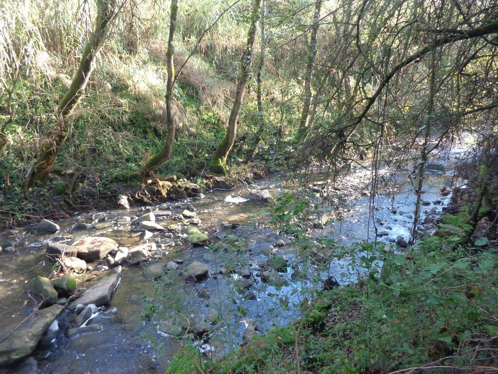
This walk takes place in a rural area between the municipalities of Arruda dos Vinhos and Vila Franca de Xira. It's still possible to find places with fabulous panoramic views very close to Lisbon, excellent trails where you can enjoy nature to the full. The Cardosas and Cachoeiras areas are proof of this.
Our walk will take us through the beautiful valley between the villages of Cardosas and Cachoeiras.
Some of the points of interest on the walk
- Parish Church of Nossa Senhora da Purificação - Cachoeiras Viewpoint - Cardosas Church - Cardosas Viewpoint - Mills - Rossio - Rural landscapes - Trails along the valley -
Location
Meeting Point
Largo Humberto Delgado in Cardosas
Largo Humberto Delgado - 2630-422 Cardosas
Latitude: 38°58’40.16″N
Longitude: 9° 2’26.29″W
Departure time: 9.30am
Estimated end time: 13h
Route Features and Equipment
Circular
Circuit
Equipment
Footwear and clothing suitable for hiking
RESERVE
REGISTER NOW
25€ per person
Includes:
- Guidance and support
- Personal accident insurance
- Civil liability insurance
Not included:
- All items not mentioned.
Comments:
- Only registrations made by 4.30pm on the day before the event will be eligible for Personal Accident Insurance.
- PLACES WILL BE FILLED WHEN PROOF OF PAYMENT IS RECEIVED
Data collection:
Personal information Name, date of birth and VAT number are required for personal accident insurance purposes.
Book:
After successfully submitting the bookingYou will be redirected to a confirmation page. If you have any difficulties making a booking, please contact contact us.
Registration Form
"*" indicates required fields
January
Timetable
(Saturday) 9:30 - 14:30
Meeting Point
Caminho Municipal 1237, n.º 2, Povos 2600-208 Vila Franca de Xira
Event details
[fusion_builder_container admin_label="" hundred_percent="no" equal_height_columns="no" menu_anchor="" hide_on_mobile="small-visibility,medium-visibility,large-visibility" class="" id="" background_color="" background_image="" background_position="center center" background_repeat="no-repeat" fade="no" background_parallax="none" enable_mobile="no" parallax_speed="0.3" video_mp4="" video_webm="" video_ogv="" video_url="" video_aspect_ratio="16:9" video_loop="yes" video_mute="yes" video_preview_image="" border_color="#ea1717" border_style="solid" margin_top="10px" margin_bottom="10px" padding_top="25px"
Event details




Event Description
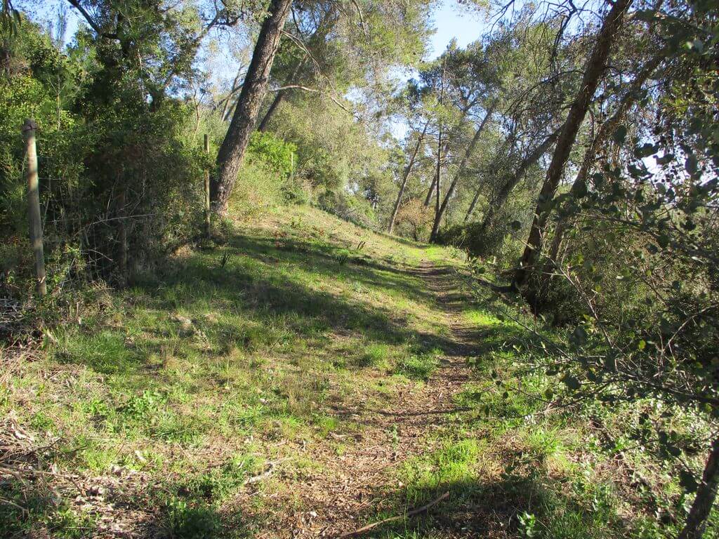
During this event we'll walk through a wooded area with magnificent views of the Lezíria and the River Tagus. Along the way we'll pass the Senhor da Boa Morte viewpoint and the Monte dos Castelinhos archaeological site on a hillside overlooking the River Grande da Pipa. Another event not to be missed!
Chapel of the Lord of Good Death:
Isolated on a terrace with views of the marshes and the Tagus, it is surrounded by the ruins of the manor house of the Count of Castanheira, the remains of the castle and a necropolis. The chapel was built in the 16th century by the Count of Castanheira, D. António de Ataíde, on the site of the old parish church that had been destroyed by the earthquake of 1531. Its chancel is still Gothic and covered in 17th century tiles. Linked to the cult of the Dead Christ, whose devotion grew in the 18th and 19th centuries, much of the decoration is from the 19th century, when the nave was rebuilt, the rocaille paintings commissioned and the altarpiece of the high altar with the sculpture of Christ crucified.
Quinta da Fábrica:
A farm with a vast leisure area and an important agricultural area, its main points of interest are the industrial complex (which was the first tannery in the kingdom - founded in 1729 by João Mendes de Faria) and the private chapel attached to the residential building.
Monte dos Castelinhos:
The site dates back to the Chalcolithic and Iron Age, as well as the Roman period - tegulae, column bricks, loom weights, domestic ceramics, a lucerne and a bronze piece of furniture were discovered - and the medieval period.
Some of the points of interest on the walk
- Walk in the forest area of the municipality of Vila Franca de Xira - Alto do Senhor da Boa Morte viewpoint - 16th century chapel and manor house - Monte dos Castelinhos - Quinta da Fábrica - Natural landscapes -
Location
Meeting Point
LIDL car park in Povos (Vila Franca de Xira)
Latitude: 38°58'31.74″N
Longitude: 8°58'47.12″W
Municipal Road 1237, no. 2, Povos
2600-208 Vila Franca de Xira
Departure time: 9h30
Estimated end time: 14h30
Route Features and Equipment
Circular
Circuit
Equipment
Footwear and clothing suitable for hiking
RESERVE
REGISTER NOW
25€ per person
Includes:
- Guidance and support
- Personal accident insurance
- Civil liability insurance
Not included:
- All items not mentioned.
Comments:
- Only registrations made by 4.30pm on the day before the event will be eligible for Personal Accident Insurance.
- PLACES WILL BE FILLED WHEN PROOF OF PAYMENT IS RECEIVED
Data collection:
Personal information Name, date of birth and VAT number are required for personal accident insurance purposes.
Book:
After successfully submitting the bookingYou will be redirected to a confirmation page. If you have any difficulties making a booking, please contact contact us.
Registration Form
"*" indicates required fields
February
Timetable
(Sunday) 9:30 - 14:00
Meeting Point
Rua Alfredo Keil - 2600-219 Vila Franca de Xira
Event details
[fusion_builder_container admin_label="" hundred_percent="no" equal_height_columns="no" menu_anchor="" hide_on_mobile="small-visibility,medium-visibility,large-visibility" class="" id="" background_color="" background_image="" background_position="center center" background_repeat="no-repeat" fade="no" background_parallax="none" enable_mobile="no" parallax_speed="0.3" video_mp4="" video_webm="" video_ogv="" video_url="" video_aspect_ratio="16:9" video_loop="yes" video_mute="yes" video_preview_image="" border_color="#ea1717" border_style="solid" margin_top="10px" margin_bottom="10px" padding_top="25px"
Event details




Event Description
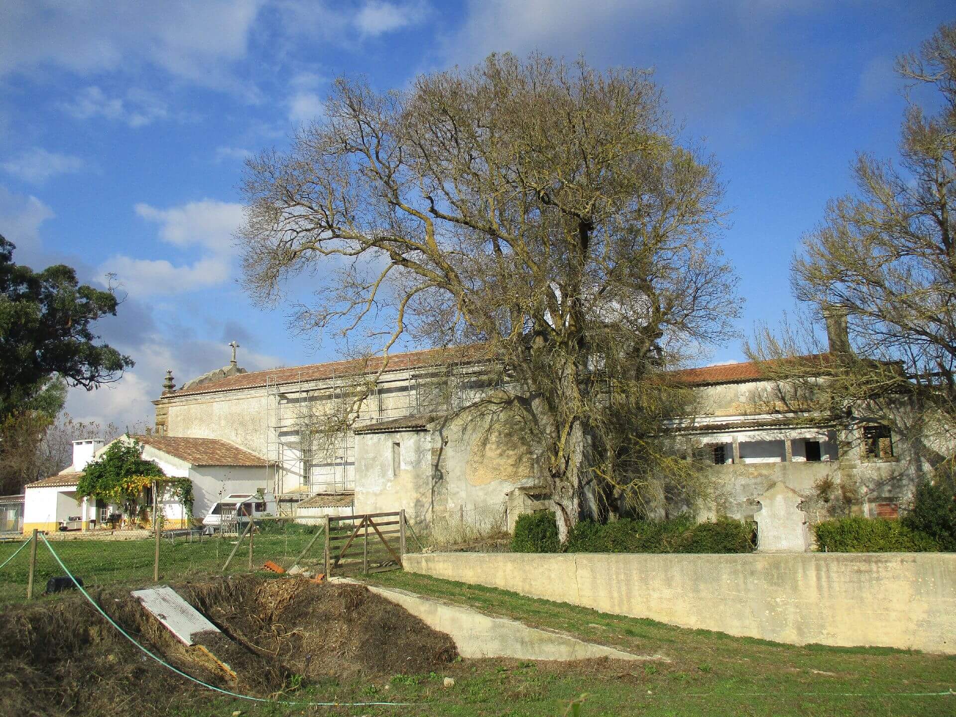
This proposed walk starts next to the Vila Franca de Xira Municipal Swimming Pools and from there we begin our route that takes us to some of the most fantastic viewpoints over the Tagus and the Lezírias, where there will be plenty of climbs that will be an exciting challenge for the group of walkers. The route includes the Miradouro do Sr. da Boa Morte and Monte Gordo, as well as other natural viewpoints! Also noteworthy are the diverse landscapes and rural farms that characterise this part of Ribatejo! Another event not to be missed!
Lord of the Good Death:
It's a natural viewpoint, where the castle of the old town of Povos once stood. From here you can see the Tagus - the great water feature of the region, the Lezírias and the city, feeling surrounded by the mysteries of other times.
Next to this viewpoint, with a terrace resting on the remains of the ramparts of the old castle, there are medieval remains (anthropomorphic graves from the 12th-12th centuries), the ruins of the Ataíde Manor House, Counts of Castanheira and Lords of the Peoples (16th-18th centuries), and the Independence Cross (1940).
The hermitage, the original parish church of Povos (dedicated to Our Lady) and built on a probable Arab morabito, later became a shrine dedicated to the cult of the Dead Lord (15th-18th century). The Feast of the Lord of Good Death takes place on Ascension Thursday and is a municipal holiday. Nearby, we can also discover the Loca da Boa Morte, where a certain popular tradition claims that the miraculous image of the Dead Jesus Christ was discovered in that niche.
Some of the points of interest on the walk
- Santo António Convent - Monte Gordo Viewpoint - Ermida do Sr. da Boa Morte - Viewpoint - Cova da Camela - Natural landscapes over the River Tagus and the Lezírias -
Location
Meeting Point
Vila Franca de Xira Municipal Swimming Pools
Alfredo Keil Street
2600-219 Vila Franca de Xira
Latitude: 38°57’50.85”N
Longitude: 8°59’11.32”W
Departure time: 9h30
Estimated end time: 14h00
Route Features and Equipment
Circular
Circuit
Equipment
Footwear and clothing suitable for hiking
RESERVE
REGISTER NOW
25€ per person
Includes:
- Guidance and support
- Personal accident insurance
- Civil liability insurance
Not included:
- All items not mentioned.
Comments:
- Only registrations made by 4.30pm on the day before the event will be eligible for Personal Accident Insurance.
- PLACES WILL BE FILLED WHEN PROOF OF PAYMENT IS RECEIVED
Data collection:
Personal information Name, date of birth and VAT number are required for personal accident insurance purposes.
Book:
After successfully submitting the bookingYou will be redirected to a confirmation page. If you have any difficulties making a booking, please contact contact us.
Registration Form
"*" indicates required fields