

Location West Zone
October
Timetable
(Saturday) 9:20 - 14:00
Meeting Point
Largo da Igreja Matriz de Cheleiros
Event details
[fusion_builder_container admin_label="" hundred_percent="no" equal_height_columns="no" menu_anchor="" hide_on_mobile="small-visibility,medium-visibility,large-visibility" class="" id="" background_color="" background_image="" background_position="center center" background_repeat="no-repeat" fade="no" background_parallax="none" enable_mobile="no" parallax_speed="0.3" video_mp4="" video_webm="" video_ogv="" video_url="" video_aspect_ratio="16:9" video_loop="yes" video_mute="yes" video_preview_image="" border_color="#ea1717" border_style="solid" margin_top="10px" margin_bottom="10px" padding_top="25px"
Event details




Event Description
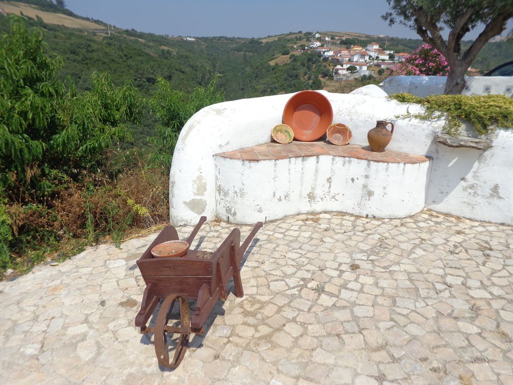
At this event we will walk in an area where there is no shortage of places of interest, be it the Roman Bridge of Cheleiros, the Anços Waterfalls or the well-preserved village of Mata Pequena. Another event not to be missed!
Cheleiros Roman Bridge:
The bridge has a single round arch with a trestle deck and a walled guard. The intrados of the arch reveals the stonework, while all the other surfaces are fully plastered, with the exception of the pavement, which is made up of rolled pebbles.
Penedo do Lexim:
A former volcanic chimney of the Lisbon volcanic complex, Penedo do Lexim has a natural monumentality, almost like a cliff castle.
This elevation, located next to the Ribeira de Cheleiros (now the União das Freguesias de Igreja Nova e Cheleiros), was chosen as a living space for millennia and is one of the most significant archaeological sites in the municipality of Mafra.
This site has recorded occupation phases from various chronological periods, from the Neolithic period (4000 BC) to Roman times.
Around 5,000 years ago, a group of shepherds and farmers settled in Penedo do Lexim and left significant traces of their occupation: everyday artefacts (pottery, chipped and polished stone, worked bone, metal and food remains), living areas (huts) and defensive structures.
This "natural castle" surrounded by cliffs was fortified with walls and is an example of the first defensive architecture to appear in the 3rd millennium BC throughout the Iberian Peninsula.
Some of the points of interest on the walk
- Walk in the west - Cheleiros Roman Bridge - Cheleiros Mother Church - Lizandro River - Mourão River - Mourão River Waterfalls, in Anços - Penedo do Lexim - Mata Pequena Village - Mills - Natural landscapes -
Location
Meeting Point
Largo da Igreja Matriz de Cheleiros
Rua da Sociedade 2640 Cheleiros
Latitude: 38°53'22.04″N
Longitude: 9°19'38.93″W
Meeting time: 9h20
Estimated end time: 14h
Route Features and Equipment
Circular
Circuit
Equipment
Footwear and clothing suitable for hiking
RESERVE
CLOSED EVENT
REGISTER NOW
8€ per person
Includes:
- Guidance and support
- Personal accident insurance
- Civil liability insurance
Not included:
- All items not mentioned.
Comments:
- Only registrations made by 4.30pm on the day before the event will be eligible for Personal Accident Insurance.
- PLACES WILL BE FILLED WHEN PROOF OF PAYMENT IS RECEIVED
Data collection:
Personal information Name, date of birth and VAT number are required for personal accident insurance purposes.
Book:
After successfully submitting the bookingYou will be redirected to a confirmation page. If you have any difficulties making a booking, please contact contact us.
Registration Form
"*" indicates required fields
November
Timetable
(Saturday) 9:20 - 14:30
Meeting Point
Largo da Igreja Matriz do Furadouro (Chapel Square)
Event details
[fusion_builder_container admin_label="" hundred_percent="no" equal_height_columns="no" menu_anchor="" hide_on_mobile="small-visibility,medium-visibility,large-visibility" class="" id="" background_color="" background_image="" background_position="center center" background_repeat="no-repeat" fade="no" background_parallax="none" enable_mobile="no" parallax_speed="0.3" video_mp4="" video_webm="" video_ogv="" video_url="" video_aspect_ratio="16:9" video_loop="yes" video_mute="yes" video_preview_image="" border_color="#ea1717" border_style="solid" margin_top="10px" margin_bottom="10px" padding_top="25px"
Event details










Event Description
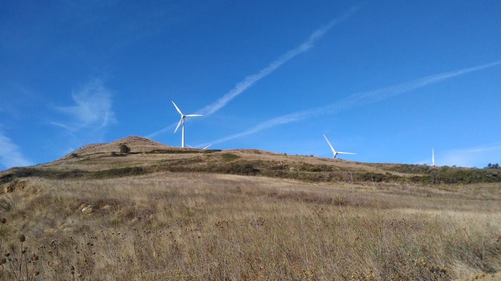
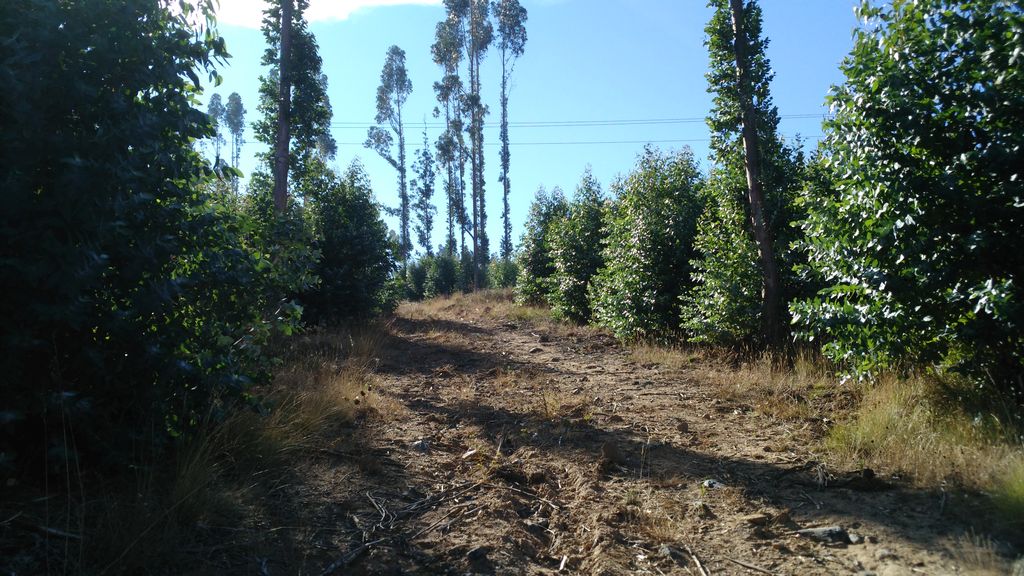
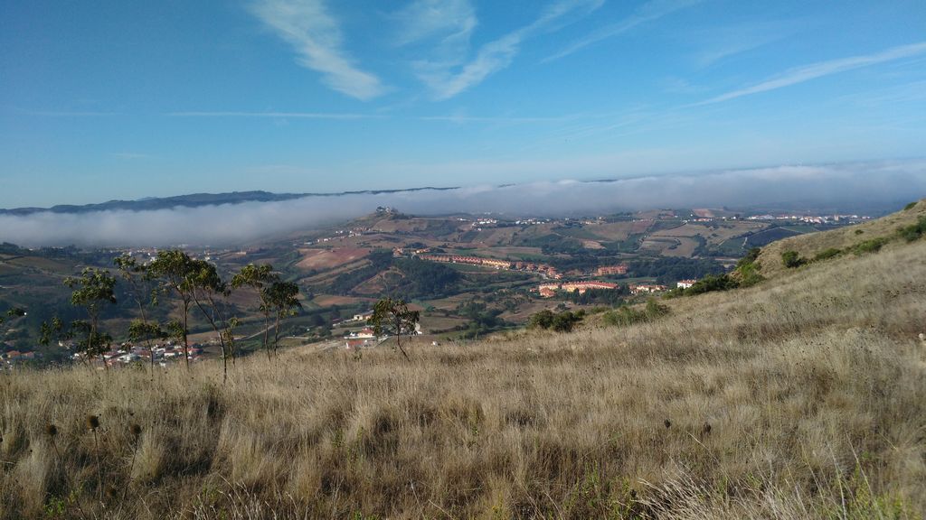
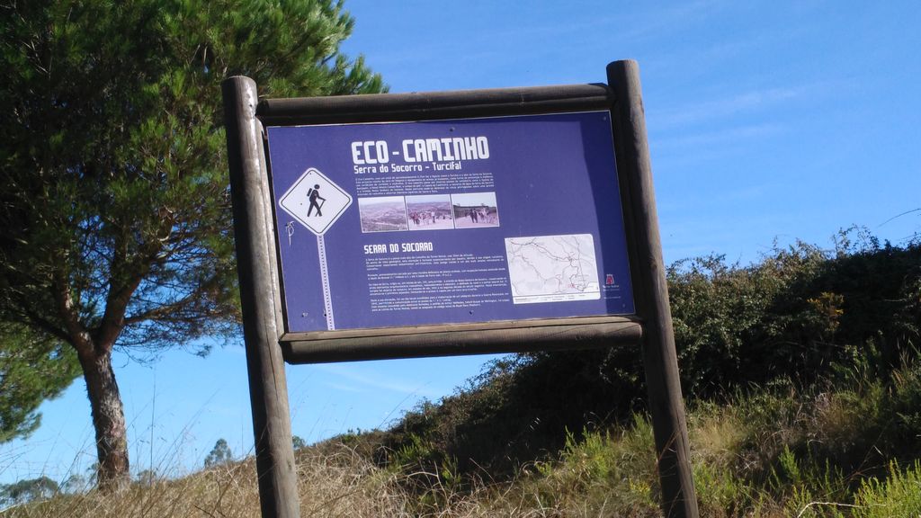
At this event we will walk in an area where the remains of the Lines of Defence of Torres Vedras are clearly visible, such as the Archeira Fort, which can be seen along part of the route. On the other hand, the emblematic Serra do Socorro is a challenge that we will have to overcome by climbing it after passing through Cadriceira. At the top we'll have an excellent panoramic view of the surrounding area and, if visibility permits, we'll be able to see Peniche and Berlenga Island. If they're open, we'll take the opportunity to visit the Lines of Torres Vedras Interpretive Centre, as well as the Hermitage.
The Serra do Socorro and the Lines of Torres Vedras:
Part of the Historical Route of the Lines of Torres Vedras, this exhibition area was inaugurated in November 2008 and is part of the Enxara Circuit. The Serra do Socorro dominates the landscape of the “heart of the Lines of Torres Vedras”, surrounded by forts and headquarters, where the central communications station of the Lines of Torres Vedras was installed (1810-11).
The exhibition is organised into three sections: the History and Heritage of Serra do Socorro, Visual Communications in the Peninsular War and the Serra do Socorro Telegraph.
The Interpretive Centre is located in the area next to the hermitage of Serra do Socorro or Neves, built in the first half of the 16th century (Rota das Enxaras).
Chapel of Our Lady of Socorro
A Chapel of Our Lady of Socorro is located at the top of the mountain of the same name. Legend has it that the Chapel of Nossa Senhora do Socorro, at the top of the mountain from where you can enjoy an admirable panoramic view, was once a mosque, converted into a Catholic temple by King Afonso Henriques and rebuilt during the reign of King Manuel I. It is also rumoured that the founder was the same person who had the parish church built. As the town of Enxara began to populate and he wished to live alone, he would have moved to this location, ending up buried in a stone sarcophagus that would have existed until the 18th century, attached to the wall of the parish church. The Manueline stonework visible inside gives an indication of the origin of the temple, which was the scene of a fire in 1996 that destroyed almost all of its contents.
Some of the points of interest on the walk
- Hiking in the west - Archeira Fort - Furadouro Mother Church - Archeira Mountain Mills - Socorro Mountain - Nossa Senhora do Socorro Hermitage - Socorro Mountain Eco-path - Turcifal - Lines of Torres Vedras Interpretation Centre - Natural landscapes -
Location
Meeting Point
Largo da Igreja Matriz do Furadouro (Chapel Square)
Rua da Capela - Furadouro (Torres Vedras)
Latitude: 39° 1’48.47″N
Longitude: 9°12’37.90″W
Meeting time: 9h20
Estimated end time: 14h30
Route Features and Equipment
Circular
Circuit
Equipment
Footwear and clothing suitable for hiking
RESERVE
CLOSED EVENT
REGISTER NOW
8€ per person
Includes:
- Guidance and support
- Personal accident insurance
- Civil liability insurance
Not included:
- All items not mentioned.
Comments:
- Only registrations made by 4.30pm on the day before the event will be eligible for Personal Accident Insurance.
- PLACES WILL BE FILLED WHEN PROOF OF PAYMENT IS RECEIVED
Data collection:
Personal information Name, date of birth and VAT number are required for personal accident insurance purposes.
Book:
After successfully submitting the bookingYou will be redirected to a confirmation page. If you have any difficulties making a booking, please contact contact us.
Registration Form
"*" indicates required fields
Timetable
(Saturday) 9:00 - 14:00
Meeting Point
Largo Brigadeiro França Borges 2565-797 Turcifal
Event details
[fusion_builder_container admin_label="" hundred_percent="no" equal_height_columns="no" menu_anchor="" hide_on_mobile="small-visibility,medium-visibility,large-visibility" class="" id="" background_color="" background_image="" background_position="center center" background_repeat="no-repeat" fade="no" background_parallax="none" enable_mobile="no" parallax_speed="0.3" video_mp4="" video_webm="" video_ogv="" video_url="" video_aspect_ratio="16:9" video_loop="yes" video_mute="yes" video_preview_image="" border_color="#ea1717" border_style="solid" margin_top="10px" margin_bottom="10px" padding_top="25px"
Event details




Event Description
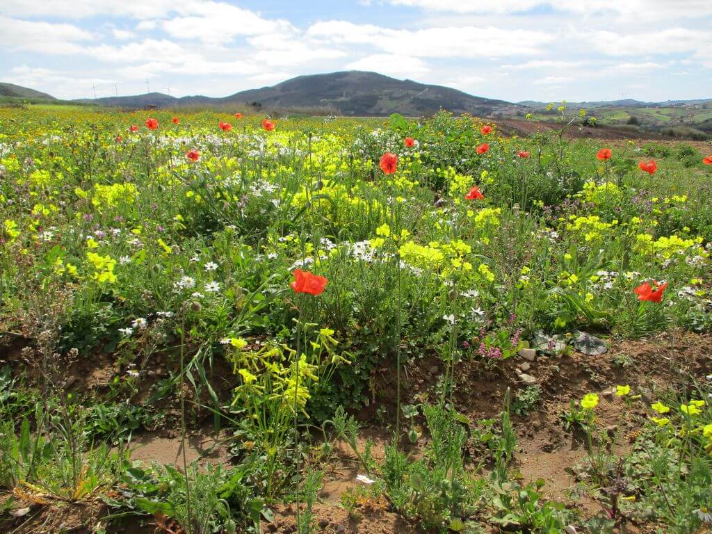
This walk takes in some of the most beautiful landscapes in the west, particularly in the area around the emblematic Serra do Socorro, passing by the Feiteira Fort and the old windmills, surrounded by orchards and extensive vineyards. This is undoubtedly another event not to be missed, to get to know other landscapes!
Feiteira Fort
At an altitude of 249 metres, with a perimeter of 287.5 metres and an area of 5,901 metres.2The Feiteira Fort was built after the Napoleonic army withdrew from the front of the Lines. It is a medium-sized military construction, part of the 1st Defensive Line of the Lines of Torres Vedras (Lines of Defence north of Lisbon during the Peninsular War). Located between the forts of Catefica and Archeira, respectively to the north and south of this fortification, and under the command of General Spencer and Baron d'Eben, its function was to defend the Ribaldeira and Runa valleys. Also known as the Archeira / Meio fort, it had 13 gunboats and 9 fire hydrants (6 9 calibre and 3 12 calibre), with capacity for a garrison of 350 men. The moat has a masonry escarpment and counter-escarpment and well-defined interior beams with masonry bedding.
Turcifal Church
According to records, the parish church of Turcifal, dedicated to St Mary Magdalene, has existed since before 1353. However, all that remains of the original church is the floor and the tombstones from the 16th century because in the late 17th and early 18th centuries the church was extensively remodelled to what we see today.
The year 1749 is inscribed on the main portal of the church, which corresponds to the completion of the remodelling of the body of the church. Inside the church we can see tiles and paintings from the early 18th century. The church has a single nave and a chancel on a longitudinal plan, and the tower was possibly completed at the end of that century, given the corbelled finish with pinnacles, typical of that period.
Some of the points of interest on this walk
- Walk on the west side - Feiteira Fort - Turcifal Parish Church - Holy Spirit Chapel - Cadriceira - Old Military Road - Mugideira - Natural landscapes -
Location
Meeting Point
Largo Brigadeiro França Borges
2565-797 Turcifal
Latitude: 39° 2'33.65″N
Longitude: 9°15'57.33″W
Meeting time: 9h00
Estimated end time: 14h00
Route Features and Equipment
Circular
Circuit
Equipment
Suitable footwear and clothing for hiking
Take at least 1.5 litres of water
Hat
Sunscreen
RESERVE
CLOSED EVENT
REGISTER NOW
8€ per person
Includes:
- Guidance and support
- Personal accident insurance
- Civil liability insurance
Not included:
- All items not mentioned.
Comments:
- Only registrations made by 4.30pm on the day before the event will be eligible for Personal Accident Insurance.
- PLACES WILL BE FILLED WHEN PROOF OF PAYMENT IS RECEIVED
Data collection:
Personal information Name, date of birth and VAT number are required for personal accident insurance purposes.
Book:
After successfully submitting the bookingYou will be redirected to a confirmation page. If you have any difficulties making a booking, please contact contact us.
Registration Form
"*" indicates required fields
Timetable
(Sunday) 9:30 - 13:30
Meeting Point
Intermarché supermarket car park
Event details
[fusion_builder_container admin_label="" hundred_percent="no" equal_height_columns="no" menu_anchor="" hide_on_mobile="small-visibility,medium-visibility,large-visibility" class="" id="" background_color="" background_image="" background_position="center center" background_repeat="no-repeat" fade="no" background_parallax="none" enable_mobile="no" parallax_speed="0.3" video_mp4="" video_webm="" video_ogv="" video_url="" video_aspect_ratio="16:9" video_loop="yes" video_mute="yes" video_preview_image="" border_color="#ea1717" border_style="solid" margin_top="10px" margin_bottom="10px" padding_top="25px"
Event details



Event Description
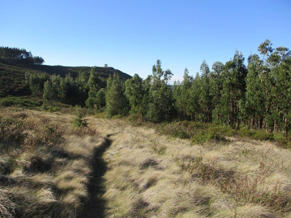
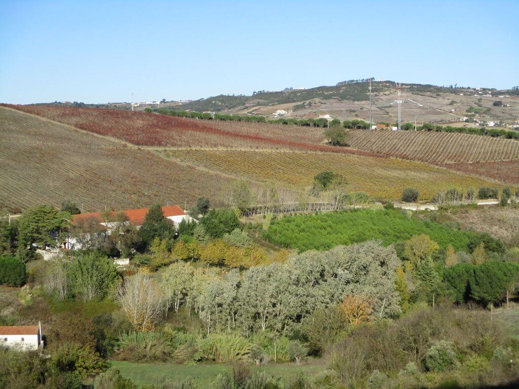
This proposed hike takes place on the outskirts of Arruda dos Vinhos and has all the ingredients for a morning well spent, where there will be no shortage of “challenges” that everyone will successfully overcome, being rewarded with one of the best panoramic views in the area. This route is essentially characterised by the rural nature of the area, with many farms and vineyards as almost constant companions on our adventure. Another event not to be missed!
The origin of the name “Arruda dos Vinhos”:
Arruda, a historic town to which the first reference dates back to 1160, when King Afonso Henriques, the first King of Portugal, granted it a charter. Archaeological remains and toponymic references suggest that this territory began to be settled a few centuries before Christ. However, controversy over the origin of the place name Arruda has prevailed throughout its existence.
The most consistent theory has to do with its geographical location, its territorial layout as a crossing point, combined with the fertility of the land. It has also been known since ancient times for growing vegetables and, above all, for producing wine. Wine is a hallmark not only of Arruda, but also of the Western region, which is closer to the capital. The wines from Torres Vedras, Dois Portos, would be transported to the Tagus (according to the authors in S. Iria da Azóia, since there are historical references to the «Lisbon wine called ansoye» (p.5). and then exported on merchant ships. Arruda was also a route for the Caminhos de Santiago, through the parish of Santiago, which was founded by crusaders in the 12th century.
Some of the points of interest on the walk
- Rio Grande da Pipa - Giesteira - Quintas de Pé-do-Monte - Mills - Louriceira de Baixo - Ribeira de Sabugos - Sabugos - Natural landscapes -
Location
Meeting Point
Intermarché supermarket car park
Rua das Laranjeiras, 2630-358 Arruda dos Vinhos
Latitude: 38°59’52.52″N
Longitude: 9° 5’7.44″W
Meeting time: 9.30am
Estimated final time: 13h30
Route Features and Equipment
Circular
Circuit
Equipment
Suitable footwear
Suitable clothing for hiking
Take 1.5 litres of water
Hat
RESERVE
CLOSED EVENT
REGISTER NOW
8€ per person
Includes:
- Guidance and support
- Personal accident insurance
- Civil liability insurance
Not included:
- All items not mentioned.
Comments:
- Only registrations made by 4.30pm on the day before the event will be eligible for Personal Accident Insurance.
- PLACES WILL BE FILLED WHEN PROOF OF PAYMENT IS RECEIVED
Data collection:
Personal information Name, date of birth and VAT number are required for personal accident insurance purposes.
Book:
After successfully submitting the bookingYou will be redirected to a confirmation page. If you have any difficulties making a booking, please contact contact us.
Registration Form
"*" indicates required fields
21Nov9:2014:00Walking the Quintas Route9:20 - 14:00 São Domingos de CarmõesEvent type:Hiking
Timetable
(Saturday) 9:20 - 14:00
Meeting Point
São Domingos de Carmões
Event details
[fusion_builder_container admin_label="" hundred_percent="no" equal_height_columns="no" menu_anchor="" hide_on_mobile="small-visibility,medium-visibility,large-visibility" class="" id="" background_color="" background_image="" background_position="center center" background_repeat="no-repeat" fade="no" background_parallax="none" enable_mobile="no" parallax_speed="0.3" video_mp4="" video_webm="" video_ogv="" video_url="" video_aspect_ratio="16:9" video_loop="yes" video_mute="yes" video_preview_image="" border_color="#ea1717" border_style="solid" margin_top="10px" margin_bottom="10px" padding_top="25px"
Event details



Event Description
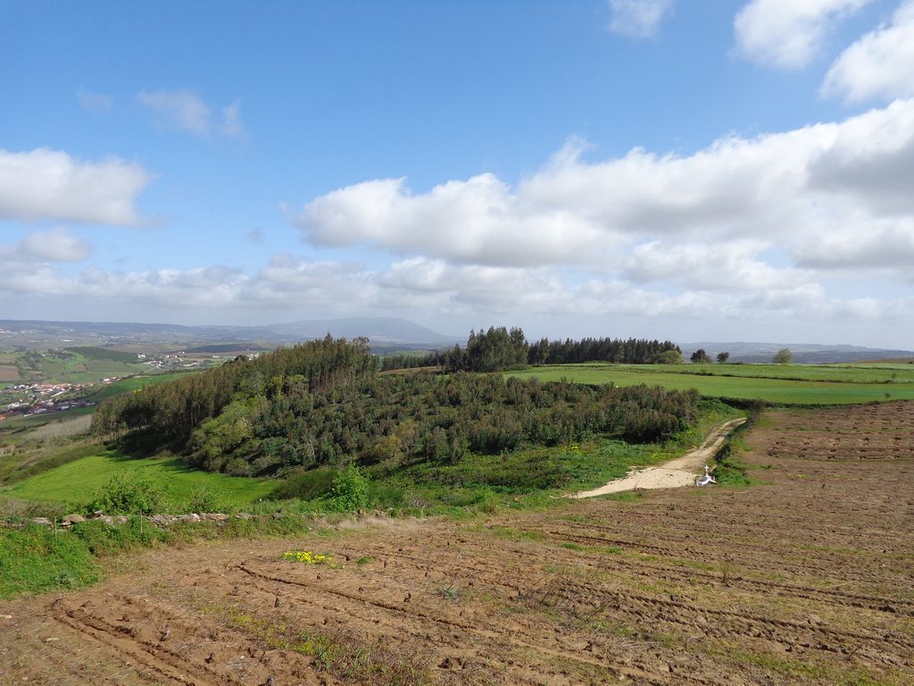
This walk starts next to the car park, in front of the S. Domingos de Carmões Parish Council. It's a markedly rural route, with unique perspectives and panoramas of the surrounding area, with special emphasis on the imposing Serra de Montejunto. Another event not to be missed!
São Domingos de Carmões
Carmões is the second smallest parish in the municipality of Torres Vedras, the furthest from the county seat, which is about 16 kilometres away, and is located in the south-western part of the municipality. With an area of 6.88 km2, this parish is made up of the hamlets of São Domingos de Carmões, Carmões, Alfeiria, Setinheira, Carrasqueira, Corujeira, Sobrigal, Tojais, Freiria and Braçal. In addition to these places, the parish has several farms and homesteads that bear witness to the existence of illustrious families on the land: such as the Botto Pimentel family, former owners of Quinta de Carmões, to whom King Afonso V granted the use of a coat of arms, and the Leal e Silva family, owners of Quinta do Belo Jardim and Quinta do Maia, who stood out for the quantity and quality of what they produced on their land.
Everything indicates that the territory occupied by the parish has been inhabited since ancient times, before the foundation of the nation. It is said that there were Castro fortifications here, used for dwellings by the Lusitanian peoples. It is probable that it was also populated at the time of the Roman occupation, although no traces of this have been found. As a parish, Carmões is one of the oldest in the municipality of Torres Vedras, having been founded in the mid-16th century.
Some of the points of interest on the walk
- Igreja Matriz de S. Domingos de Carmões - Rua das Fontes - Capela do Braçal - Santuário de Nossa Senhora dos Milagres - Maceira - Carreiras - Calvários da Corujeira - Quintas da região - Natural landscapes - Country lanes -
Location
Meeting Point
São Domingos de Carmões
Rua da Igreja, no. 4
Latitude: 39° 3’25.83″N
Longitude: 9° 8’14.21″W
Meeting time: 9.20am
Estimated final time: 14h
Route Features and Equipment
Circular
Circuit
Equipment
Footwear and clothing suitable for hiking
Hat
Minimum 1.5 litres of water
Sunscreen
Food
RESERVE
CLOSED EVENT
REGISTER NOW
8€ per person
Includes:
- Guidance and support
- Personal accident insurance
- Civil liability insurance
Not included:
- All items not mentioned.
Comments:
- Only registrations made by 4.30pm on the day before the event will be eligible for Personal Accident Insurance.
- PLACES WILL BE FILLED WHEN PROOF OF PAYMENT IS RECEIVED
Data collection:
Personal information Name, date of birth and VAT number are required for personal accident insurance purposes.
Book:
After successfully submitting the bookingYou will be redirected to a confirmation page. If you have any difficulties making a booking, please contact contact us.
Registration Form
"*" indicates required fields
Timetable
(Saturday) 9:30 - 14:00
Meeting Point
São Martinho do Porto
Event details
[fusion_builder_container admin_label="" hundred_percent="no" equal_height_columns="no" menu_anchor="" hide_on_mobile="small-visibility,medium-visibility,large-visibility" class="" id="" background_color="" background_image="" background_position="center center" background_repeat="no-repeat" fade="no" background_parallax="none" enable_mobile="no" parallax_speed="0.3" video_mp4="" video_webm="" video_ogv="" video_url="" video_aspect_ratio="16:9" video_loop="yes" video_mute="yes" video_preview_image="" border_color="#ea1717" border_style="solid" margin_top="10px" margin_bottom="10px" padding_top="25px"
Event details




Event Description
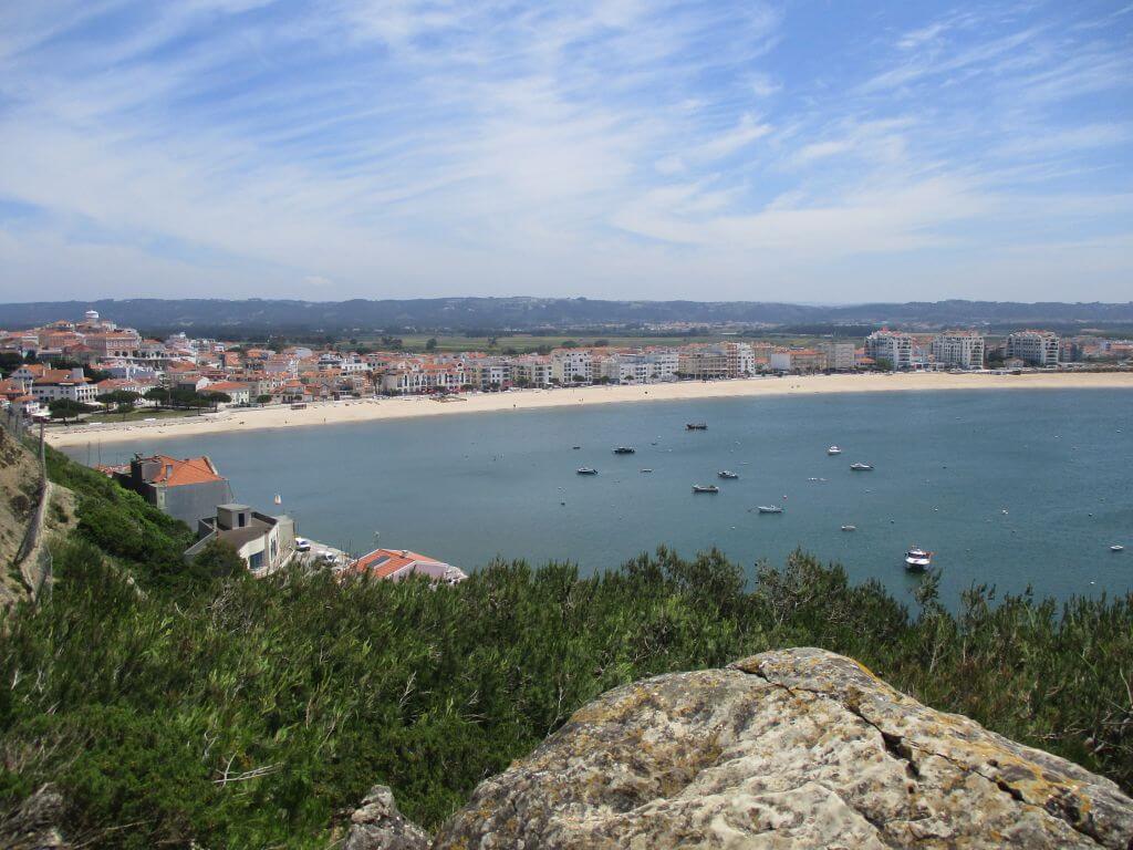
This walk will take place in an environment of great natural beauty, starting and finishing at the bay of São Martinho do Porto, from where we'll walk along the coast towards Nazaré and on the way back we'll go to the Facho viewpoint and the lighthouse at the entrance to the bay. Another event not to be missed!
São Martinho do Porto
The shell of São Martinho is what remains of an ancient gulf that occupied a vast area, where Alfeizerão was a harbour of considerable importance. With the progressive silting up of the bay, Salir came to fulfil the functions that Alfeizerão could no longer do. The town probably originated as a fishing village. The Granja de São Martinho was founded on this site by the Cistercian Order, which came to settle the population and give the land its name. Later, the name "do Porto" was added.
São Martinho do Porto Viewpoint - Facho Viewpoint
From this elevation you can see the entire bay of São Martinho do Porto, a geographical feature that, due to its perfect shell shape, is unique in the country and in Europe. It has three kilometres of sand and a 250-metre bar between the Morros de Santana to the south and the Farol to the north.
José Bento da Silva Square Viewpoint
One of the most beautiful viewpoints in São Martinho do Porto, overlooking the bay and with direct access from the Outeiro lift.
Morro de Santo António Lighthouse
It now has no function beyond tourism and remembrance, and once defended the entrance to the bay of São Martinho do Porto. Today the lighthouse has been replaced by more modern systems that fulfil the same function. From the site of the lighthouse, there is an impressive view over the bay, the town and the sea, as well as a beautiful 400 metre walk along the cliff tops.
Cruise and Viewpoint
It is located at the top of the hill of Santo António and was built in 1940, according to the inscriptions engraved on it: VIII CENTENARY OF THE INDEPENDENCE AND III OF THE RESTORATION OF PORTUGAL MCMXL.
Some of the points of interest on the walk
- Baía de São Martinho do Porto - Miradouro do Facho - Praia da Gralha - Cruzeiro e Miradouro - Farol do morro de Santo António - Igreja Matriz - Serra dos Mangues - Natural landscapes -
Location
Meeting Point
José Frederico Ulrich Square
2460-649 São Martinho Do Porto
Latitude: 39°30'45.85″N
Longitude:9° 8'10.96″W
Meeting time: 9.20am
Estimated end time: 14h
Route Features and Equipment
Circular
Circuit
Equipment
Footwear and clothing suitable for hiking
RESERVE
CLOSED EVENT
REGISTER NOW
8€ per person
Includes:
- Guidance and support
- Personal accident insurance
- Civil liability insurance
Not included:
- All items not mentioned.
Comments:
- Only registrations made by 4.30pm on the day before the event will be eligible for Personal Accident Insurance.
- PLACES WILL BE FILLED WHEN PROOF OF PAYMENT IS RECEIVED
Data collection:
Personal information Name, date of birth and VAT number are required for personal accident insurance purposes.
Book:
After successfully submitting the bookingYou will be redirected to a confirmation page. If you have any difficulties making a booking, please contact contact us.
Registration Form
"*" indicates required fields
Timetable
(Sunday) 9:30 - 14:00
Meeting Point
Rua da Ponte Velha, Peniche
Event details
[fusion_builder_container admin_label="" hundred_percent="no" equal_height_columns="no" menu_anchor="" hide_on_mobile="small-visibility,medium-visibility,large-visibility" class="" id="" background_color="" background_image="" background_position="center center" background_repeat="no-repeat" fade="no" background_parallax="none" enable_mobile="no" parallax_speed="0.3" video_mp4="" video_webm="" video_ogv="" video_url="" video_aspect_ratio="16:9" video_loop="yes" video_mute="yes" video_preview_image="" border_color="#ea1717" border_style="solid" margin_top="10px" margin_bottom="10px" padding_top="25px"
Event details




Event Description
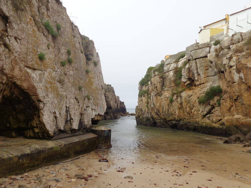
This walk takes in the fantastic Peniche peninsula, once an island, highlighting countless points of interest and incredible landscapes all along the coast, from Cape Carvoeiro to the Peniche Fortress, the Cruz dos Remédios viewpoint, the Varanda de Pilatos and the Papôa Islet area. Another event not to be missed!
Pilate's balcony
Before reaching the lighthouse at Cape Carvoeiro, on the limestone cliff by the sea is the so-called “Pilate's Balcony”, from where you can admire the Nau dos Corvos (a rock by the coast where cormorants usually land), Cape Carvoeiro with its lighthouse and, on clear days, the Berlengas archipelago.
Part of the "Peniche Peninsula" geosite, which is a limestone platform that has been eroded by wind, rain and the sea, you can see the beautiful shapes that erosion has created, forming a lapiás.
Papôa Islet
On the north coast of Peniche, there is a small peninsula with limestone and volcanic breccia, known as the Papoa Islet. This rock formation is karst-shaped and is a popular fishing spot, also offering beautiful views of the sea. The Papoa islet marks the beginning of Baleal beach, is a refuge for surfers when the wind blows from the south-east and is also an excellent spot for watching seabirds. Peniche is the best place in Europe for spotting migratory birds, such as the Cormorant, Lesser Kite, Laughing Gull and Roseate Tern.
Portinho da Areia do Norte Beach
Praia do Portinho da Areia do Norte is a privileged spot from which to contemplate the Berlengas Nature Reserve from afar. The small sandy beach is located in a cove and to the north of it is the Papôa Peninsula, known for the existence of a large wave peak in its immediate vicinity. It was on this beach that the victims of the shipwreck of the Kingdom of Spain's San Pedro de Alcântara on 2 February 1786 were buried
Some of the points of interest on the walk
- Peniche Fortress - Fort Viewpoint - São Pedro Beach - Peniche Marina - Camaroa Beach - Portinho da Areia Sul Beach - Dominique's Balcony - Furninha Cave - Carvoeiro Viewpoint and Cape Carvoeiro - Pilatos Balcony - Cruz dos Remédios and Revelim Viewpoint - Portinho da Areia do Norte Beach - Papôa Islet - Quebrado Beach - Baluarte Park - Natural landscapes -
Location
Meeting Point
Rua da Ponte Velha, Peniche
Car park in front of the Volunteer Fire Brigade
Latitude: 39°21’26.85″N
Longitude: 9°22’37.24″W
Meeting time: 9h30
Estimated end time: 14h00
Route Features and Equipment
Circular
Circuit
Equipment
Footwear and clothing suitable for hiking
RESERVE
CLOSED EVENT
REGISTER NOW
8€ per person
Includes:
- Guidance and support
- Personal accident insurance
- Civil liability insurance
Not included:
- All items not mentioned.
Comments:
- Only registrations made by 4.30pm on the day before the event will be eligible for Personal Accident Insurance.
- PLACES WILL BE FILLED WHEN PROOF OF PAYMENT IS RECEIVED
Data collection:
Personal information Name, date of birth and VAT number are required for personal accident insurance purposes.
Book:
After successfully submitting the bookingYou will be redirected to a confirmation page. If you have any difficulties making a booking, please contact contact us.
Registration Form
"*" indicates required fields
Timetable
(Sunday) 9:30 - 13:45
Meeting Point
Casa da Forja Museum - Santana da Carnota
Event details
[fusion_builder_container admin_label="" hundred_percent="no" equal_height_columns="no" menu_anchor="" hide_on_mobile="small-visibility,medium-visibility,large-visibility" class="" id="" background_color="" background_image="" background_position="center center" background_repeat="no-repeat" fade="no" background_parallax="none" enable_mobile="no" parallax_speed="0.3" video_mp4="" video_webm="" video_ogv="" video_url="" video_aspect_ratio="16:9" video_loop="yes" video_mute="yes" video_preview_image="" border_color="#ea1717" border_style="solid" margin_top="10px" margin_bottom="10px" padding_top="25px"
Event details






Event Description
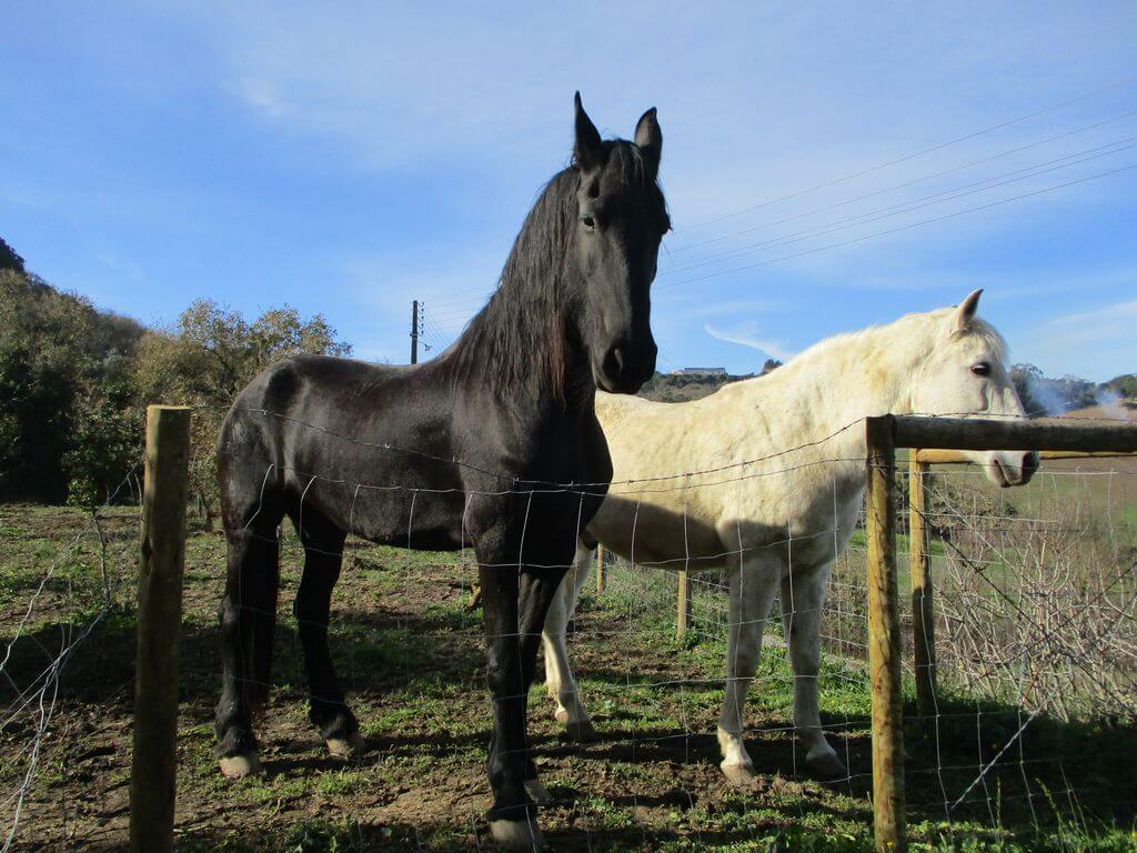
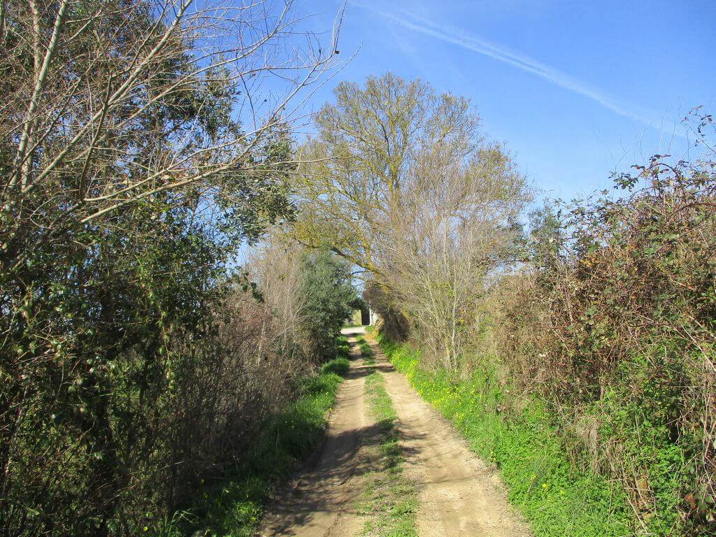
This walk starts in Santana da Carnota, a parish in the council of Aleqnuer, and takes in various rural paths and trails, offering wide-ranging views of the surrounding area, from the Serra de Montejunto mountain range to the fields of the lezíria as far as the eye can see, south of the River Tagus. Our route takes us through places like Serra, Soupo, Casal das Balas and Gataria. Come and spend another beautiful morning with us.
Santana da Carnota
The place name is probably related to the remote existence on this site of a hermitage invoking St Anne, which may have been the origin of the current parish church. In 1590 there was a Quinta de Santa Ana belonging to João de Mesquita Perestrelo. The information comes from Guilherme Henriques. As for Carnota, we think it's a badge, adopted because of its proximity to an old place of this name, now disappeared, in the parish of Cadafais, which may have been of some importance in the Middle Ages.
The place already existed at the end of the 15th century with just three dwellings. But by 1527 the number had tripled. At the beginning of the 18th century there were already 30 families. In 1911 it had 39 dwellings and 165 inhabitants. In 1873, the town and parish belonged to the 2nd district of the Justice of the Peace, with its seat in the parish of S. Miguel de Palhacana. It was also home to one of the ten primary schools for boys in the municipality of Alenquer. In 1896 it already had a post office.
he parish church is a rebuilding of an earlier church, whose chancel was totally ruined by the 1755 earthquake. Built a few years after this date, it has a great balance of proportions. The interior's architectural decoration includes stone and stucco work, in keeping with the taste of the time. Some interesting images are kept here, some in bas-relief from the 17th and 18th centuries.
Some of the points of interest on the walk
- Santana da Carnota - Casa da Forja Museum - Santa Ana Church - Mountains - Windmills - Casal das Balas - Gataria - Natural landscapes -
Location
Meeting Point
Casa da Forja Museum
Rua da Liberdade, 24
2580-154 - Santana da Carnota (Alenquer)
Car park next to the Casa da Forja Museum in Santana da Carnota
Latitude: 39° 2'16.04″N
Longitude: 9° 4'2.05″W
Meeting time: 9h30
Estimated end time: 13h45m
Route Features and Equipment
Circular
Circuit
Equipment
Footwear and clothing suitable for hiking
RESERVE
CLOSED EVENT
REGISTER NOW
8€ per person
Includes:
- Guidance and support
- Personal accident insurance
- Civil liability insurance
Not included:
- All items not mentioned.
Comments:
- Only registrations made by 4.30pm on the day before the event will be eligible for Personal Accident Insurance.
- PLACES WILL BE FILLED WHEN PROOF OF PAYMENT IS RECEIVED
Data collection:
Personal information Name, date of birth and VAT number are required for personal accident insurance purposes.
Book:
After successfully submitting the bookingYou will be redirected to a confirmation page. If you have any difficulties making a booking, please contact contact us.
Registration Form
"*" indicates required fields
Timetable
(Sunday) 9:30 - 14:00
Meeting Point
Av. do Mar, 2500-896 Foz do Arelho
Event details
[fusion_builder_container admin_label="" hundred_percent="no" equal_height_columns="no" menu_anchor="" hide_on_mobile="small-visibility,medium-visibility,large-visibility" class="" id="" background_color="" background_image="" background_position="center center" background_repeat="no-repeat" fade="no" background_parallax="none" enable_mobile="no" parallax_speed="0.3" video_mp4="" video_webm="" video_ogv="" video_url="" video_aspect_ratio="16:9" video_loop="yes" video_mute="yes" video_preview_image="" border_color="#ea1717" border_style="solid" margin_top="10px" margin_bottom="10px" padding_top="25px"
Event details








Event Description
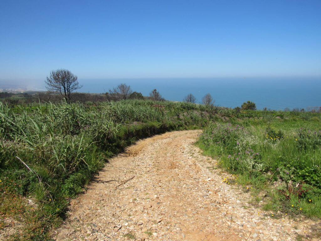
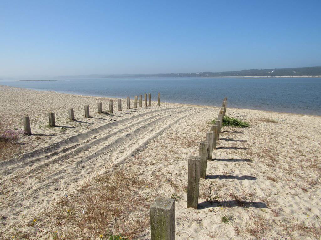
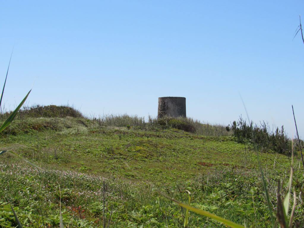
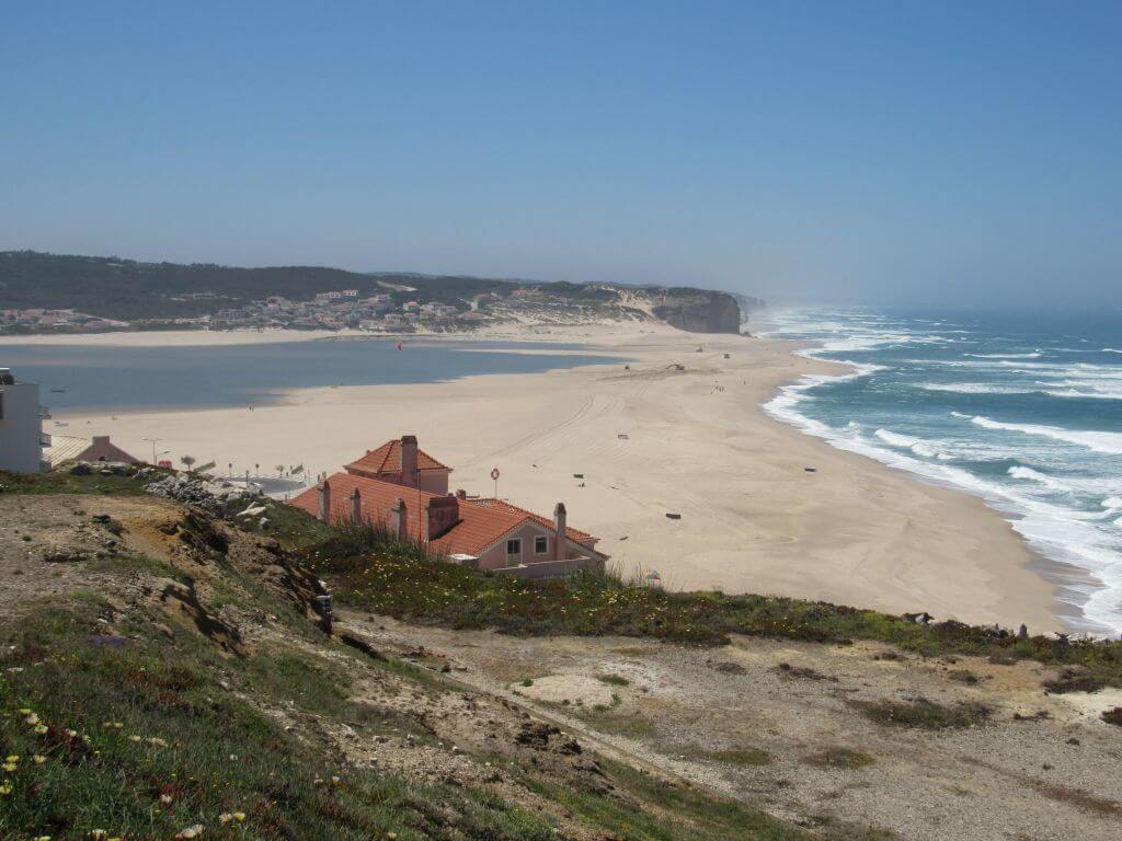
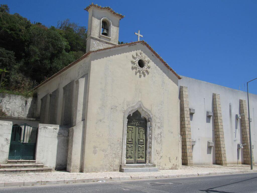
This proposed walk takes place in Foz do Arelho, taking advantage of the unique nature of this area, with special emphasis on the shores of Óbidos Lagoon, the Foz do Arelho Walkways and the north coast, as well as part of the Serra de Bouro. Another event not to be missed!
Foz do Arelho
Foz do Arelho has its origins in a fishing community that survived on what the calm waters provided. However, the land along the Óbidos Lagoon was used for agriculture, fertilised with the silt collected. Reports of these lands date back to the year 1580, when the "Quinta de Nossa Senhora de Guadalupe" gained a place in history for its importance in "renting" its land for agriculture, and it seems that this is where the place grew from. The place began to gain prominence in the second half of the 19th century, at a time when beaches began to be prioritised by holidaymakers.
Foz do Arelho was the most popular place, and it quickly became a favourite haunt of some of the most important names in Portuguese society, who often travelled to the spa in Caldas da Rainha.
Among the most honoured visitors were King Carlos I, a great fan of the gastronomy made with fish from the Lagoon, and the businessman Francisco Almeida Grandela, the owner of the well-known Grandela Warehouses in Lisbon, who even considered opening a branch of these warehouses in Caldas. The old town was part of the parish of Serra do Bouro until 1919, and it was in 2009 that it became a town.
Foz do Arelho Walkways
Designed by landscape architect Nádia Schilling, the Foz do Arelho walkway was the way to create a safe path for contemplation and leave the rest of the area free for the growth of spontaneous vegetation. The natural cut of the hillside either covers or blurs the Atlantic Ocean, depending on whether you go up or down the small flights of steps that help you climb the slopes. But when you reach any of the seven viewpoints, with swivelling benches so you can see 360 degrees, the sea is always there (on the best days, you can even see the Berlengas archipelago) and the sunset has a special charm.
Some of the points of interest on the walk
- Foz do Arelho beach - Óbidos lagoon - Walkways - Penedo Furado - Serra do Bouro - Mother Church - Foz do Arelho viewpoint - Natural landscapes -
Location
Meeting Point
Av. do Mar,
2500-896 Foz do Arelho
(next to the yellow kiosk - opposite the Cabana do Pescador restaurant)
Latitude: 39°25'58.26″N
Longitude:9°13'40.16″W
Meeting time: 9.20am
Estimated end time: 14h
Route Features and Equipment
Circular
Circuit
Equipment
Footwear and clothing suitable for hiking
RESERVE
CLOSED EVENT
REGISTER NOW
8€ per person
Includes:
- Guidance and support
- Personal accident insurance
- Civil liability insurance
Not included:
- All items not mentioned.
Comments:
- Only registrations made by 4.30pm on the day before the event will be eligible for Personal Accident Insurance.
- PLACES WILL BE FILLED WHEN PROOF OF PAYMENT IS RECEIVED
Data collection:
Personal information Name, date of birth and VAT number are required for personal accident insurance purposes.
Book:
After successfully submitting the bookingYou will be redirected to a confirmation page. If you have any difficulties making a booking, please contact contact us.
Registration Form
"*" indicates required fields
December
Timetable
(Saturday) 9:30 - 13:45
Meeting Point
Reguengo Grande Parish Council
Event details
[fusion_builder_container admin_label="" hundred_percent="no" equal_height_columns="no" menu_anchor="" hide_on_mobile="small-visibility,medium-visibility,large-visibility" class="" id="" background_color="" background_image="" background_position="center center" background_repeat="no-repeat" fade="no" background_parallax="none" enable_mobile="no" parallax_speed="0.3" video_mp4="" video_webm="" video_ogv="" video_url="" video_aspect_ratio="16:9" video_loop="yes" video_mute="yes" video_preview_image="" border_color="#ea1717" border_style="solid" margin_top="10px" margin_bottom="10px" padding_top="25px"
Event details


Event Description
In this event we'll be walking on the Cesaredas Plateau, in the west, passing through the magnificent Cornaga Valley, where the Galvão River flows, with its bridges, watermill and waterfall in a beautiful natural setting, very close to Reguengo Grande. Another event not to be missed!
The Cesaredas Plateau
The Cesaredas Plateau, located in the western region of Portugal, dates back to the Middle and Upper Jurassic period (170 to 150 million years ago). Stretching over 49km through the municipalities of Lourinhã, Bombarral, Óbidos and Peniche, it varies in altitude between 130 and 170 metres. The Cesaredas Plateau, known for the presence of Caesar's troops in the region (Nery Delgado, 1867), contains fossils of ammonites, corals, bivalves and brachiopods and echinoderms and rare remains of vertebrates such as dinosaurs and crocodilomorphs. There are around 50 caves, grottoes and cavities on the plateau, such as Lapa da Feteira and Gruta dos Ralis, some of which have been identified as classified archaeological sites (Palaeolithic and Neolithic). The plateau supplies four river basins: Rio Grande, Rio de Atouguia, Rio Real and Ribeira de Benfeito, and is an important natural aquifer, responsible for recharging groundwater. The production of the reguengueira apple was an important economic activity, so much so that the name "reguengueira apple" was also given to this fruit, which came from Reguengo Grande.
The Cesaredas Plateau owes its name to the presence of an encampment of Caesar's troops in the area, as Nery Delgado wrote in 1867. Leite Vasconcelos also mentions the collection of a bronze xorna and a bronze arrowhead from Moledo and Moita dos Ferreiros. Along the route, we come across some of the territory's characteristic features, such as the lime kilns - an example of industrial architecture with the function of producing lime - the morouços, the result of the piling up of stones from clearing farmland, and the shepherds' shelters, ancient stone constructions.
The Cornaga Valley
The Cornaga Valley was once a vital area for the development of the parish of Reguengo Grande. The watermills, bridges, fountains and waterfall give charm to this place that was once very busy, not only for farmers, but also for washerwomen and all those who bathed in the water of the Galvão river
Some of the points of interest on the walk
- Reguengo Grande - Planalto das Cesaredas - Igreja das Cesaredas - Vale Cornaga - Aldeia do Reguengo Pequeno - Jardim do Rossio - Cascata / Waterfall - Church of São Domingos - Natural landscapes -
Location
Meeting Point
Car park in front of Reguengo Grande Parish Council
Urbanisation of Junta de Freguesia 2
2530-584 Reguengo Grande
Latitude:39°17'4.21″N
Longitude: 9°13'13.93″W
Meeting time: 9.30am
Estimated end time: 13h45
Route Features and Equipment
Circular
Circuit
Equipment
Footwear and clothing suitable for hiking
RESERVE
CLOSED EVENT
REGISTER NOW
8€ per person
Includes:
- Guidance and support
- Personal accident insurance
- Civil liability insurance
Not included:
- All items not mentioned.
Comments:
- Only registrations made by 4.30pm on the day before the event will be eligible for Personal Accident Insurance.
- PLACES WILL BE FILLED WHEN PROOF OF PAYMENT IS RECEIVED
Data collection:
Personal information Name, date of birth and VAT number are required for personal accident insurance purposes.
Book:
After successfully submitting the bookingYou will be redirected to a confirmation page. If you have any difficulties making a booking, please contact contact us.
Registration Form
"*" indicates required fields
Timetable
(Sunday) 9:30 - 14:00
Meeting Point
Ecological Park, 2665-295 Venda do Pinheiro
Event details
[fusion_builder_container admin_label="" hundred_percent="no" equal_height_columns="no" menu_anchor="" hide_on_mobile="small-visibility,medium-visibility,large-visibility" class="" id="" background_color="" background_image="" background_position="center center" background_repeat="no-repeat" fade="no" background_parallax="none" enable_mobile="no" parallax_speed="0.3" video_mp4="" video_webm="" video_ogv="" video_url="" video_aspect_ratio="16:9" video_loop="yes" video_mute="yes" video_preview_image="" border_color="#ea1717" border_style="solid" margin_top="10px" margin_bottom="10px" padding_top="25px"
Event details


Event Description
This proposed walk will allow us to get to know the Malveira area better, more specifically the whole area around Venda do Pinheiro, in a heavily wooded area with wide-ranging views and fantastic trails. Also noteworthy is the Venda do Pinheiro Ecological Park, a pleasant leisure area and the starting point for our walk. Another event not to be missed!
Venda do Pinheiro Ecological Park
Integrated into the urban fabric of Venda do Pinheiro, this new space combines environmental preservation with leisure and mobility. The Ecological and Intermodal Park includes an Interpretive Centre (making the most of its proximity to the source of the River Lizandro), spaces for outdoor activities, sports equipment and spaces for socialising and leisure.
Mount Atalaia
Atalaia (municipality of Mafra) is a 431 metre high hill, located between Venda do Pinheiro and Avessada, topped by a rock formation of volcanic origin.
Some of the points of interest on the walk
- Venda do Pinheiro Ecological Park - Monte Atalaia - The Way of the Cross - Natural landscapes -
Location
Meeting Point
Venda do Pinheiro Ecological Park
Car park in front of the EB 2,3 school
2665-295 Venda do Pinheiro
Latitude: 38°55’34.43″N
Longitude: 9°14’7.07″W
Meeting time: 9.20am
Estimated end time: 14h00
Route Features and Equipment
Circular
Circuit
Equipment
Footwear and clothing suitable for hiking
RESERVE
CLOSED EVENT
REGISTER NOW
8€ per person
Includes:
- Guidance and support
- Personal accident insurance
- Civil liability insurance
Not included:
- All items not mentioned.
Comments:
- Only registrations made by 4.30pm on the day before the event will be eligible for Personal Accident Insurance.
- PLACES WILL BE FILLED WHEN PROOF OF PAYMENT IS RECEIVED
Data collection:
Personal information Name, date of birth and VAT number are required for personal accident insurance purposes.
Book:
After successfully submitting the bookingYou will be redirected to a confirmation page. If you have any difficulties making a booking, please contact contact us.
Registration Form
"*" indicates required fields
January
Timetable
(Saturday) 9:30 - 14:00
Meeting Point
Porto Novo Beach Car Park
Event details
[fusion_builder_container admin_label="" hundred_percent="no" equal_height_columns="no" menu_anchor="" hide_on_mobile="small-visibility,medium-visibility,large-visibility" class="" id="" background_color="" background_image="" background_position="center center" background_repeat="no-repeat" fade="no" background_parallax="none" enable_mobile="no" parallax_speed="0.3" video_mp4="" video_webm="" video_ogv="" video_url="" video_aspect_ratio="16:9" video_loop="yes" video_mute="yes" video_preview_image="" border_color="#ea1717" border_style="solid" margin_top="10px" margin_bottom="10px" padding_top="25px"
Event details







Event Description
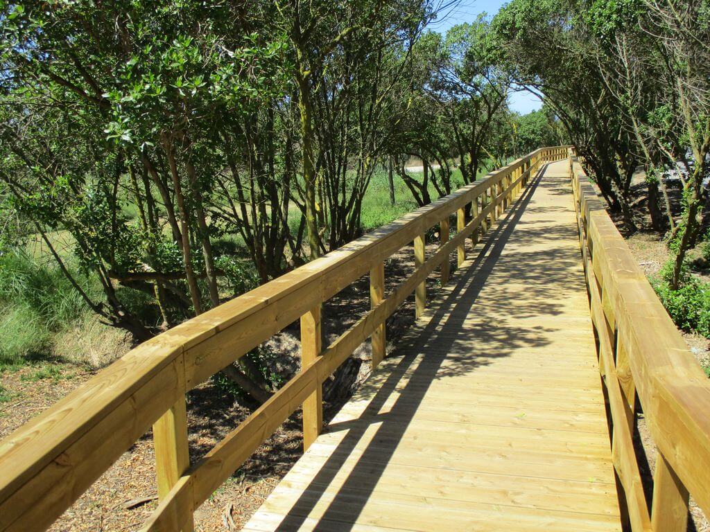
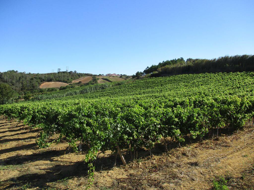
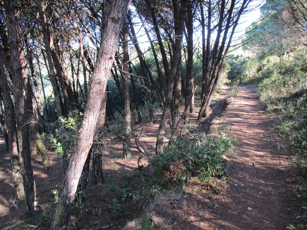
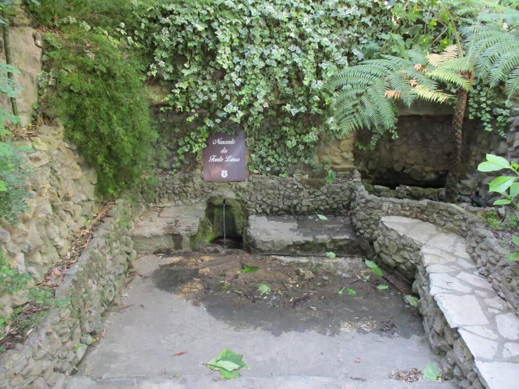
On this walk we'll be travelling through some of the most beautiful scenery in our western region, including some unmissable places, such as the recently inaugurated Maceira Walkways, which make it easy to walk between this town and Porto Novo beach, and the Alcabrichel river valley and its imposing cliffs. Another event not to be missed!
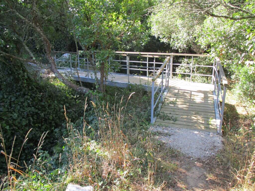
The Maceira Walkways
In a walk of rare beauty between the town of Maceira and the beaches of Porto Novo and Santa Rita, the Maceira Escarpment Walkway offers a rich and wide panorama, as well as the tranquillity typical of this location. Just one kilometre long, it connects two of the region's many points of interest on a route that highlights the stunning coastal scenery, but also the experience of contact with nature through the local fauna and flora. Along the walk there are information panels with additional information about the area and its surroundings.
Porto Novo and Santa Rita Beach
Porto Novo beach stands out for its natural bay, which almost embraces it, while Santa Rita is open and wide. The former also reveals various moments in history: as well as caves with prehistoric remains, it was here that the Duke of Wellington's troops landed during the French Invasions. In Santa Rita, the length of the sand offers space and spaciousness, while the rough sea is a drawcard for water sports enthusiasts.
Some of the points of interest of this event
- Maceira walkways - Alcabrichel river mouth - Pitagudo trail - Vimeiro thermal baths - Santa Rita beach - Alcabrichel river valley - Porto Novo beach - Natural landscapes -
Location
Meeting Point
Porto Novo Beach Car Park
Duke of Wellington Street
Latitude: 39°10'38.14″N
Longitude: 9°21'17.56″W
Meeting time: 9.30am
Estimated final time: 14h
Route Features and Equipment
Circular
Circuit
Equipment
Shoes and clothes suitable for the event
RESERVE
CLOSED EVENT
REGISTER NOW
8€ per person
Includes:
- Guidance and support
- Personal accident insurance
- Civil liability insurance
Not included:
- All items not mentioned.
Comments:
- Only registrations made by 4.30pm on the day before the event will be eligible for Personal Accident Insurance.
- PLACES WILL BE FILLED WHEN PROOF OF PAYMENT IS RECEIVED
Data collection:
Personal information Name, date of birth and VAT number are required for personal accident insurance purposes.
Book:
After successfully submitting the bookingYou will be redirected to a confirmation page. If you have any difficulties making a booking, please contact contact us.
Registration Form
"*" indicates required fields
February
Timetable
(Saturday) 9:30 - 14:00
Meeting Point
Rua Principal - 2640-639 Sobral da Abelheira
Event details
[fusion_builder_container admin_label="" hundred_percent="no" equal_height_columns="no" menu_anchor="" hide_on_mobile="small-visibility,medium-visibility,large-visibility" class="" id="" background_color="" background_image="" background_position="center center" background_repeat="no-repeat" fade="no" background_parallax="none" enable_mobile="no" parallax_speed="0.3" video_mp4="" video_webm="" video_ogv="" video_url="" video_aspect_ratio="16:9" video_loop="yes" video_mute="yes" video_preview_image="" border_color="#ea1717" border_style="solid" margin_top="10px" margin_bottom="10px" padding_top="25px"
Event details




Event Description
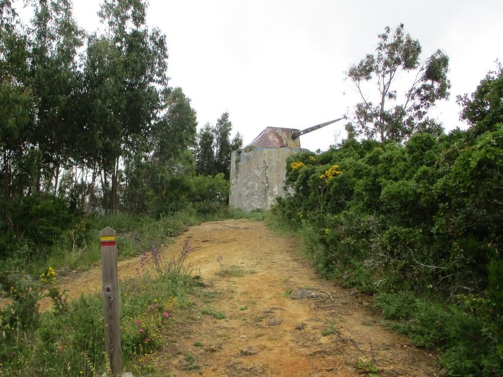
This proposed walk starts in Sobral da Abelheira and takes in various rural paths and trails of great beauty, with some slopes to the hikers' liking. Around Sobral da Abelheira you'll find farmland, citrus groves and pear trees, among others, with a special mention for strawberry production, which is also the subject of an annual festival. In terms of vegetation, the green patches of pine trees, oaks, cork oaks and eucalyptus trees should be emphasised. We'll pass some windmills, the village of Chanca and pass through various places of great natural beauty, between ascents and descents, with very pleasant scenery. Come along and be dazzled by these marvellous landscapes in the West, very close to Lisbon.
Sobral da Abelheira
The rugged geography to the north of Mafra favoured the creation of an urban centre with unique characteristics such as Sobral da Abelheira. Halfway up the hillside, dominating the course of the main local watercourse and organised as a small terraced property, for centuries Sobral da Abelheira was the reference town in an extensive rural area, where people and products from the area's farms converged and where the main processing and trading work was centralised. Sobral still partially fulfils this role today, despite the ongoing road revolution and the more diversified land use, which is no longer exclusively agricultural or forestry.
Equidistant from larger towns, the history of Sobral da Abelheira is largely unknown, although it has been documented since the 16th century, the period to which the oldest remains of the parish church correspond. The Manueline portal of Sobral da Abelheira's parish church, consecrated to Our Lady of the Olive Tree, is noteworthy.
It belonged to the municipality of Azueira until 1855, with which it had stronger agricultural relations and greater proximity for transporting products, taking advantage of the Lisbon - Torres Vedras road. It became part of the municipality of Mafra after Azueira was abolished and is now the municipality's main strawberry producer and an environmental area to be discovered, including an important part of the Tapada de Mafra.
Sobral da Abelheira is well known for its Strawberry Festival, which takes place around the third week of May
Codeçal Village
The village of Codeçal, located next to Celebredo, one of the entrances to the Tapada de Mafra, has a hermitage dedicated to Nossa Senhora da Piedade and became a religious centre of relative importance in the second half of the 18th century, when the attached Casa dos Peregrinos was built with the support of King José. The Parish Church of Sobral da Abelheira is one of the most important temples in the municipality, having been built in the transition from the Manueline to the Renaissance style.
Some of the points of interest on the walk
- Sobral da Abelheira valleys - Mills - Parish church of Nossa Senhora da Oliveira with Manueline portal - Chanca village - Orchards - Strawberry plantations - Natural landscapes -
Location
Meeting Point
Main Street - Sobral da Abelheira (Next to the Fountain)
Latitude: 38°59'40.21″N
Longitude: 9°19'55.30″W
Rua Principal /Largo do Chafariz)
Sobral da Abelheira
Departure time: 9h30
Estimated end time: 14h30
Route Features and Equipment
Circular
Circuit
Equipment
Suitable footwear and clothing for hiking
RESERVE
CLOSED EVENT
REGISTER NOW
8€ per person
Includes:
- Guidance and support
- Personal accident insurance
- Civil liability insurance
Not included:
- All items not mentioned.
Comments:
- Only registrations made by 4.30pm on the day before the event will be eligible for Personal Accident Insurance.
- PLACES WILL BE FILLED WHEN PROOF OF PAYMENT IS RECEIVED
Data collection:
Personal information Name, date of birth and VAT number are required for personal accident insurance purposes.
Book:
After successfully submitting the bookingYou will be redirected to a confirmation page. If you have any difficulties making a booking, please contact contact us.
Registration Form
"*" indicates required fields