

Difficulty Easy
October
Timetable
(Sexta-feira) 19:30 - 22:30
Meeting Point
Restaurante "Os Magníficos" - Alverca do Ribatejo
Event details
[fusion_builder_container admin_label="" hundred_percent="no" equal_height_columns="no" menu_anchor="" hide_on_mobile="small-visibility,medium-visibility,large-visibility" class="" id="" background_color="" background_image="" background_position="center center" background_repeat="no-repeat" fade="no" background_parallax="none" enable_mobile="no" parallax_speed="0.3" video_mp4="" video_webm="" video_ogv="" video_url="" video_aspect_ratio="16:9" video_loop="yes" video_mute="yes" video_preview_image="" border_color="#ea1717" border_style="solid" margin_top="10px" margin_bottom="10px" padding_top="25px"
Event details

Event Description
Este ano vamos assinalar o nosso 11º Aniversário através de um Jantar-Convívio entre todos os nossos clientes e amigos, que possam juntar neste agradável momento de comemoração, alegria a partilha entre muitos momentos vividos durante a nossa existência enquanto Agência de Viagens, Agentes de Animação Turística e um dos maiores grupos de eventos da área da grande Lisboa. Se puder venha daí divertir-se e confraternizar nesta noite de 6ª feira. Esperamos por vós!
INSCRIÇÕES APENAS ATÉ DIA 18 DE OUTUBRO
Walking.co.uk
JANTAR A PAGAR NO RESTAURANTE:
Entradas: Diversas
Pratos: A escolher por cada após a inscrição
Bebidas: A escolher por cada após a inscrição
Valor aproximado: 20 a 25€ por pessoa (depende naturalmente das escolhas de cada participante)
Places are limited, so enrolments will be considered on a first-come, first-served basis.
Note: Oferta aos clientes habituais da Caminhando
Some of the points of interest on the walk
• Jantar de Aniversário •
Location
Meeting Point
Restaurante “Os Magníficos”
Av. Cidade de Alverca nº 55, 2615-130 Alverca do Ribatejo
Latitude: 38.8989614
Longitude: -9.0402868
Meeting time: 19h30m
Estimated final time: 22h30
Route Features and Equipment
Circular
Circuit
Equipment
Suitable footwear
Suitable clothing for hiking
Take 1.5 litres of water
Hat
RESERVE
REGISTER NOW
215€ per person
- 245€ in a single room
Includes:
- Transport by coach/bus/tourist van from Lisbon to each of the places described above
• Alojamento em Hotel de 3 estrelas com pequeno-almoço incluído
- The proposed accommodation option includes various room types
- Guidance and support
- Personal accident insurance
- Civil liability insurance
Not included:
- All items not mentioned.
Comments:
- Only registrations made by 4.30pm on the day before the event will be eligible for Personal Accident Insurance.
- PLACES WILL BE FILLED WHEN PROOF OF PAYMENT IS RECEIVED
Data collection:
Personal information Name, date of birth and VAT number are required for personal accident insurance purposes.
Book:
After successfully submitting the bookingYou will be redirected to a confirmation page. If you have any difficulties making a booking, please contact contact us.
Registration Form
"*" indicates required fields
Timetable
(Sábado) 16:00 - 18:00
Meeting Point
Aldeia do Escaroupim, next to the wharf (follow signs to Restaurante "O Escaroupim")
Event details
[fusion_builder_container admin_label="" hundred_percent="no" equal_height_columns="no" menu_anchor="" hide_on_mobile="small-visibility,medium-visibility,large-visibility" class="" id="" background_color="" background_image="" background_position="center center" background_repeat="no-repeat" fade="no" background_parallax="none" enable_mobile="no" parallax_speed="0.3" video_mp4="" video_webm="" video_ogv="" video_url="" video_aspect_ratio="16:9" video_loop="yes" video_mute="yes" video_preview_image="" border_color="#ea1717" border_style="solid" margin_top="10px" margin_bottom="10px" padding_top="25px"
Event details




Event Description
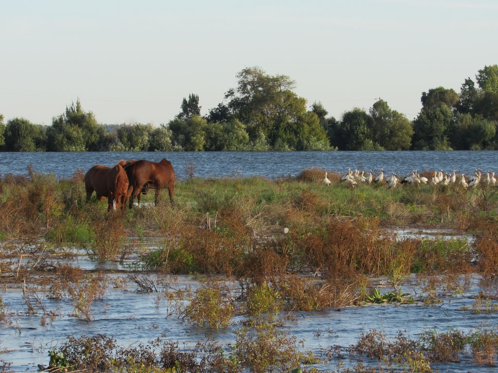
This activity proposal will take us to discover the charms of our Tagus River on a Sunset Cruise, an event not only for all photography lovers, but for all those who like to discover the charms of nature, often so close to our doorstep.
On this tour, which lasts approximately 2 hours, we'll get to know the mouchões, sail close to the pier and the houses of Aldeias Avieiras, such as Palhota and Escaroupim, disembark at a river beach (when river conditions allow), watch the herons return to their island at dusk, pass by Ilha dos Amores, and return to Escaroupim, our starting point.
There will also be a wine tasting, with two wines (white and red) and a liqueur.
Escaroupim
About 7 kilometres from Salvaterra de Magos is the village of EscaroupimThis is an excellent option for a weekend, or just a Saturday or Sunday, to enjoy the calm and tranquillity if you want to get away from Lisbon, which is about 70 kilometres from the city on the N 118.
Escaroupim is a typical fishing village, formed in the mid-30s. Alves Redol called these families "river nomads" who, during the winter months, travelled from Vieira de Leiria to the River Tagus for the winter fishing campaigns, returning in the summer to their homeland to fish in the sea. Some of these fishermen stayed on the banks of the Tagus, forming small fishing villages along the river.
From an ornithological point of view, this place stands out for its heron colony, located in a mouchão on the Tagus.
Village of Palhota
Palhota is a typical fishing village, built with wooden houses on stilts, whose origins are lost in time. Alves Redol, a great Portuguese writer who wrote a lot about the Tagus and its people, once lived in this village.
Some of the points of interest on the walk
- 2-hour boat trip back to the meeting point (Escaroupim) - Escaroupim village - Avieira house in Escaroupim village - Valada do Ribatejo river beach and picnic park - Rainha D. Amélia bridge - Palhota Avieira village - Mouchão das Garças - Mouchão dos Cavalos - Ilha dos Amores - Natural landscapes and banks of the Tagus river -
Location
Meeting Point
Aldeia do Escaroupim, next to the pier (follow the signs to Restaurante "O Escaroupim".
Cais do Escaroupim | Largo dos Avieiros, 3 - Escaroupim
2120-018 Salavaterra de Magos
Latitude: 39° 4'1.44″N
Longitude: 8°45'26.31″W
Meeting time: 16h00
Estimated end time: 18h00
Route Features and Equipment
Circular
Circuit
Equipment
Suitable footwear and clothing for the event
RESERVE
REGISTER NOW
215€ per person
- 245€ in a single room
Includes:
- Transport by coach/bus/tourist van from Lisbon to each of the places described above
• Alojamento em Hotel de 3 estrelas com pequeno-almoço incluído
- The proposed accommodation option includes various room types
- Guidance and support
- Personal accident insurance
- Civil liability insurance
Not included:
- All items not mentioned.
Comments:
- Only registrations made by 4.30pm on the day before the event will be eligible for Personal Accident Insurance.
- PLACES WILL BE FILLED WHEN PROOF OF PAYMENT IS RECEIVED
Data collection:
Personal information Name, date of birth and VAT number are required for personal accident insurance purposes.
Book:
After successfully submitting the bookingYou will be redirected to a confirmation page. If you have any difficulties making a booking, please contact contact us.
Registration Form
"*" indicates required fields
November
Timetable
(Saturday) 9:30 - 13:45
Meeting Point
Rua do Rouxinol - Corroios
Event details
[fusion_builder_container admin_label="" hundred_percent="no" equal_height_columns="no" menu_anchor="" hide_on_mobile="small-visibility,medium-visibility,large-visibility" class="" id="" background_color="" background_image="" background_position="center center" background_repeat="no-repeat" fade="no" background_parallax="none" enable_mobile="no" parallax_speed="0.3" video_mp4="" video_webm="" video_ogv="" video_url="" video_aspect_ratio="16:9" video_loop="yes" video_mute="yes" video_preview_image="" border_color="#ea1717" border_style="solid" margin_top="10px" margin_bottom="10px" padding_top="25px"
Event details






Event Description
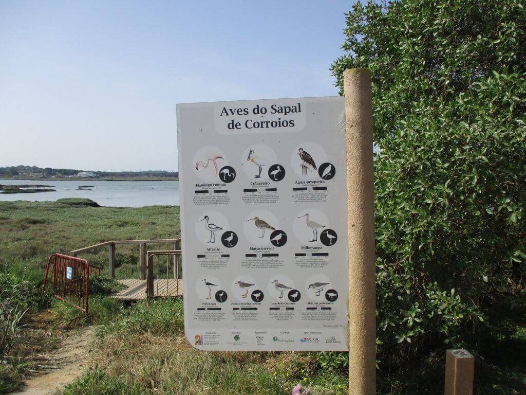
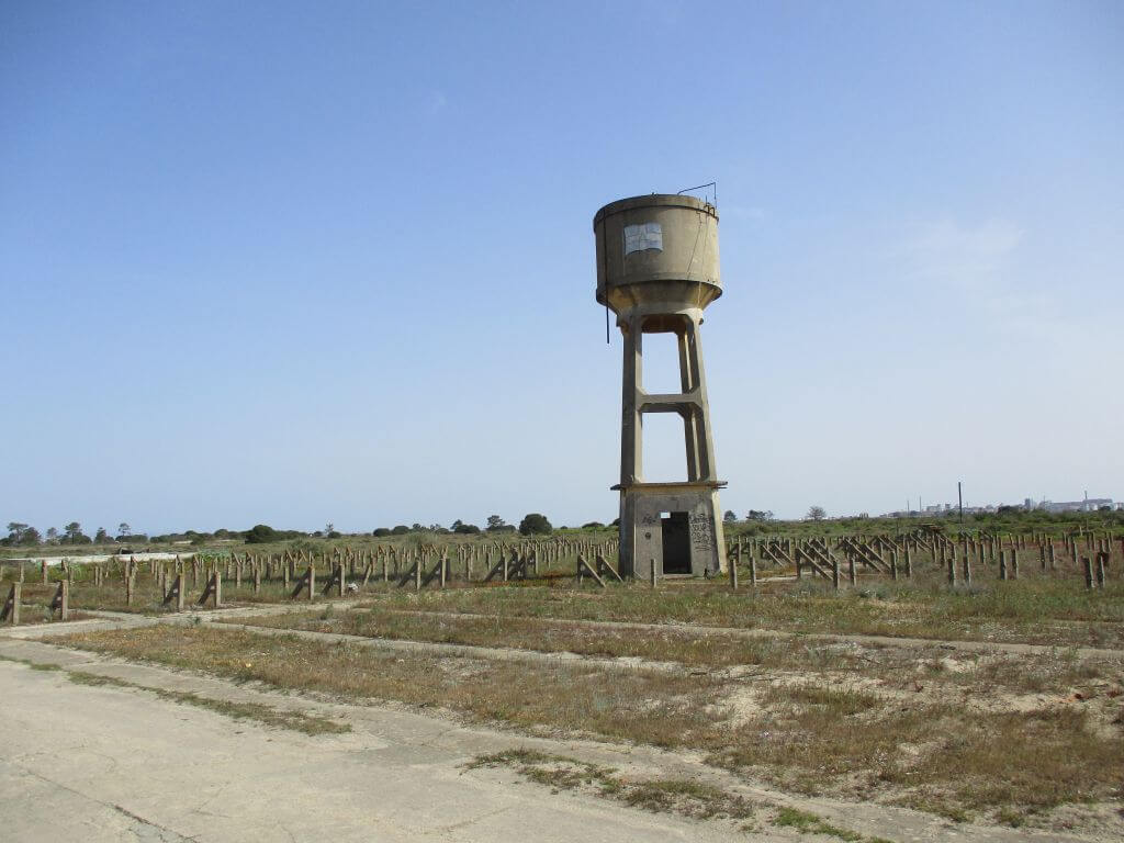
In this event, we're going to walk around Ponta dos Corvos, in the municipality of Seixal, taking the opportunity to learn more about a marshland area where various species of birds nest and feed. We'll also take advantage of the walk to pass by the facilities of what was once a large cod drying factory and we'll also have the opportunity to see what remains of four old tide mills that once stood on this peninsula, with excellent panoramic views of the surrounding area, including the city of Lisbon. Another event not to be missed!
Cod drying factory:
The Fábrica da Seca de Bacalhau of the Companhia Atlântica de Pesca. It was the largest in the area and was established here in 1947, closing at the beginning of the 90s. It occupied an area of around 40 hectares and employed around 600 workers, most of them women. The cod was dried between October and March, as the ideal temperature for drying cod is around 20 degrees centigrade. There are traces of a pier, whose foundations still mark the presence of what was once the scene of heavy daily labour. Judging by its length, it would have allowed for several moorings at the same time, which testifies to the routine hustle and bustle of this factory, as well as a large workforce. In the surrounding grounds we can still see the hundreds of stakes used to dry this appetising fish in the sun, giving us the opportunity to realise the scale of production at this industrial unit.
Circuit of the 5 tidal mills:
Along our walk we will pass the following tidal mills:
- Corroios Tide Mill
- Galvão Tide Mill
- Captain's Tide Mill
- Passagem Tide Mill
- Torre Tide Mill
Corroios Tide Mill
The Corroios Tide Mill, built in 1403 on the initiative of the Holy Constable Nuno Álvares Pereira, is an example of the use of tidal energy, the application of which to the milling activity became widespread in the Tagus estuary in other times.
In 1404, the Constable donated it and his property in the area to the Convent of Carmel, a religious order of which he was Master. It was enlarged at the beginning of the 18th century, but soon underwent renovations again as the 1755 earthquake caused major damage. This mill, also known as Moinho do Castelo, is still in working order today. In 1980 it was acquired by the local authority. For six years it underwent restoration work and in 1986 it was opened to the public as part of the Seixal Municipal Ecomuseum.
Some of the points of interest on the walk
- Walk at Ponta dos Corvos - “Atlântica” Codfish Drying Factory - Corroios Marsh and Tagus Estuary - Seixal Bay - Galvão Tide Mill - Capitão Tide Mill - Passagem Tide Mill - Torre Tide Mill - Natural landscapes -
Location
Meeting Point
Rua do Rouxinol - Quinta do Rouxinol
2855-193 Corroios
In front of the entrance to the Corroios Tide Mill
Latitude: 38°38’41.28″N
Longitude: 9° 8’45.93″W
Meeting time: 9h30
Estimated end time: 13h45
Route Features and Equipment
Circular
Circuit
Equipment
Footwear and clothing suitable for hiking
RESERVE
REGISTER NOW
215€ per person
- 245€ in a single room
Includes:
- Transport by coach/bus/tourist van from Lisbon to each of the places described above
• Alojamento em Hotel de 3 estrelas com pequeno-almoço incluído
- The proposed accommodation option includes various room types
- Guidance and support
- Personal accident insurance
- Civil liability insurance
Not included:
- All items not mentioned.
Comments:
- Only registrations made by 4.30pm on the day before the event will be eligible for Personal Accident Insurance.
- PLACES WILL BE FILLED WHEN PROOF OF PAYMENT IS RECEIVED
Data collection:
Personal information Name, date of birth and VAT number are required for personal accident insurance purposes.
Book:
After successfully submitting the bookingYou will be redirected to a confirmation page. If you have any difficulties making a booking, please contact contact us.
Registration Form
"*" indicates required fields
Timetable
(Sunday) 9:30 - 13:45
Meeting Point
At the end of Av. 1º de Maio, near the roundabout
Event details
[fusion_builder_container admin_label="" hundred_percent="no" equal_height_columns="no" menu_anchor="" hide_on_mobile="small-visibility,medium-visibility,large-visibility" class="" id="" background_color="" background_image="" background_position="center center" background_repeat="no-repeat" fade="no" background_parallax="none" enable_mobile="no" parallax_speed="0.3" video_mp4="" video_webm="" video_ogv="" video_url="" video_aspect_ratio="16:9" video_loop="yes" video_mute="yes" video_preview_image="" border_color="#ea1717" border_style="solid" margin_top="10px" margin_bottom="10px" padding_top="25px"
Event details





Event Description
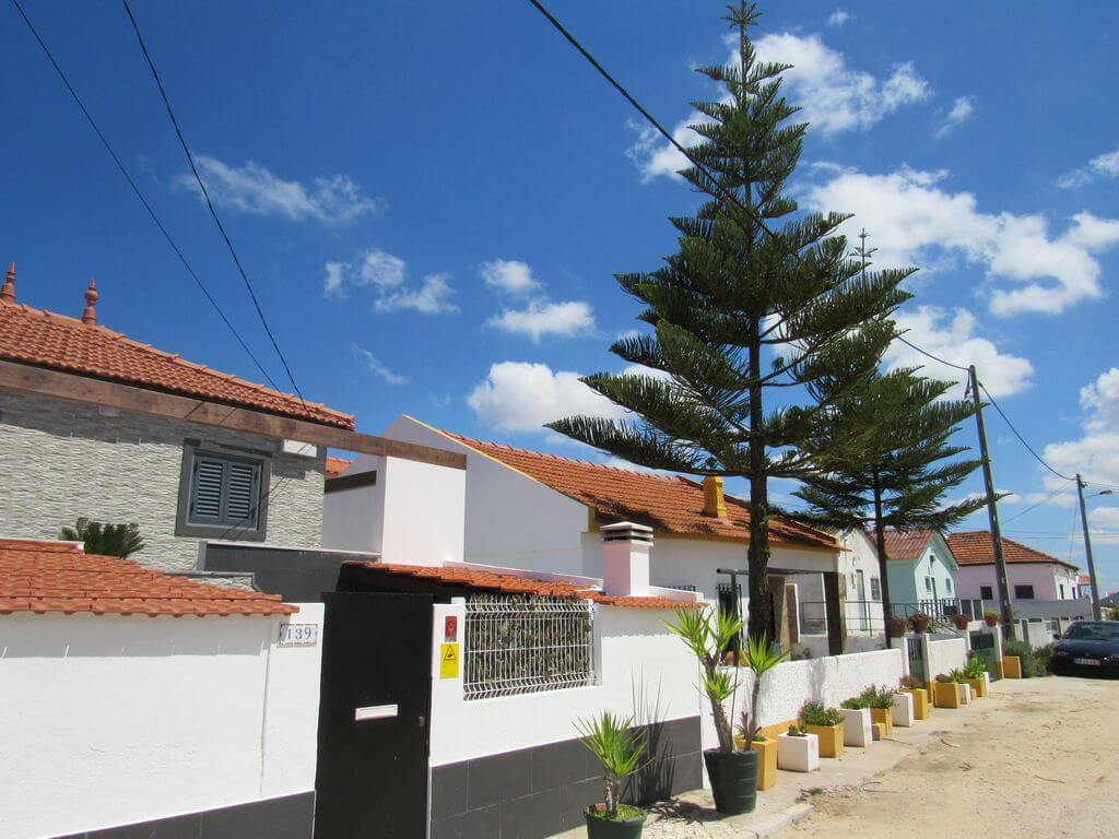
This walk starts in Costa da Caparica, on Av. 1 de Maio, near the roundabout behind the restaurant "O BARBAS".
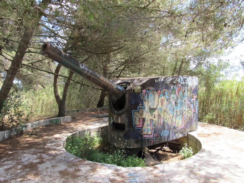
The route passes along the entire coastline from Caparica to Cova do Vapor, with excellent views of the sea, the mouth of the Tagus and the entire city of Lisbon and the Cascais coastline. There are also the Raposeira and Alpena Forts before returning to our starting point. This will be another event not to be missed, where the blue of the sea will be an almost constant presence during the walk.
Cova do Vapor
Cova do Vapor used to be a fishing village, nowadays it's a bathing, fishing and suburban village. In fifty years it has been pushed more than half a dozen times by the sea into the Mata de S. João; its inhabitants have walked with their houses on their backs, on ox carts. At Praia da Cova do Vapor, strong winds allow for kite surfing and during low tide a sandbank is uncovered where shellfish, also known as "cadelinhas", are caught.
The Alpena and Raposeira Batteries
The construction of these batteries began in 1893, forming part of the system known as Campo Entrincheirado de Lisboa (Lisbon Entrenched Camp) and later integrating the Lisbon Maritime Defence Front. The complex consists of four batteries, the first two of which were completed in 1901 and 1902, and the others in 1909 and 1911. The Raposeira batteries are located next to the old Vigia Fort, on a higher level, and the Alpena batteries near the old strongholds of Raposeira Grande and Pequena (the latter are now abandoned). The garrison of the batteries was housed in the Trafaria barracks, built for the purpose and inaugurated in 1905 by King Carlos.
The Raposeira Battery is closely linked to its neighbour the Alpena Battery, and to the BIRT (Battalion of Information and Reconnaissance Transmissions), the former supported it as an armoury, the latter was its nerve centre... all were deactivated by the restructuring of the army in 1996 and are now abandoned.
Some of the points of interest on the walk
- Costa da Caparica promenade - São João Beach - Cova do Vapor Beach - Segundo Torrão Beach - Raposeira Battery - Alpena Fort - Views over the Atlantic and Lisbon coast - Santo António da Caparica Municipal Park - Natural landscapes -
Location
Meeting Point
At the end of Av. 1º de Maio, near the roundabout
(for those coming from the fast lane on the Lisbon side, keep going straight ahead until you reach the roundabout)
Latitude: 38°38'38.65″N
Longitude: 9°14'25.68″W
Meeting time: 9.20am
Estimated end time: 13h45
Route Features and Equipment
Circular
Circuit
Equipment
Footwear and clothing suitable for hiking
RESERVE
REGISTER NOW
215€ per person
- 245€ in a single room
Includes:
- Transport by coach/bus/tourist van from Lisbon to each of the places described above
• Alojamento em Hotel de 3 estrelas com pequeno-almoço incluído
- The proposed accommodation option includes various room types
- Guidance and support
- Personal accident insurance
- Civil liability insurance
Not included:
- All items not mentioned.
Comments:
- Only registrations made by 4.30pm on the day before the event will be eligible for Personal Accident Insurance.
- PLACES WILL BE FILLED WHEN PROOF OF PAYMENT IS RECEIVED
Data collection:
Personal information Name, date of birth and VAT number are required for personal accident insurance purposes.
Book:
After successfully submitting the bookingYou will be redirected to a confirmation page. If you have any difficulties making a booking, please contact contact us.
Registration Form
"*" indicates required fields
Timetable
(Sunday) 9:30 - 14:00
Meeting Point
R. Bacelo Oeste 34, 7005-423 Évora
Event details
[fusion_builder_container admin_label="" hundred_percent="no" equal_height_columns="no" menu_anchor="" hide_on_mobile="small-visibility,medium-visibility,large-visibility" class="" id="" background_color="" background_image="" background_position="center center" background_repeat="no-repeat" fade="no" background_parallax="none" enable_mobile="no" parallax_speed="0.3" video_mp4="" video_webm="" video_ogv="" video_url="" video_aspect_ratio="16:9" video_loop="yes" video_mute="yes" video_preview_image="" border_color="#ea1717" border_style="solid" margin_top="10px" margin_bottom="10px" padding_top="25px"
Event details






Event Description
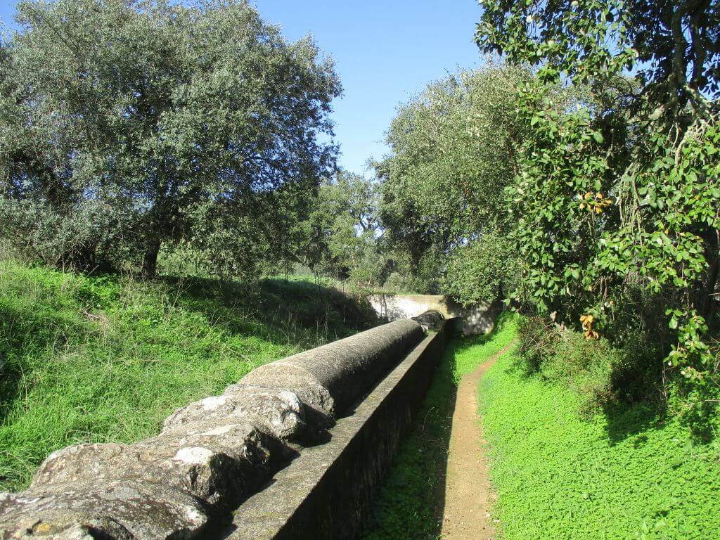
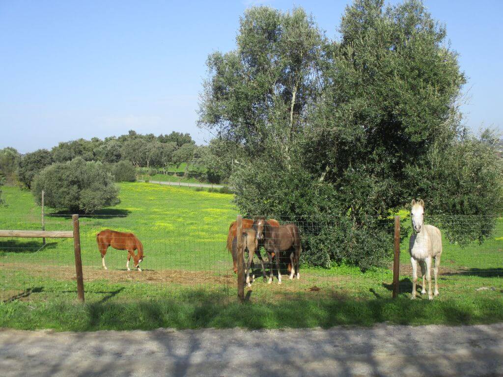
This proposed walk will allow us to get to know an important part of the route of the Água de Prata Aqueduct, the most important hydraulic work of the 16th century and a national monument that brought water from the Divor springs to the city of Évora. Another event not to be missed!
Silver Water Aqueduct
The Silver Water Aqueduct, also known as the Silver Water Aqueduct or Silver Aqueduct, is a complex work of Renaissance hydraulic engineering with the aim of supplying the city of Évora with water. Inaugurated in 1537, it was built during the reign of King João III and designed and built by the royal architect Francisco de Arruda. The aqueduct carries water from springs located in Graça do Divor, within the grounds of the São Bento de Castris Convent, which "have their first beginnings in the Herdade das Figueiras de Lobo", to the city of Évora, which is about 18 kilometres away. It is an integral part of Évora's Historic Centre.
The Água de Prata Aqueduct was the most important hydraulic work built in Portugal in the 16th century and is classified as a National Monument.
Some of the points of interest on the walk
- Silver Water Aqueduct - Alto de São Bento - Ecotrail - 16th century arcade - Évora - Natural landscapes -
Location
Meeting Point
Car park in front of ECO-FRANGO - Barbecue area
R. Bacelo Oeste 34,
7005-423 Évora
Latitude: 38°35'28.76″N
Longitude: 7°54'51.36″W
Meeting time: 9.30am
Estimated end time: 14h00
Route Features and Equipment
Circular
Circuit
Equipment
Footwear and clothing suitable for hiking
RESERVE
REGISTER NOW
215€ per person
- 245€ in a single room
Includes:
- Transport by coach/bus/tourist van from Lisbon to each of the places described above
• Alojamento em Hotel de 3 estrelas com pequeno-almoço incluído
- The proposed accommodation option includes various room types
- Guidance and support
- Personal accident insurance
- Civil liability insurance
Not included:
- All items not mentioned.
Comments:
- Only registrations made by 4.30pm on the day before the event will be eligible for Personal Accident Insurance.
- PLACES WILL BE FILLED WHEN PROOF OF PAYMENT IS RECEIVED
Data collection:
Personal information Name, date of birth and VAT number are required for personal accident insurance purposes.
Book:
After successfully submitting the bookingYou will be redirected to a confirmation page. If you have any difficulties making a booking, please contact contact us.
Registration Form
"*" indicates required fields
Timetable
(Saturday) 9:30 - 13:00
Meeting Point
Praça Dom Luís I, 1200-109 Lisbon
Event details
[fusion_builder_container admin_label="" hundred_percent="no" equal_height_columns="no" menu_anchor="" hide_on_mobile="small-visibility,medium-visibility,large-visibility" class="" id="" background_color="" background_image="" background_position="center center" background_repeat="no-repeat" fade="no" background_parallax="none" enable_mobile="no" parallax_speed="0.3" video_mp4="" video_webm="" video_ogv="" video_url="" video_aspect_ratio="16:9" video_loop="yes" video_mute="yes" video_preview_image="" border_color="#ea1717" border_style="solid" margin_top="10px" margin_bottom="10px" padding_top="25px"
Event details



Event Description
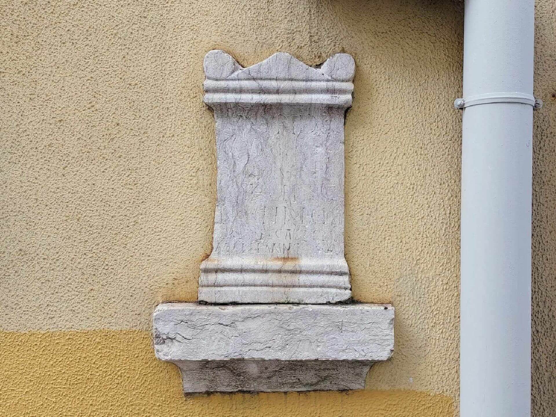
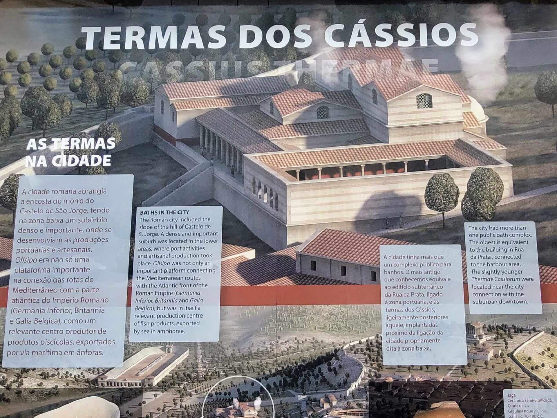
Do you know what Lisbon looked like when the Romans arrived here in 137 BC? How was the Roman city of Olisipo organised on the ground? What were its most emblematic buildings? Come with us on this walk and find out not only the answer to these questions, but also other curious aspects of the Roman presence in Lisbon.
The walk follows paths of great historical and heritage interest, starting in the garden of Praça D. Luís I, heading towards Cais do Sodré and from there, by the Tagus, to Praça do Comércio. The route will then continue along the riverside area of the Roman city of Olisipo, then up through the heart of Alfama to Portas do Sol. This is followed by a circuit around the Castle hill, stopping off at some of the most significant sites of the Roman presence in Lisbon. After reaching the Lisbon Cathedral area, rich in various testimonies from Roman times, the walk will continue to the Praça da Figueira and Praça do Rossio areas, where the Necropolis and the Roman Circus will be discussed. On the way back to the starting point of the walk, we'll pass by the Archaeological Centre of Rua dos Correeiros and the Cryptoporticus of Rua da Conceição. A little surprise is in store for the end.
Throughout the walk, which does not include visits to the museum sites, there will be brief presentations of the most significant sites, also contextualising their importance within the functioning and urban organisation of the Roman city. Another event not to be missed!
Some of the points of interest on the tour
- Praça do Comércio - Casa dos Bicos - Aurea Museum - Late Roman Wall - Portas do Sol - Roman Theatre - Lisbon Cathedral - Black Stones tombstones - Cassios Thermal Baths - Necropolis of Praça da Figueira - Roman Circus - Cryptoporticus of Rua da Conceição - Archaeological Centre of Rua dos Correeiros -
Location
Meeting Point
Latitude: 38°42’27.0″N
Longitude: 9°08’47.8″W
Meeting time: 9.20am
Departure time: 9.30am
Estimated end time: 13:00
Route Features and Equipment
Circular
Circuit
Equipment
Footwear and clothing suitable for hiking
RESERVE
REGISTER NOW
215€ per person
- 245€ in a single room
Includes:
- Transport by coach/bus/tourist van from Lisbon to each of the places described above
• Alojamento em Hotel de 3 estrelas com pequeno-almoço incluído
- The proposed accommodation option includes various room types
- Guidance and support
- Personal accident insurance
- Civil liability insurance
Not included:
- All items not mentioned.
Comments:
- Only registrations made by 4.30pm on the day before the event will be eligible for Personal Accident Insurance.
- PLACES WILL BE FILLED WHEN PROOF OF PAYMENT IS RECEIVED
Data collection:
Personal information Name, date of birth and VAT number are required for personal accident insurance purposes.
Book:
After successfully submitting the bookingYou will be redirected to a confirmation page. If you have any difficulties making a booking, please contact contact us.
Registration Form
"*" indicates required fields
Timetable
(Saturday) 9:30 - 14:00
Meeting Point
São Martinho do Porto
Event details
[fusion_builder_container admin_label="" hundred_percent="no" equal_height_columns="no" menu_anchor="" hide_on_mobile="small-visibility,medium-visibility,large-visibility" class="" id="" background_color="" background_image="" background_position="center center" background_repeat="no-repeat" fade="no" background_parallax="none" enable_mobile="no" parallax_speed="0.3" video_mp4="" video_webm="" video_ogv="" video_url="" video_aspect_ratio="16:9" video_loop="yes" video_mute="yes" video_preview_image="" border_color="#ea1717" border_style="solid" margin_top="10px" margin_bottom="10px" padding_top="25px"
Event details




Event Description
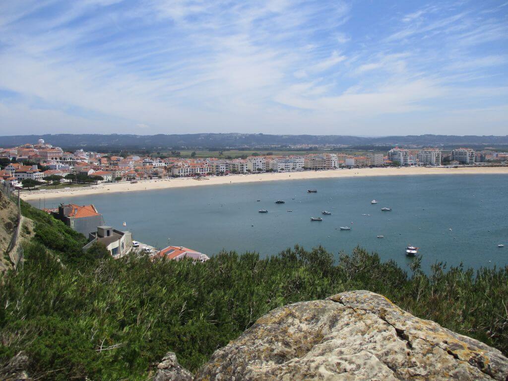
This walk will take place in an environment of great natural beauty, starting and finishing at the bay of São Martinho do Porto, from where we'll walk along the coast towards Nazaré and on the way back we'll go to the Facho viewpoint and the lighthouse at the entrance to the bay. Another event not to be missed!
São Martinho do Porto
The shell of São Martinho is what remains of an ancient gulf that occupied a vast area, where Alfeizerão was a harbour of considerable importance. With the progressive silting up of the bay, Salir came to fulfil the functions that Alfeizerão could no longer do. The town probably originated as a fishing village. The Granja de São Martinho was founded on this site by the Cistercian Order, which came to settle the population and give the land its name. Later, the name "do Porto" was added.
São Martinho do Porto Viewpoint - Facho Viewpoint
From this elevation you can see the entire bay of São Martinho do Porto, a geographical feature that, due to its perfect shell shape, is unique in the country and in Europe. It has three kilometres of sand and a 250-metre bar between the Morros de Santana to the south and the Farol to the north.
José Bento da Silva Square Viewpoint
One of the most beautiful viewpoints in São Martinho do Porto, overlooking the bay and with direct access from the Outeiro lift.
Morro de Santo António Lighthouse
It now has no function beyond tourism and remembrance, and once defended the entrance to the bay of São Martinho do Porto. Today the lighthouse has been replaced by more modern systems that fulfil the same function. From the site of the lighthouse, there is an impressive view over the bay, the town and the sea, as well as a beautiful 400 metre walk along the cliff tops.
Cruise and Viewpoint
It is located at the top of the hill of Santo António and was built in 1940, according to the inscriptions engraved on it: VIII CENTENARY OF THE INDEPENDENCE AND III OF THE RESTORATION OF PORTUGAL MCMXL.
Some of the points of interest on the walk
- Baía de São Martinho do Porto - Miradouro do Facho - Praia da Gralha - Cruzeiro e Miradouro - Farol do morro de Santo António - Igreja Matriz - Serra dos Mangues - Natural landscapes -
Location
Meeting Point
José Frederico Ulrich Square
2460-649 São Martinho Do Porto
Latitude: 39°30'45.85″N
Longitude:9° 8'10.96″W
Meeting time: 9.20am
Estimated end time: 14h
Route Features and Equipment
Circular
Circuit
Equipment
Footwear and clothing suitable for hiking
RESERVE
REGISTER NOW
215€ per person
- 245€ in a single room
Includes:
- Transport by coach/bus/tourist van from Lisbon to each of the places described above
• Alojamento em Hotel de 3 estrelas com pequeno-almoço incluído
- The proposed accommodation option includes various room types
- Guidance and support
- Personal accident insurance
- Civil liability insurance
Not included:
- All items not mentioned.
Comments:
- Only registrations made by 4.30pm on the day before the event will be eligible for Personal Accident Insurance.
- PLACES WILL BE FILLED WHEN PROOF OF PAYMENT IS RECEIVED
Data collection:
Personal information Name, date of birth and VAT number are required for personal accident insurance purposes.
Book:
After successfully submitting the bookingYou will be redirected to a confirmation page. If you have any difficulties making a booking, please contact contact us.
Registration Form
"*" indicates required fields
Timetable
(Saturday) 9:30 - 15:00
Meeting Point
EB1 de Grândola - Rua das Pontes, 7570-227 Grândola
Event details
[fusion_builder_container admin_label="" hundred_percent="no" equal_height_columns="no" menu_anchor="" hide_on_mobile="small-visibility,medium-visibility,large-visibility" class="" id="" background_color="" background_image="" background_position="center center" background_repeat="no-repeat" fade="no" background_parallax="none" enable_mobile="no" parallax_speed="0.3" video_mp4="" video_webm="" video_ogv="" video_url="" video_aspect_ratio="16:9" video_loop="yes" video_mute="yes" video_preview_image="" border_color="#ea1717" border_style="solid" margin_top="10px" margin_bottom="10px" padding_top="25px"
Event details


Event Description
This walk takes place in the fantastic Serra de Grândola, in an immense patch of forest where the cork oak is king, on a route in the middle of nature and in some parts along the Grândola stream. Another event not to be missed!
Grândola Mountains
At 326 metres at its highest point, the Grândola mountain range (which extends into the municipality of Santiago de Cacém) is one of the most important natural components of the Grândola area. Unlike most Portuguese mountains, which are oblique to the coast, Grândola is parallel to it, which makes it difficult for sea air to penetrate, although it does contribute to cloud condensation. Part of the Iberian Plateau, dating back to the Lower Carbonic period, it is essentially made up of schist, which in some places is foliated and in others has a harder, more compact consistency.
Its main watercourse - the Ribeira de Grândola or Davino River - with its wooded banks, runs through a valley with dissymmetrical slopes, the one on the right bank having a steeper slope. On the east side of the Santiago road, the relief is roughly the same and the main watercourse is the Castelhanos stream (a tributary of the Davino). It should be noted that both streams remain largely dry during the summer, with water only remaining in a few catchments.
Due to its characteristics, the soils of the Serra de Grândola are generally poor and unsuitable for agriculture, which has led its owners to take up tree farming. Today, most of it is covered in cork oaks, which produce some of the best cork in Portugal. Here and there, small patches of pine and eucalyptus can also be seen. In areas with less human intervention, spontaneous vegetation still prevails, consisting of sargasso, cistus, bearberry, bramble, strawberry trees, carrasqueiros, zambujeiros, gilbardeiros and other Mediterranean-type plants.
Chapel of Our Lady of Penha de França
This chapel is located in the Outeiro da Penha. On 15 May 1664, the Order of Santiago authorised the construction of this chapel, which must have happened in the following years. The chapel has a ground floor with a gable roof, a small bell tower with a bell, two front doors, a door and three windows on the west wall, two pointed buttresses at the rear and a door and two benches on the south-east wall. The interior consists of a nave, a chancel (with an altar), a sacristy and an annex. The lower part of the nave is decorated with 18th century blue and white tile panels depicting flowers, angels and fruit, while the chancel has more elaborate panels showing “aspects of the life of Our Lady”. The panel above the door to the sacristy has a frieze with the date 1721.
Some of the points of interest on the walk
- Serra de Grândola - Grândola Stream - Chapel of Our Lady of Penha de França - Outeiro da Penha - Montinho da Ribeira Eco-park - Natural landscapes -
Location
Meeting Point
EB1 Grândola
Bridges Street
7570-227 Grândola
Latitude: 38°10’21.16″N
Longitude: 8°34’4.90″W
Meeting time: 9.30am
Estimated end time 15h
Route Features and Equipment
Circular
Circuit
Equipment
Footwear and clothing suitable for hiking
RESERVE
REGISTER NOW
215€ per person
- 245€ in a single room
Includes:
- Transport by coach/bus/tourist van from Lisbon to each of the places described above
• Alojamento em Hotel de 3 estrelas com pequeno-almoço incluído
- The proposed accommodation option includes various room types
- Guidance and support
- Personal accident insurance
- Civil liability insurance
Not included:
- All items not mentioned.
Comments:
- Only registrations made by 4.30pm on the day before the event will be eligible for Personal Accident Insurance.
- PLACES WILL BE FILLED WHEN PROOF OF PAYMENT IS RECEIVED
Data collection:
Personal information Name, date of birth and VAT number are required for personal accident insurance purposes.
Book:
After successfully submitting the bookingYou will be redirected to a confirmation page. If you have any difficulties making a booking, please contact contact us.
Registration Form
"*" indicates required fields
Timetable
(Sunday) 9:30 - 14:00
Meeting Point
Rua da Ponte Velha, Peniche
Event details
[fusion_builder_container admin_label="" hundred_percent="no" equal_height_columns="no" menu_anchor="" hide_on_mobile="small-visibility,medium-visibility,large-visibility" class="" id="" background_color="" background_image="" background_position="center center" background_repeat="no-repeat" fade="no" background_parallax="none" enable_mobile="no" parallax_speed="0.3" video_mp4="" video_webm="" video_ogv="" video_url="" video_aspect_ratio="16:9" video_loop="yes" video_mute="yes" video_preview_image="" border_color="#ea1717" border_style="solid" margin_top="10px" margin_bottom="10px" padding_top="25px"
Event details




Event Description
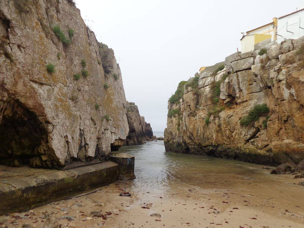
This walk takes in the fantastic Peniche peninsula, once an island, highlighting countless points of interest and incredible landscapes all along the coast, from Cape Carvoeiro to the Peniche Fortress, the Cruz dos Remédios viewpoint, the Varanda de Pilatos and the Papôa Islet area. Another event not to be missed!
Pilate's balcony
Before reaching the lighthouse at Cape Carvoeiro, on the limestone cliff by the sea is the so-called “Pilate's Balcony”, from where you can admire the Nau dos Corvos (a rock by the coast where cormorants usually land), Cape Carvoeiro with its lighthouse and, on clear days, the Berlengas archipelago.
Part of the "Peniche Peninsula" geosite, which is a limestone platform that has been eroded by wind, rain and the sea, you can see the beautiful shapes that erosion has created, forming a lapiás.
Papôa Islet
On the north coast of Peniche, there is a small peninsula with limestone and volcanic breccia, known as the Papoa Islet. This rock formation is karst-shaped and is a popular fishing spot, also offering beautiful views of the sea. The Papoa islet marks the beginning of Baleal beach, is a refuge for surfers when the wind blows from the south-east and is also an excellent spot for watching seabirds. Peniche is the best place in Europe for spotting migratory birds, such as the Cormorant, Lesser Kite, Laughing Gull and Roseate Tern.
Portinho da Areia do Norte Beach
Praia do Portinho da Areia do Norte is a privileged spot from which to contemplate the Berlengas Nature Reserve from afar. The small sandy beach is located in a cove and to the north of it is the Papôa Peninsula, known for the existence of a large wave peak in its immediate vicinity. It was on this beach that the victims of the shipwreck of the Kingdom of Spain's San Pedro de Alcântara on 2 February 1786 were buried
Some of the points of interest on the walk
- Peniche Fortress - Fort Viewpoint - São Pedro Beach - Peniche Marina - Camaroa Beach - Portinho da Areia Sul Beach - Dominique's Balcony - Furninha Cave - Carvoeiro Viewpoint and Cape Carvoeiro - Pilatos Balcony - Cruz dos Remédios and Revelim Viewpoint - Portinho da Areia do Norte Beach - Papôa Islet - Quebrado Beach - Baluarte Park - Natural landscapes -
Location
Meeting Point
Rua da Ponte Velha, Peniche
Car park in front of the Volunteer Fire Brigade
Latitude: 39°21’26.85″N
Longitude: 9°22’37.24″W
Meeting time: 9h30
Estimated end time: 14h00
Route Features and Equipment
Circular
Circuit
Equipment
Footwear and clothing suitable for hiking
RESERVE
REGISTER NOW
215€ per person
- 245€ in a single room
Includes:
- Transport by coach/bus/tourist van from Lisbon to each of the places described above
• Alojamento em Hotel de 3 estrelas com pequeno-almoço incluído
- The proposed accommodation option includes various room types
- Guidance and support
- Personal accident insurance
- Civil liability insurance
Not included:
- All items not mentioned.
Comments:
- Only registrations made by 4.30pm on the day before the event will be eligible for Personal Accident Insurance.
- PLACES WILL BE FILLED WHEN PROOF OF PAYMENT IS RECEIVED
Data collection:
Personal information Name, date of birth and VAT number are required for personal accident insurance purposes.
Book:
After successfully submitting the bookingYou will be redirected to a confirmation page. If you have any difficulties making a booking, please contact contact us.
Registration Form
"*" indicates required fields
Timetable
Novembro 28 (Sábado) 7:00 - Dezembro 1 (Terça-feira) 19:30
Meeting Point
Orient Bus Terminal
Event details
[fusion_builder_container admin_label="" hundred_percent="no" equal_height_columns="no" menu_anchor="" hide_on_mobile="small-visibility,medium-visibility,large-visibility" class="" id="" background_color="" background_image="" background_position="center center" background_repeat="no-repeat" fade="no" background_parallax="none" enable_mobile="no" parallax_speed="0.3" video_mp4="" video_webm="" video_ogv="" video_url="" video_aspect_ratio="16:9" video_loop="yes" video_mute="yes" video_preview_image="" border_color="#ea1717" border_style="solid" margin_top="10px" margin_bottom="10px" padding_top="25px"
Event details


Event Description
EVENT: Caminhando em Aracena, Gruta das Maravilhas, Parque Mineiro de Rio Tinto, Aroche, Cortegana, Fregenal de La Sierra e Barrancos
DATE OF REALISATION: 28, 29, 30 de Novembro e 1 Dezembro 2026
ENROLMENT DEADLINE : 31 August 2026
DESCRIÇÃO DO EVENTO: “Caminhando em Aracena, Gruta das Maravilhas, Parque Mineiro de Rio Tinto, Aroche, Cortegana, Fregenal de La Sierra e Barrancos”
Nesta proposta de atividade iremos fazer 1 caminhada nos Bosques de Aracena, e passeios em Cortegana, Aroche, Aracena, Fregenal de La Sierra e Barrancos, com destaque para várias visitas onde destacamos o Parque Mineiro de Rio Tinto, e a Gruta das Maravilhas, para além de Castelos e outros lugares fantásticos de Espanha. Venha daí conosco e não se vai arrepender! Lugares limitados!
Cidade romana de Turobriga
A cidade romana de Arucci/Turobriga é o único sítio do seu género aberto ao público na província de Huelva. As suas características únicas fazem dela um local que vale bem a pena visitar. A extensão e a preservação do traçado completo da cidade, com edifícios públicos como o fórum, as termas e o recinto, misturam-se com espaços privados como a Casa Norte e a Casa da Coluna.
Castelo de Aroche
A fortificação de Aroche é um forte andaluz antigo (hisn) construído durante o período almóada para defender-se do avanço português em direção ao Algarve e ao Vale do Guadalquivir, como ocorreu em Moura e Serpa. Durante o período islâmico, fez parte da Cora of Beja . Após a sua conquista pela Ordem Militar do Hospital, em apoio ao Reino de Portugal, e a sua subsequente filiação jurisdicional à Coroa de Castela, tornou-se parte da Banda Galega, que proporcionava defesa passiva ao extenso distrito de Sevilha na sua fronteira noroeste. A sua localização elevada oferece-lhe uma vista privilegiada sobre a planície de Chanza, uma passagem natural para a entrada histórica deste território a partir da região do Alentejo.
A Gruta das Maravilhas em Aracena
A Gruta das Maravilhas é o símbolo máximo de Aracena. Localizada bem no centro da cidade, a riqueza e a variedade de formações visíveis ao longo dos seus 1.200 metros de percurso fazem dela uma das grutas turísticas mais visitadas de Espanha, e também uma das pioneiras deste tipo de turismo na Europa. The primeiras referências à sua descoberta datam de 1850, através de trabalhos de mineração , e foi aberta ao público em 1914. A vasta extensão de seus lagos, a abundância e variedade de formações, e a longa duração de seu desenvolvimento fazem deste complexo subterrâneo um lugar de grande beleza e esplendor, sendo, portanto, especialmente atraente do ponto de vista turístico.
Parque Mineiro de Rio Tinto
Museu da Mineração: 5.000 anos de história da mineração.
O antigo edifício do hospital da Rio Tinto, totalmente restaurado, transporta-nos, através de autênticas exposições museológicas, para as diferentes civilizações que moldaram a história mineira da região. Um espaço único onde podemos explorar o interior de uma mina romana, vivenciar o luxo de um marajá hindu, descobrir os segredos geológicos do subsolo ou maravilhar-nos com o poder da mineração para transformar uma paisagem e influenciar a vida dos seus habitantes. Arqueologia, geologia, antropologia, engenharia, medicina, educação, história, economia… tudo isso em 17 salas que também servem como centro das atividades turísticas do Parque Mineiro.
Casa 21: A pegada britânica
Não há melhor maneira de compreender o legado de 100 anos de presença britânica em Riotinto do que explorar o bairro inglês de Bella Vista, uma verdadeira colônia onde os executivos da Rio Tinto Company Ltd., isolados dos trabalhadores locais, mantinham seus costumes e privilégios. No coração dessa “ilha” britânica, a Casa 21, construída em 1885, é preservada com detalhes, móveis e pertences que nos transportam para o final do século XIX e início do século XX, permitindo-nos mergulhar em seu modo de vida, vivenciar o ritual do chá da tarde ou imaginar momentos de lazer praticando desportos e jogos então desconhecidos em Espanha, como ténis, polo, críquete… ou futebol.
Comboio Turístico: Uma viagem através do tempo e de paisagens de outro mundo.
A experiência mais popular no Parque Mineiro é a restauração de parte da linha férrea original que, desde 1875, ligava as minas ao Porto de Huelva. Em vagões de madeira reconstruídos a partir de projetos do século XIX e com locomotivas que são verdadeiras joias do patrimônio ferroviário mundial, vamos viajar por paisagens transformadas pela ação humana durante 150 anos de atividade mineira, seguindo o curso do Rio Tinto e o seu ecossistema singular. Essa combinação de sensações transporta os visitantes para cenários que parecem de outro planeta.
Ferrovia a diesel: 22 km (ida e volta).
Iron Rock: A Mina do Arco-Íris
Num dos locais mais belos da Bacia Mineira, uma Paisagem Protegida, uma antiga galeria com mais de 200 metros de comprimento foi restaurada. Os visitantes podem experimentar a emoção da mineração subterrânea e contemplar, do miradouro da mina a céu aberto, a paleta multicolorida de um subsolo rico em minerais — um verdadeiro arco-íris subterrâneo. Estudos científicos do CAB (Centro de Astrobiologia), do INTA (Instituto Nacional de Tecnologia Aeroespacial) e da NASA para o desenvolvimento do Projeto Marte foram realizados neste local extraordinário. Um complexo de antigas instalações de mineração e industriais e o Centro de Interpretação do Rio Tinto completam este impressionante sítio.
Visite uma das maravilhas da província de Huelva.
A imensidão da Corta Atalaya é de tirar o fôlego. Marco da mineração mundial, ela exibe o impressionante trabalho dos milhares de mineiros que esculpiram cada um de seus terraços. Um dos símbolos da província de Huelva, pode ser apreciada no Parque Mineiro.
Castelo de Cortegana
Esta fortaleza-castelo foi construída no final do século XIII para proteger o Reino de Sevilha de possíveis incursões portuguesas. Entre o início da construção e até ao século XVI estão documentadas várias reformas e extensões, o que lhe deu uma maior força e altura das suas muralhas, bem como o levantamento de abóbadas nas suas torres. Hoje tem uma aparência muito bem preservada graças ao trabalho de restauro e recuperação que foi concluído em 2006.
These are some of the most important places we'll be visiting during this event:
- Cidade romana de Turobriga
- Aroche
- Castelo de Cortegana
- Miradouro de La Serrana
- Parque Mineiro de Rio Tinto
- Aracena
- Gruta das Maravilhas
- Fregenal de La Sierra
- Barrancos
- Natural landscapes
TIME: Departure from Lisbon at 7am
RETURN: Arrival in Lisbon at 7.30pm
Dia 28 de Novembro (sábado)
11h00 – Visita à Cidade Romana de Turobriga e Castelo de Aroche
13h00 – Sugestão de Almoço livre
14h30 – Passeio Aroche e Miradouro de La Serrana
15h30 – Passeio em Cortegana e Visita ao Castelo
17h30 – Check-in no Hotel Aracena
19h30 – Sugestão de Jantar de Grupo
Dia 29 de Novembro (domingo)
10h00 – Visita ao Parque Mineiro de Rio Tinto (duração aproximada entre todos os locais a visitar, incluindo a viagem de comboio é de aproximadamente 6 horas)
16h30 – Regresso previsto a Aracena
17h00 – Passeio urbano em Aracena
Dia 30 de Novembro (2ª feira)
9h30 – Caminhando por Bosques encantados de Aracena – 10kms
13h00 – Sugestão de Almoço livre
14h30 – Visita à Gruta das Maravilhas e Castelo de Aracena
16h30 – Passeio em Aracena
19h30 – Sugestão de Jantar de Grupo
Dia 1 de Dezembro (3ª feira)
9h30 – Saída para Fregenal de La Sierra
10h15 – Passeio em Fregenal de La Sierra, com Visita ao Castelo
13h00 – Sugestão de Almoço em Barrancos
14h30 – Pequeno passeio em Barrancos
15h15 – Fim da atividade e regresso a Lisboa
Equipment: Suitable footwear and clothing for hiking/walking
Registration fee:
Price includes:
– Transporte desde Lisboa para cada um dos locais descritos
– 3 noites de alojamento em Alojamento Local no centro de Aracena (2 apartamentos totalmente equipados, com 4 quartos cada – 2 twins e 2 de casal, e 2 wc’s por apartamento)
– Passeio em Aroche e Miradouro de La Serrana
– Visita à Cidade Romana de Turobriga
– Pequeno passeio e Visita ao Castelo de Cortegana
– Visita ao Parque Mineiro de Rio Tinto
– Visita à Gruta das Maravilhas
– Visita ao Castelo de Aracena e Museu do Presunto
– Caminhada nos Bosques de Aracena
– Passeio e Visita ao Castelo de Fregenal de La Sierra
– Pequeno passeio em Barrancos
– Guia e acompanhamento
– Seguro de acidentes pessoais
– Seguro de responsabilidade civil
Prices with transport
Price in double room: 520€
Valor em quarto individual: 600€
Values without transport
Valor em quarto duplo: 420€
Valor em quarto individual: 500€
Seat reservation fee: 50€
THE POSSIBILITY OF CAR-POOLING AMONG PARTICIPANTS IF THEY WISH, FOR THOSE WHO DON'T WANT TO USE OUR TRANSPORT AND DON'T MIND SHARING OR HITCHHIKING WITH OTHER PARTICIPANTS.
Preços válidos até ao dia 31 de Agosto. A partir desta data os valores são de 540€ e 620€ respectivamente (opção com transporte)
Notes:
a) Registrations are limited and accommodation options are limited to availability at the time of booking.
b) If you have a group interested in this trip, contact us, we have personalised solutions.
Location
Meeting Point
TIME: Departure from Lisbon at 7am
RETURN: Arrival in Lisbon at 7.30pm
Route Features and Equipment
Circular
Circuit
Equipment
Suitable clothing and footwear for hiking
RESERVE
REGISTER NOW
215€ per person
- 245€ in a single room
Includes:
- Transport by coach/bus/tourist van from Lisbon to each of the places described above
• Alojamento em Hotel de 3 estrelas com pequeno-almoço incluído
- The proposed accommodation option includes various room types
- Guidance and support
- Personal accident insurance
- Civil liability insurance
Not included:
- All items not mentioned.
Comments:
- Only registrations made by 4.30pm on the day before the event will be eligible for Personal Accident Insurance.
- PLACES WILL BE FILLED WHEN PROOF OF PAYMENT IS RECEIVED
Data collection:
Personal information Name, date of birth and VAT number are required for personal accident insurance purposes.
Book:
After successfully submitting the bookingYou will be redirected to a confirmation page. If you have any difficulties making a booking, please contact contact us.
Registration Form
"*" indicates required fields
Timetable
(Sunday) 9:30 - 14:00
Meeting Point
Av. do Mar, 2500-896 Foz do Arelho
Event details
[fusion_builder_container admin_label="" hundred_percent="no" equal_height_columns="no" menu_anchor="" hide_on_mobile="small-visibility,medium-visibility,large-visibility" class="" id="" background_color="" background_image="" background_position="center center" background_repeat="no-repeat" fade="no" background_parallax="none" enable_mobile="no" parallax_speed="0.3" video_mp4="" video_webm="" video_ogv="" video_url="" video_aspect_ratio="16:9" video_loop="yes" video_mute="yes" video_preview_image="" border_color="#ea1717" border_style="solid" margin_top="10px" margin_bottom="10px" padding_top="25px"
Event details








Event Description
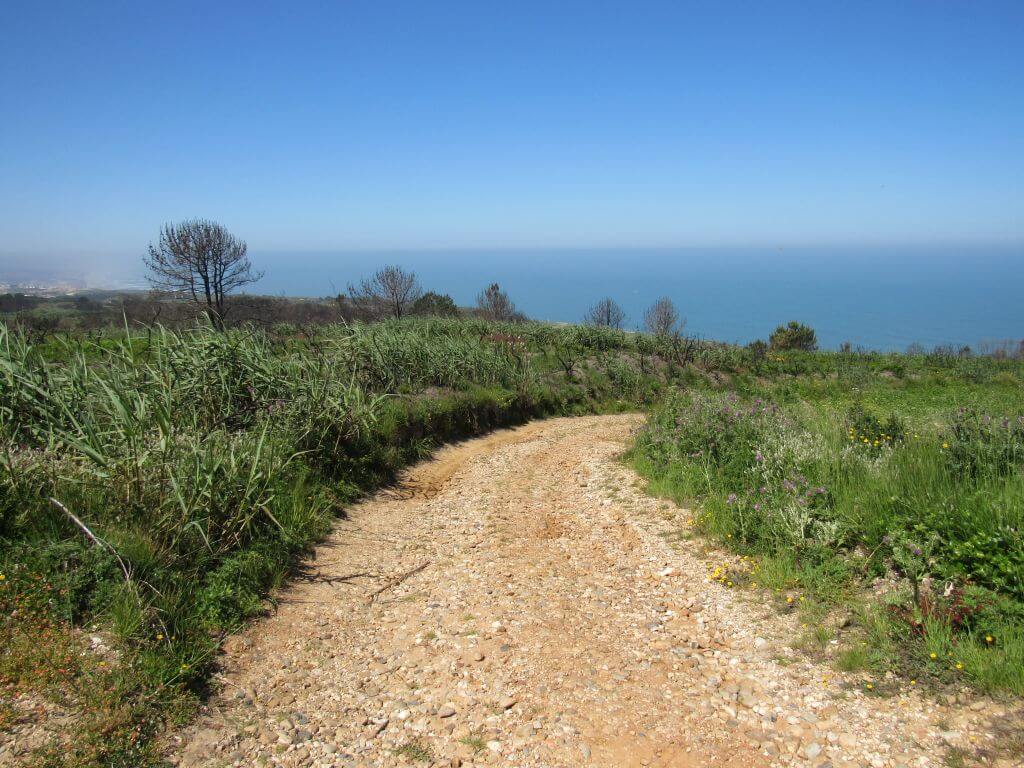
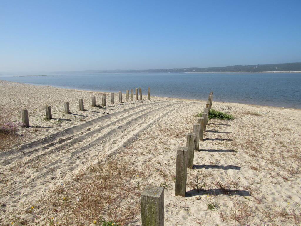
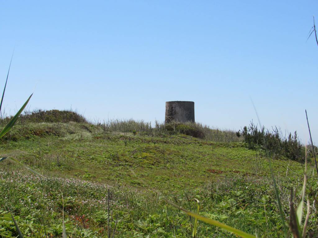
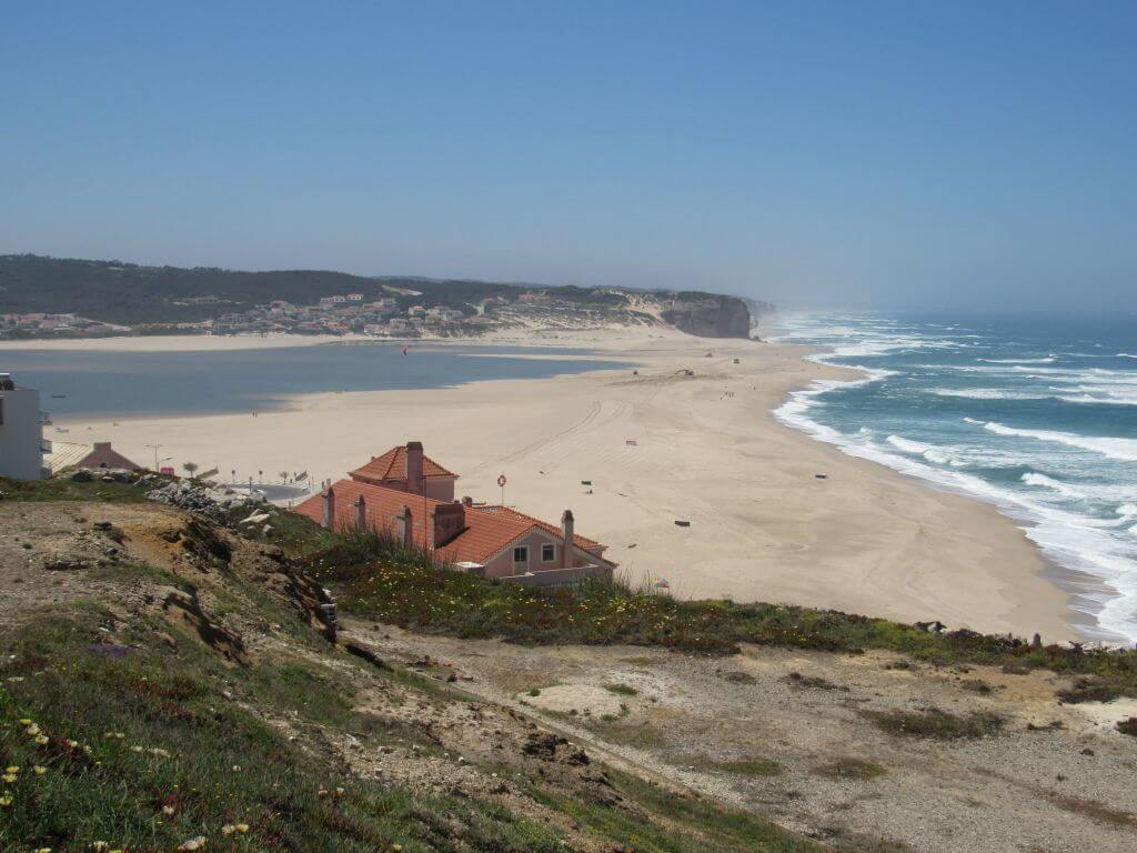
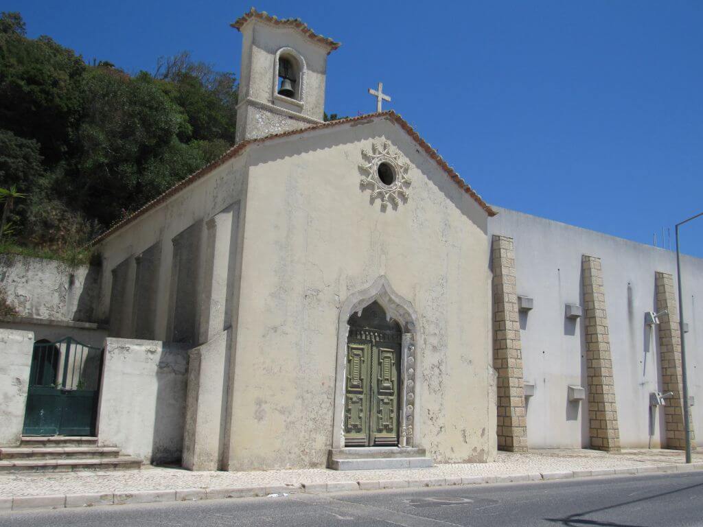
This proposed walk takes place in Foz do Arelho, taking advantage of the unique nature of this area, with special emphasis on the shores of Óbidos Lagoon, the Foz do Arelho Walkways and the north coast, as well as part of the Serra de Bouro. Another event not to be missed!
Foz do Arelho
Foz do Arelho has its origins in a fishing community that survived on what the calm waters provided. However, the land along the Óbidos Lagoon was used for agriculture, fertilised with the silt collected. Reports of these lands date back to the year 1580, when the "Quinta de Nossa Senhora de Guadalupe" gained a place in history for its importance in "renting" its land for agriculture, and it seems that this is where the place grew from. The place began to gain prominence in the second half of the 19th century, at a time when beaches began to be prioritised by holidaymakers.
Foz do Arelho was the most popular place, and it quickly became a favourite haunt of some of the most important names in Portuguese society, who often travelled to the spa in Caldas da Rainha.
Among the most honoured visitors were King Carlos I, a great fan of the gastronomy made with fish from the Lagoon, and the businessman Francisco Almeida Grandela, the owner of the well-known Grandela Warehouses in Lisbon, who even considered opening a branch of these warehouses in Caldas. The old town was part of the parish of Serra do Bouro until 1919, and it was in 2009 that it became a town.
Foz do Arelho Walkways
Designed by landscape architect Nádia Schilling, the Foz do Arelho walkway was the way to create a safe path for contemplation and leave the rest of the area free for the growth of spontaneous vegetation. The natural cut of the hillside either covers or blurs the Atlantic Ocean, depending on whether you go up or down the small flights of steps that help you climb the slopes. But when you reach any of the seven viewpoints, with swivelling benches so you can see 360 degrees, the sea is always there (on the best days, you can even see the Berlengas archipelago) and the sunset has a special charm.
Some of the points of interest on the walk
- Foz do Arelho beach - Óbidos lagoon - Walkways - Penedo Furado - Serra do Bouro - Mother Church - Foz do Arelho viewpoint - Natural landscapes -
Location
Meeting Point
Av. do Mar,
2500-896 Foz do Arelho
(next to the yellow kiosk - opposite the Cabana do Pescador restaurant)
Latitude: 39°25'58.26″N
Longitude:9°13'40.16″W
Meeting time: 9.20am
Estimated end time: 14h
Route Features and Equipment
Circular
Circuit
Equipment
Footwear and clothing suitable for hiking
RESERVE
REGISTER NOW
215€ per person
- 245€ in a single room
Includes:
- Transport by coach/bus/tourist van from Lisbon to each of the places described above
• Alojamento em Hotel de 3 estrelas com pequeno-almoço incluído
- The proposed accommodation option includes various room types
- Guidance and support
- Personal accident insurance
- Civil liability insurance
Not included:
- All items not mentioned.
Comments:
- Only registrations made by 4.30pm on the day before the event will be eligible for Personal Accident Insurance.
- PLACES WILL BE FILLED WHEN PROOF OF PAYMENT IS RECEIVED
Data collection:
Personal information Name, date of birth and VAT number are required for personal accident insurance purposes.
Book:
After successfully submitting the bookingYou will be redirected to a confirmation page. If you have any difficulties making a booking, please contact contact us.
Registration Form
"*" indicates required fields
December
Timetable
Novembro 28 (Sábado) 7:00 - Dezembro 1 (Terça-feira) 19:30
Meeting Point
Orient Bus Terminal
Event details
[fusion_builder_container admin_label="" hundred_percent="no" equal_height_columns="no" menu_anchor="" hide_on_mobile="small-visibility,medium-visibility,large-visibility" class="" id="" background_color="" background_image="" background_position="center center" background_repeat="no-repeat" fade="no" background_parallax="none" enable_mobile="no" parallax_speed="0.3" video_mp4="" video_webm="" video_ogv="" video_url="" video_aspect_ratio="16:9" video_loop="yes" video_mute="yes" video_preview_image="" border_color="#ea1717" border_style="solid" margin_top="10px" margin_bottom="10px" padding_top="25px"
Event details
Event Description
EVENT: Caminhando em Aracena, Gruta das Maravilhas, Parque Mineiro de Rio Tinto, Aroche, Cortegana, Fregenal de La Sierra e Barrancos
DATE OF REALISATION: 28, 29, 30 de Novembro e 1 Dezembro 2026
ENROLMENT DEADLINE : 31 August 2026
DESCRIÇÃO DO EVENTO: “Caminhando em Aracena, Gruta das Maravilhas, Parque Mineiro de Rio Tinto, Aroche, Cortegana, Fregenal de La Sierra e Barrancos”
Nesta proposta de atividade iremos fazer 1 caminhada nos Bosques de Aracena, e passeios em Cortegana, Aroche, Aracena, Fregenal de La Sierra e Barrancos, com destaque para várias visitas onde destacamos o Parque Mineiro de Rio Tinto, e a Gruta das Maravilhas, para além de Castelos e outros lugares fantásticos de Espanha. Venha daí conosco e não se vai arrepender! Lugares limitados!
Cidade romana de Turobriga
A cidade romana de Arucci/Turobriga é o único sítio do seu género aberto ao público na província de Huelva. As suas características únicas fazem dela um local que vale bem a pena visitar. A extensão e a preservação do traçado completo da cidade, com edifícios públicos como o fórum, as termas e o recinto, misturam-se com espaços privados como a Casa Norte e a Casa da Coluna.
Castelo de Aroche
A fortificação de Aroche é um forte andaluz antigo (hisn) construído durante o período almóada para defender-se do avanço português em direção ao Algarve e ao Vale do Guadalquivir, como ocorreu em Moura e Serpa. Durante o período islâmico, fez parte da Cora of Beja . Após a sua conquista pela Ordem Militar do Hospital, em apoio ao Reino de Portugal, e a sua subsequente filiação jurisdicional à Coroa de Castela, tornou-se parte da Banda Galega, que proporcionava defesa passiva ao extenso distrito de Sevilha na sua fronteira noroeste. A sua localização elevada oferece-lhe uma vista privilegiada sobre a planície de Chanza, uma passagem natural para a entrada histórica deste território a partir da região do Alentejo.
A Gruta das Maravilhas em Aracena
A Gruta das Maravilhas é o símbolo máximo de Aracena. Localizada bem no centro da cidade, a riqueza e a variedade de formações visíveis ao longo dos seus 1.200 metros de percurso fazem dela uma das grutas turísticas mais visitadas de Espanha, e também uma das pioneiras deste tipo de turismo na Europa. The primeiras referências à sua descoberta datam de 1850, através de trabalhos de mineração , e foi aberta ao público em 1914. A vasta extensão de seus lagos, a abundância e variedade de formações, e a longa duração de seu desenvolvimento fazem deste complexo subterrâneo um lugar de grande beleza e esplendor, sendo, portanto, especialmente atraente do ponto de vista turístico.
Parque Mineiro de Rio Tinto
Museu da Mineração: 5.000 anos de história da mineração.
O antigo edifício do hospital da Rio Tinto, totalmente restaurado, transporta-nos, através de autênticas exposições museológicas, para as diferentes civilizações que moldaram a história mineira da região. Um espaço único onde podemos explorar o interior de uma mina romana, vivenciar o luxo de um marajá hindu, descobrir os segredos geológicos do subsolo ou maravilhar-nos com o poder da mineração para transformar uma paisagem e influenciar a vida dos seus habitantes. Arqueologia, geologia, antropologia, engenharia, medicina, educação, história, economia… tudo isso em 17 salas que também servem como centro das atividades turísticas do Parque Mineiro.
Casa 21: A pegada britânica
Não há melhor maneira de compreender o legado de 100 anos de presença britânica em Riotinto do que explorar o bairro inglês de Bella Vista, uma verdadeira colônia onde os executivos da Rio Tinto Company Ltd., isolados dos trabalhadores locais, mantinham seus costumes e privilégios. No coração dessa “ilha” britânica, a Casa 21, construída em 1885, é preservada com detalhes, móveis e pertences que nos transportam para o final do século XIX e início do século XX, permitindo-nos mergulhar em seu modo de vida, vivenciar o ritual do chá da tarde ou imaginar momentos de lazer praticando desportos e jogos então desconhecidos em Espanha, como ténis, polo, críquete… ou futebol.
Comboio Turístico: Uma viagem através do tempo e de paisagens de outro mundo.
A experiência mais popular no Parque Mineiro é a restauração de parte da linha férrea original que, desde 1875, ligava as minas ao Porto de Huelva. Em vagões de madeira reconstruídos a partir de projetos do século XIX e com locomotivas que são verdadeiras joias do patrimônio ferroviário mundial, vamos viajar por paisagens transformadas pela ação humana durante 150 anos de atividade mineira, seguindo o curso do Rio Tinto e o seu ecossistema singular. Essa combinação de sensações transporta os visitantes para cenários que parecem de outro planeta.
Ferrovia a diesel: 22 km (ida e volta).
Iron Rock: A Mina do Arco-Íris
Num dos locais mais belos da Bacia Mineira, uma Paisagem Protegida, uma antiga galeria com mais de 200 metros de comprimento foi restaurada. Os visitantes podem experimentar a emoção da mineração subterrânea e contemplar, do miradouro da mina a céu aberto, a paleta multicolorida de um subsolo rico em minerais — um verdadeiro arco-íris subterrâneo. Estudos científicos do CAB (Centro de Astrobiologia), do INTA (Instituto Nacional de Tecnologia Aeroespacial) e da NASA para o desenvolvimento do Projeto Marte foram realizados neste local extraordinário. Um complexo de antigas instalações de mineração e industriais e o Centro de Interpretação do Rio Tinto completam este impressionante sítio.
Visite uma das maravilhas da província de Huelva.
A imensidão da Corta Atalaya é de tirar o fôlego. Marco da mineração mundial, ela exibe o impressionante trabalho dos milhares de mineiros que esculpiram cada um de seus terraços. Um dos símbolos da província de Huelva, pode ser apreciada no Parque Mineiro.
Castelo de Cortegana
Esta fortaleza-castelo foi construída no final do século XIII para proteger o Reino de Sevilha de possíveis incursões portuguesas. Entre o início da construção e até ao século XVI estão documentadas várias reformas e extensões, o que lhe deu uma maior força e altura das suas muralhas, bem como o levantamento de abóbadas nas suas torres. Hoje tem uma aparência muito bem preservada graças ao trabalho de restauro e recuperação que foi concluído em 2006.
These are some of the most important places we'll be visiting during this event:
- Cidade romana de Turobriga
- Aroche
- Castelo de Cortegana
- Miradouro de La Serrana
- Parque Mineiro de Rio Tinto
- Aracena
- Gruta das Maravilhas
- Fregenal de La Sierra
- Barrancos
- Natural landscapes
TIME: Departure from Lisbon at 7am
RETURN: Arrival in Lisbon at 7.30pm
Dia 28 de Novembro (sábado)
11h00 – Visita à Cidade Romana de Turobriga e Castelo de Aroche
13h00 – Sugestão de Almoço livre
14h30 – Passeio Aroche e Miradouro de La Serrana
15h30 – Passeio em Cortegana e Visita ao Castelo
17h30 – Check-in no Hotel Aracena
19h30 – Sugestão de Jantar de Grupo
Dia 29 de Novembro (domingo)
10h00 – Visita ao Parque Mineiro de Rio Tinto (duração aproximada entre todos os locais a visitar, incluindo a viagem de comboio é de aproximadamente 6 horas)
16h30 – Regresso previsto a Aracena
17h00 – Passeio urbano em Aracena
Dia 30 de Novembro (2ª feira)
9h30 – Caminhando por Bosques encantados de Aracena – 10kms
13h00 – Sugestão de Almoço livre
14h30 – Visita à Gruta das Maravilhas e Castelo de Aracena
16h30 – Passeio em Aracena
19h30 – Sugestão de Jantar de Grupo
Dia 1 de Dezembro (3ª feira)
9h30 – Saída para Fregenal de La Sierra
10h15 – Passeio em Fregenal de La Sierra, com Visita ao Castelo
13h00 – Sugestão de Almoço em Barrancos
14h30 – Pequeno passeio em Barrancos
15h15 – Fim da atividade e regresso a Lisboa
Equipment: Suitable footwear and clothing for hiking/walking
Registration fee:
Price includes:
– Transporte desde Lisboa para cada um dos locais descritos
– 3 noites de alojamento em Alojamento Local no centro de Aracena (2 apartamentos totalmente equipados, com 4 quartos cada – 2 twins e 2 de casal, e 2 wc’s por apartamento)
– Passeio em Aroche e Miradouro de La Serrana
– Visita à Cidade Romana de Turobriga
– Pequeno passeio e Visita ao Castelo de Cortegana
– Visita ao Parque Mineiro de Rio Tinto
– Visita à Gruta das Maravilhas
– Visita ao Castelo de Aracena e Museu do Presunto
– Caminhada nos Bosques de Aracena
– Passeio e Visita ao Castelo de Fregenal de La Sierra
– Pequeno passeio em Barrancos
– Guia e acompanhamento
– Seguro de acidentes pessoais
– Seguro de responsabilidade civil
Prices with transport
Price in double room: 520€
Valor em quarto individual: 600€
Values without transport
Valor em quarto duplo: 420€
Valor em quarto individual: 500€
Seat reservation fee: 50€
THE POSSIBILITY OF CAR-POOLING AMONG PARTICIPANTS IF THEY WISH, FOR THOSE WHO DON'T WANT TO USE OUR TRANSPORT AND DON'T MIND SHARING OR HITCHHIKING WITH OTHER PARTICIPANTS.
Preços válidos até ao dia 31 de Agosto. A partir desta data os valores são de 540€ e 620€ respectivamente (opção com transporte)
Notes:
a) Registrations are limited and accommodation options are limited to availability at the time of booking.
b) If you have a group interested in this trip, contact us, we have personalised solutions.
Location
Meeting Point
TIME: Departure from Lisbon at 7am
RETURN: Arrival in Lisbon at 7.30pm
Route Features and Equipment
Circular
Circuit
Equipment
Suitable clothing and footwear for hiking
RESERVE
REGISTER NOW
215€ per person
- 245€ in a single room
Includes:
- Transport by coach/bus/tourist van from Lisbon to each of the places described above
• Alojamento em Hotel de 3 estrelas com pequeno-almoço incluído
- The proposed accommodation option includes various room types
- Guidance and support
- Personal accident insurance
- Civil liability insurance
Not included:
- All items not mentioned.
Comments:
- Only registrations made by 4.30pm on the day before the event will be eligible for Personal Accident Insurance.
- PLACES WILL BE FILLED WHEN PROOF OF PAYMENT IS RECEIVED
Data collection:
Personal information Name, date of birth and VAT number are required for personal accident insurance purposes.
Book:
After successfully submitting the bookingYou will be redirected to a confirmation page. If you have any difficulties making a booking, please contact contact us.
Registration Form
"*" indicates required fields
Timetable
5 (Sábado) 6:30 - 8 (Terça-feira) 19:30
Meeting Point
Orient Bus Terminal
Event details
[fusion_builder_container admin_label="" hundred_percent="no" equal_height_columns="no" menu_anchor="" hide_on_mobile="small-visibility,medium-visibility,large-visibility" class="" id="" background_color="" background_image="" background_position="center center" background_repeat="no-repeat" fade="no" background_parallax="none" enable_mobile="no" parallax_speed="0.3" video_mp4="" video_webm="" video_ogv="" video_url="" video_aspect_ratio="16:9" video_loop="yes" video_mute="yes" video_preview_image="" border_color="#ea1717" border_style="solid" margin_top="10px" margin_bottom="10px" padding_top="25px"
Event details








Event Description
EVENT: Caminhando no Douro Internacional: Miradouros, Castelos, Aldeias, Minas de Argozelo, Ponte Suspensa e Vimioso
DATE OF REALISATION: 5 a 8 de Dezembro de 2026
ENROLMENT DEADLINE : 30 de Setembro de 2026
DESCRIÇÃO DO EVENTO: “Caminhando no Parque Natural do Douro Internacional: Miradouros, Castelos, Aldeias, Minas de Argozelo, Ponte Suspensa e Vimioso”
Nesta proposta de atividade iremos percorrer algumas das mais belas paisagens do Parque Natural do Douro Internacional, em Trás-os-Montes, onde impera a tranquilidade e nos sentimos pequenos perante a natureza agreste e bela das arribas do Douro, sem esquecer a excelente gastronomia da região. De Miranda do Douro a Mogadouro, das aldeias, e miradouros, é tempo de apreciar e contemplar esta região! Faremos ainda um Passeio até ao Vimioso, visitamos o Centro Interpretativo das Minas de Argozelo, e conheceremos uma Ponte Metálica Suspensa de 35 metro de comprimentos. Venha daí conosco e não se vai arrepender! Lugares limitados
These are some of the most important places we'll be visiting during this event:
- Walk in the village of Picote
- Fraga Amarela and Castro da Cigadonha Trail - 6kms
- Fraga Amarela Viewpoint
- Fraga do Puio viewpoint
- Walk in Miranda do Douro
- Rio Fresno Urban Park
- Mother Church and Castle of Miranda do Douro
- Penha das Torres Viewpoint Trail (the easternmost in Portugal) - 6kms
- Castrilhouço Viewpoint
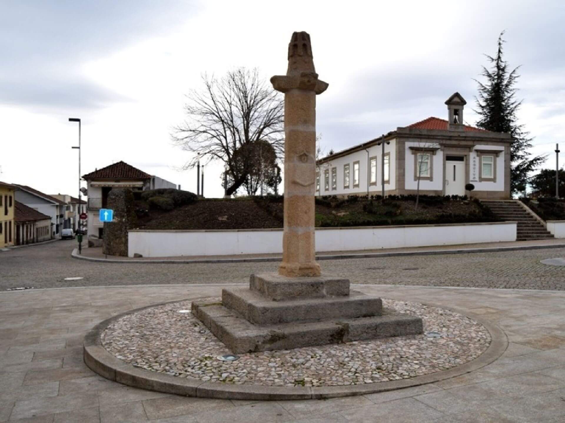
- Tour of Mogadouro (Town, Castle, Clock Tower, Convent of St Francis, Pillory, etc.)
- Visit to Penas Roias Castle
- Passeio em Vimioso
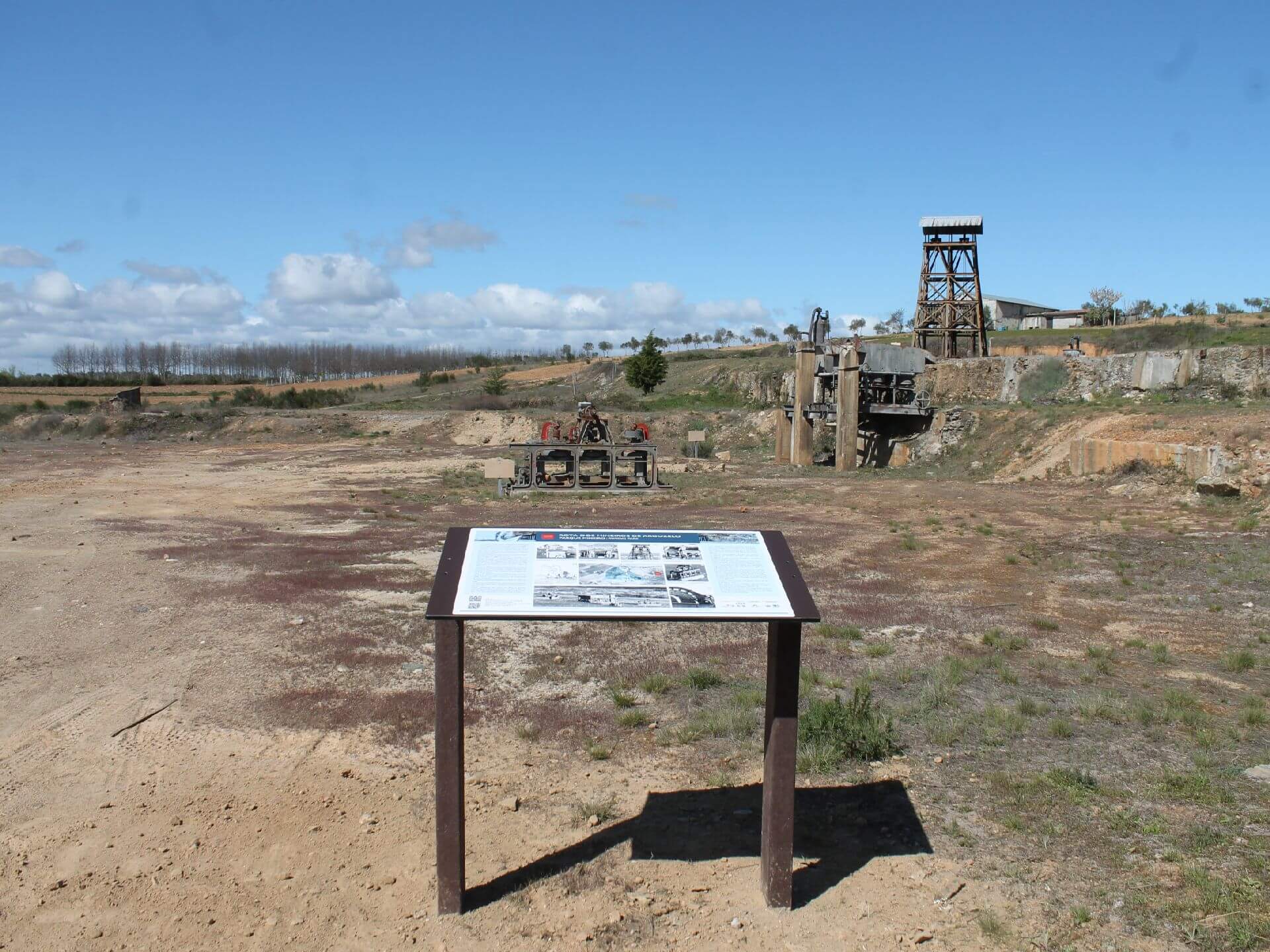
- Visita ao Centro Interpretativo das Minas de Argozelo
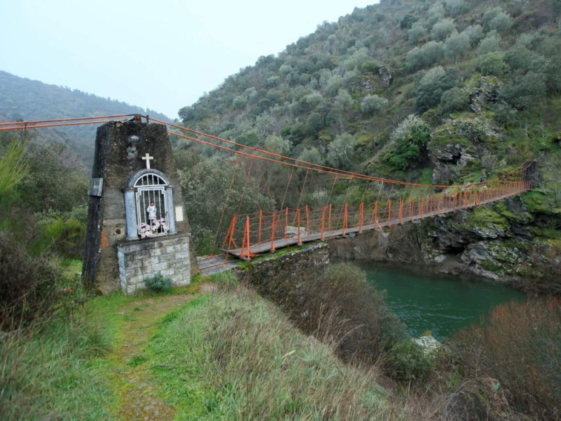
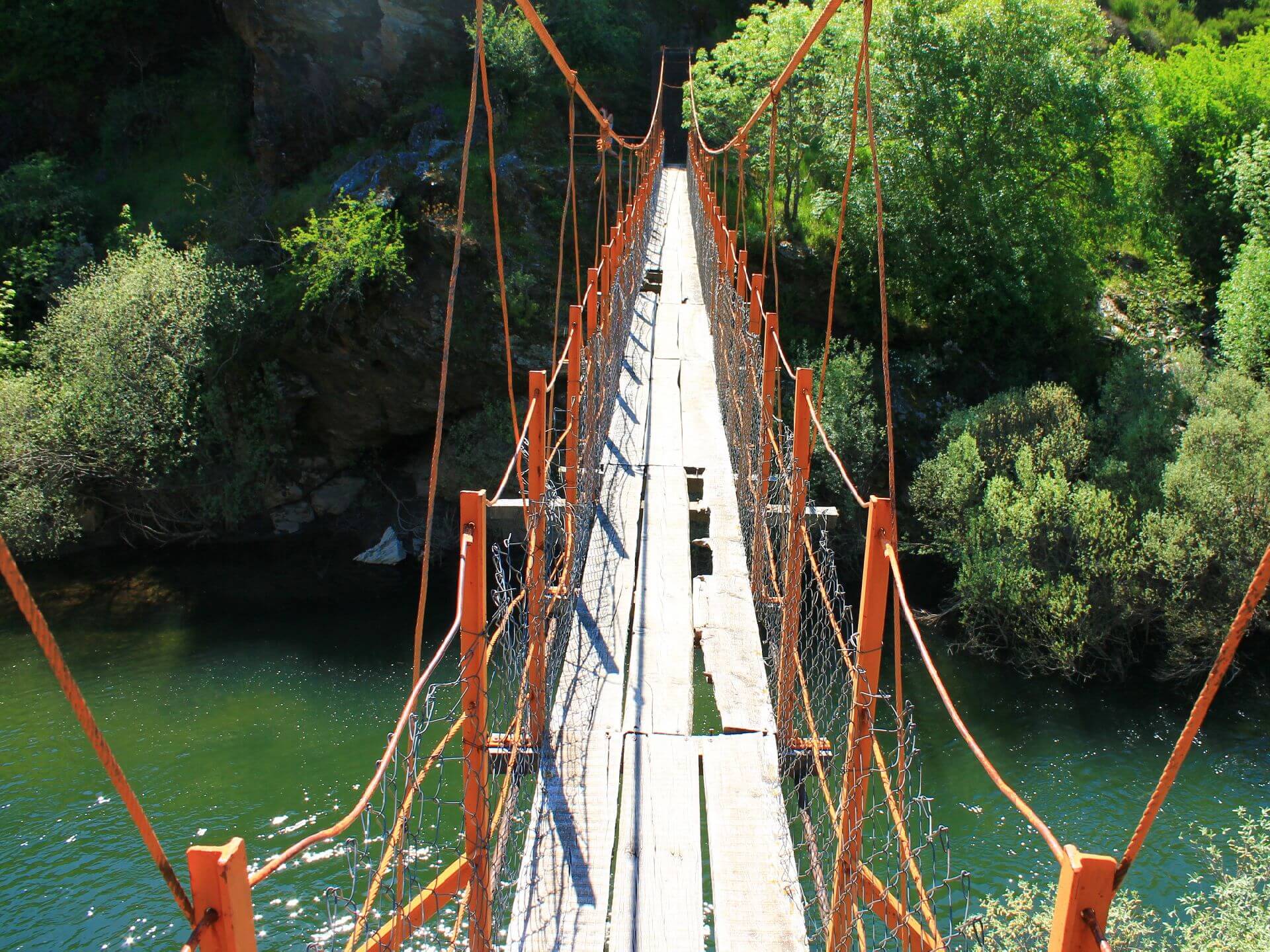
- Trilho dos Mineiros com passagem na Ponte Suspensa com 35 metros de comprimento
- Natural landscapes
TIME: Departure from Lisbon at 6.30am
RETURN: Arrival in Lisbon at 7.30pm
Dia 5 de Dezembro (sábado)
6h30 - Departure from Lisbon
12h00 - Visit to the village of Picote
12h45 - Trip to the Fraga do Puio viewpoint
13h15 - We suggest the picnic option, which is the responsibility of each participant
14h - Walking: “Fraga Amarela and Castro da Cigadonha Trail”
Points of interest: Picote Village, Fraga Amarela Viewpoint, Cigadonha Hillfort and Natural Landscapes
This is a linear route with a circular final section that allows you to visit the Cigadonha Hillfort. The whole route has a good natural setting and stunning views over the River Douro. This settlement from the 1st millennium BC occupies an extensive platform with steep cliffs overlooking the River Douro, where birds nest. The wall shows a large field of stones set with the end facing upwards, like sharp razors, defending the settlement's gateway.
Level of difficulty of the route: 2 (Scale of 1 to 5)
Route length: 6 kilometres
Estimated time: 2 hours
16h45 - Check-in at the hotel in Miranda do Douro and suggestion of a short walk at dusk
19h30 - Group Dinner Suggestion
Dia 6 de Dezembro (domingo)
9h15 - Walking: “Penha das Torres Viewpoint Trail” / Paradela
Points of interest: Paradela village, Penha das Torres viewpoint and Douro river cliffs
The route starts in the village of Paradela and follows rural paths to the Paradela viewpoint (Penha das Torres) overlooking the Spanish Castro dam. This is one of the most representative landscapes in the Douro International Valley, with the viewpoints located on the edge of a river canyon that locally consists of a gorge with vertical walls of over 150 metres.
Level of difficulty of the route: 2 (Scale of 1 to 5)
Route length: 6 kilometres
Estimated time: 2 hours
12h15 - Visit to the Castrilhouço viewpoint
13h00 - Lunch suggestion in Miranda do Douro
15h00 - Suggested Environmental Cruise on the River Douro (duration 1h30, departing from Miranda) - If it's of interest to the group, we'll have to book as soon as possible: ticket price: 22€ (not included)
16h45 - Walk in the Rio Fresno Urban Park
19h30 - Group Dinner Suggestion
Dia 7 de Dezembro (2ª feira)
9h - Hotel check-out
10h - Visita ao Centro Interpretativo das Minas de Argozelo
10h45 – Caminhada – “No Trilho dos Mineiros e da Ponte Suspensa”
Points of interest: Santuário de São Bartolomeu, Ponte dos Mineiros – Ponte Suspensa e Paisagens naturais
A Ponte dos Mineiros, uma ponte suspensa pênsil, metálica, sobre o rio Sabor, foi construída em 1956 e diariamente utilizada por centenas de pessoas que trabalhavam em outras minas da região, nomeadamente as minas da Ribeira, na freguesia de Coelhoso. É uma ponte estreita com 35 metros de comprimento, suspensa a uma altura de 10 metros sobre o leito do rio. Foi recuperada em 2002 pela população local em memória d atividade mineira na região.
Level of difficulty of the route: 2 (Scale of 1 to 5)
Extensão do Percurso: 7 kms,
Estimated time: 2 hours
13h30 - Sugestão de almoço em Vimioso
15h00 - Passeio em Vimioso – Pelourinho, Igreja Matriz, etc
19h30 - Group Dinner Suggestion
Dia 8 de Dezembro (3ª feira)
9h - Hotel check-out
9h45 - Visit to Penas Roias - Castle, Viewpoint and Mother Church, etc.
10h30 - Tour of Mogadouro - Castle, Clock Tower, Pillory, Convent of St Francis, Mother Church, etc.
12h30 - Suggested lunch in Mogadouro
14h30 - End of activity and return to Lisbon
Equipment: Suitable footwear and clothing for hiking/walking
Registration fee:
Price includes:
- Transport by coach/bus/tourist van from Lisbon to each of the places described above
- 3 Walks and the route described above
- Accommodation in a 3-star hotel, breakfast included
- The proposed accommodation option includes various room types
- Guided Walks
- Compulsory insurance
Prices with transport
Valor em quarto duplo: 350€
Price in single room: 375€
Values without transport
Price in double room: 250€
Valor em quarto individual: 275€
Seat reservation fee: 50€
THE POSSIBILITY OF CAR-POOLING AMONG PARTICIPANTS IF THEY WISH, FOR THOSE WHO DON'T WANT TO USE OUR TRANSPORT AND DON'T MIND SHARING OR HITCHHIKING WITH OTHER PARTICIPANTS.
Preços válidos até ao dia 30 de Setembro. A partir desta data os valores são de 375€ e 400€ respectivamente (opção com transporte)
Notes:
a) Registrations are limited and accommodation options are limited to availability at the time of booking.
b) If you have a group interested in this trip, contact us, we have personalised solutions.
Location
Meeting Point
TIME: Departure from Lisbon at 6.30am
RETURN: Arrival in Lisbon at 7.30pm
Route Features and Equipment
Circular
Circuit
Equipment
Suitable clothing and footwear for hiking
RESERVE
REGISTER NOW
215€ per person
- 245€ in a single room
Includes:
- Transport by coach/bus/tourist van from Lisbon to each of the places described above
• Alojamento em Hotel de 3 estrelas com pequeno-almoço incluído
- The proposed accommodation option includes various room types
- Guidance and support
- Personal accident insurance
- Civil liability insurance
Not included:
- All items not mentioned.
Comments:
- Only registrations made by 4.30pm on the day before the event will be eligible for Personal Accident Insurance.
- PLACES WILL BE FILLED WHEN PROOF OF PAYMENT IS RECEIVED
Data collection:
Personal information Name, date of birth and VAT number are required for personal accident insurance purposes.
Book:
After successfully submitting the bookingYou will be redirected to a confirmation page. If you have any difficulties making a booking, please contact contact us.
Registration Form
"*" indicates required fields
Timetable
(Saturday) 17:45 - 20:30
Meeting Point
Dom Fernando II Square - São Pedro de Penaferrim
Event details
[fusion_builder_container admin_label="" hundred_percent="no" equal_height_columns="no" menu_anchor="" hide_on_mobile="small-visibility,medium-visibility,large-visibility" class="" id="" background_color="" background_image="" background_position="center center" background_repeat="no-repeat" fade="no" background_parallax="none" enable_mobile="no" parallax_speed="0.3" video_mp4="" video_webm="" video_ogv="" video_url="" video_aspect_ratio="16:9" video_loop="yes" video_mute="yes" video_preview_image="" border_color="#ea1717" border_style="solid" margin_top="10px" margin_bottom="10px" padding_top="25px"
Event details




Event Description
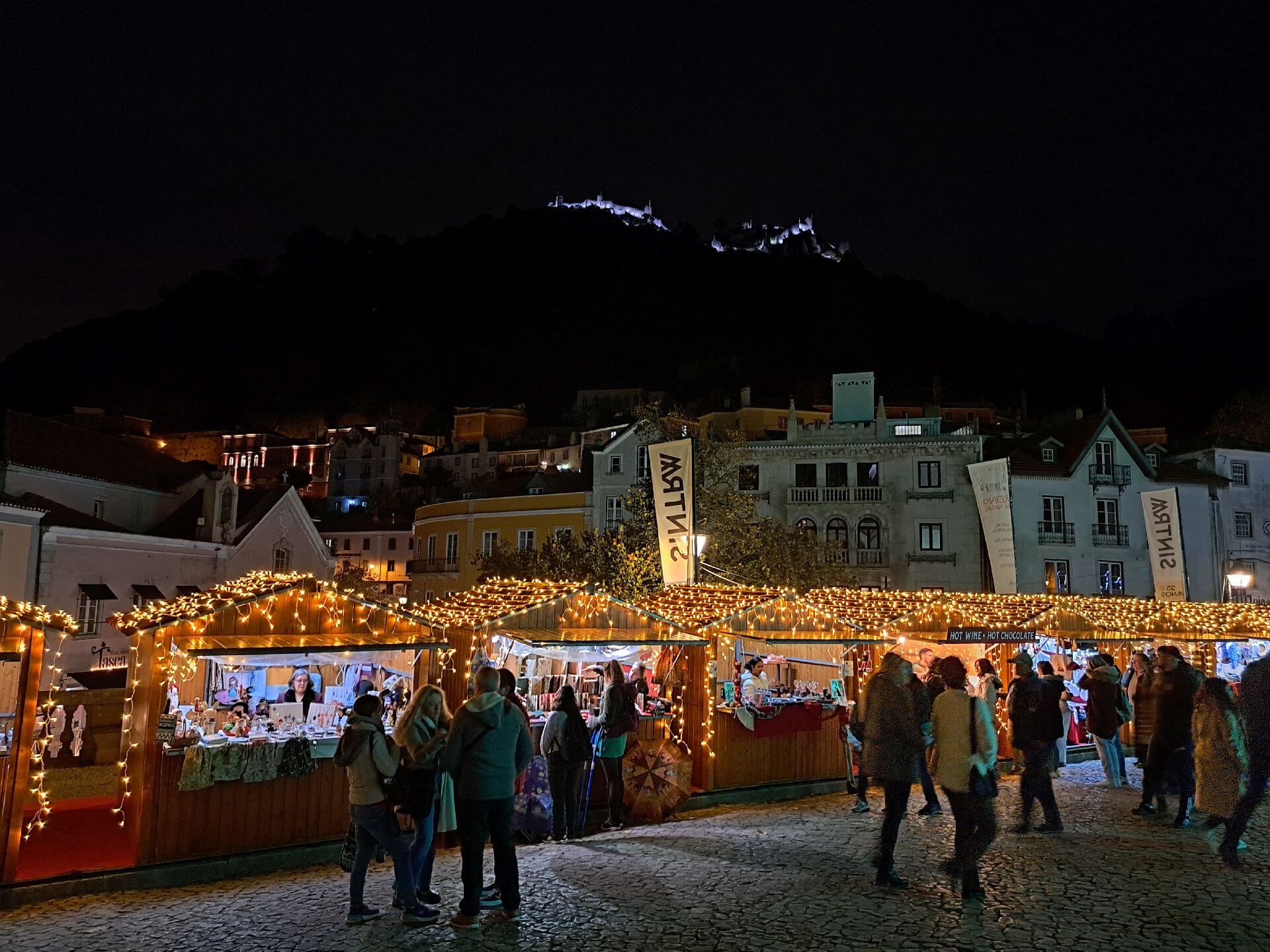
This Christmas Walk will allow us to experience all the magic of Christmas in the always enchanting town of Sintra. Thus, along a route of around 7 kilometres in length, we will pass through the most beautiful illuminated streets, from the Portela de Sintra area to São Pedro, not forgetting the Palácio da Vila area, Volta do Duche, historic alleys and panoramic views of the town. Another event not to be missed!
During our tour we will make a stop so that those who so wish can savour some of Sintra's most famous delicacies...
Sintra's Travesseiros and Queijadas
This sweet is one of the ex-libris of the town of Sintra and makes the reputation of “Piriquita”, an old Sintra bakery founded in 1862. At the time, Amaro dos Santos, a baker by trade, and his wife, Constância Gomes, worked there. The name Piriquita came from the nickname that King Carlos I gave Constância Gomes because she was a woman of short stature.
It was King Carlos I himself who encouraged the couple to make queijadas, a sweet he regularly consumed during his summers in Sintra. The success was enormous and the bakery soon became a pastry shop.
Years later, in the 1940s, while much of the world was at war, a new treasure was born in Sintra. Constância Luísa Cunha, the founder's daughter, felt the need to innovate and, while reading an old recipe book, found the recipe for Travesseiro, which today is such a hit with visitors to the village.
The original recipe hides a secret ingredient that the family that runs Piriquita has never revealed to anyone.
.
Some of the points of interest on the walk
- Vila de Sintra - Christmas Lights - Natural landscapes -
Location
Meeting Point
Dom Fernando II Square (in front of Lugar dos Sabores in São Pedro de Penaferrim)
Praça Dom Fernando II, 2710-483 Sintra
Latitude: 38°47'24.90″N
Longitude: 9°22'46.49″W
Meeting time: 17h45
Estimated end time: 20h30
Route Features and Equipment
Circular
Circuit
Equipment
Footwear and clothing suitable for hiking
RESERVE
REGISTER NOW
215€ per person
- 245€ in a single room
Includes:
- Transport by coach/bus/tourist van from Lisbon to each of the places described above
• Alojamento em Hotel de 3 estrelas com pequeno-almoço incluído
- The proposed accommodation option includes various room types
- Guidance and support
- Personal accident insurance
- Civil liability insurance
Not included:
- All items not mentioned.
Comments:
- Only registrations made by 4.30pm on the day before the event will be eligible for Personal Accident Insurance.
- PLACES WILL BE FILLED WHEN PROOF OF PAYMENT IS RECEIVED
Data collection:
Personal information Name, date of birth and VAT number are required for personal accident insurance purposes.
Book:
After successfully submitting the bookingYou will be redirected to a confirmation page. If you have any difficulties making a booking, please contact contact us.
Registration Form
"*" indicates required fields
Timetable
12 (Sábado) 7:30 - 13 (Domingo) 19:30
Meeting Point
Orient Bus Terminal
Event details
[fusion_builder_container admin_label="" hundred_percent="no" equal_height_columns="no" menu_anchor="" hide_on_mobile="small-visibility,medium-visibility,large-visibility" class="" id="" background_color="" background_image="" background_position="center center" background_repeat="no-repeat" fade="no" background_parallax="none" enable_mobile="no" parallax_speed="0.3" video_mp4="" video_webm="" video_ogv="" video_url="" video_aspect_ratio="16:9" video_loop="yes" video_mute="yes" video_preview_image="" border_color="#ea1717" border_style="solid" margin_top="10px" margin_bottom="10px" padding_top="25px"
Event details
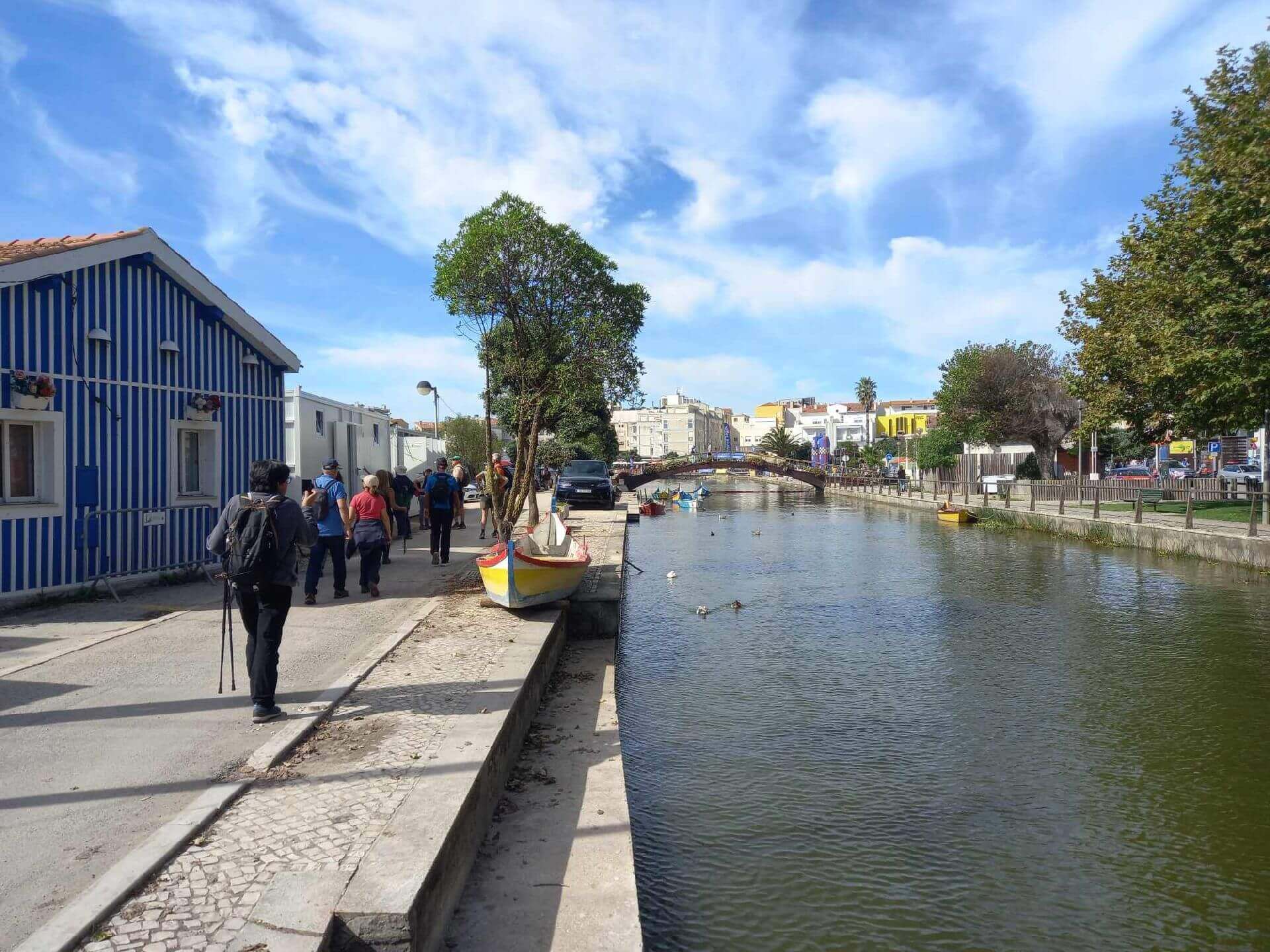
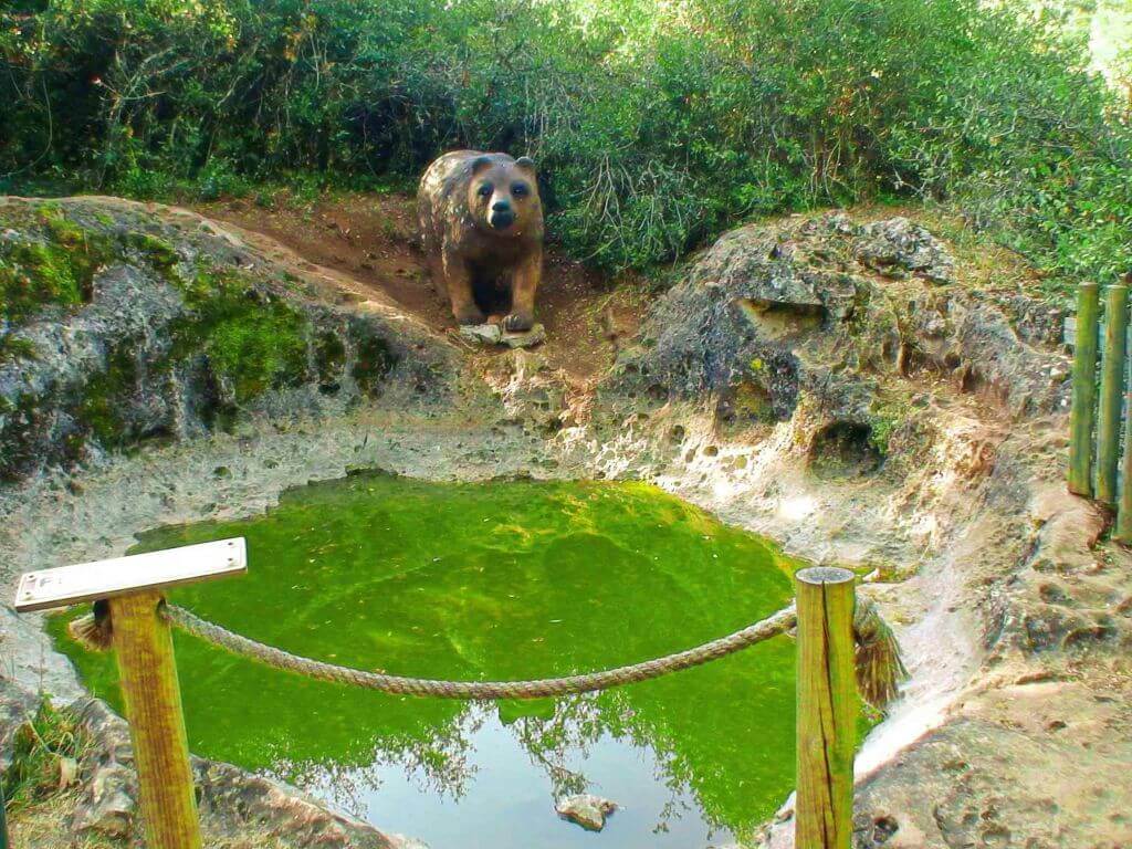
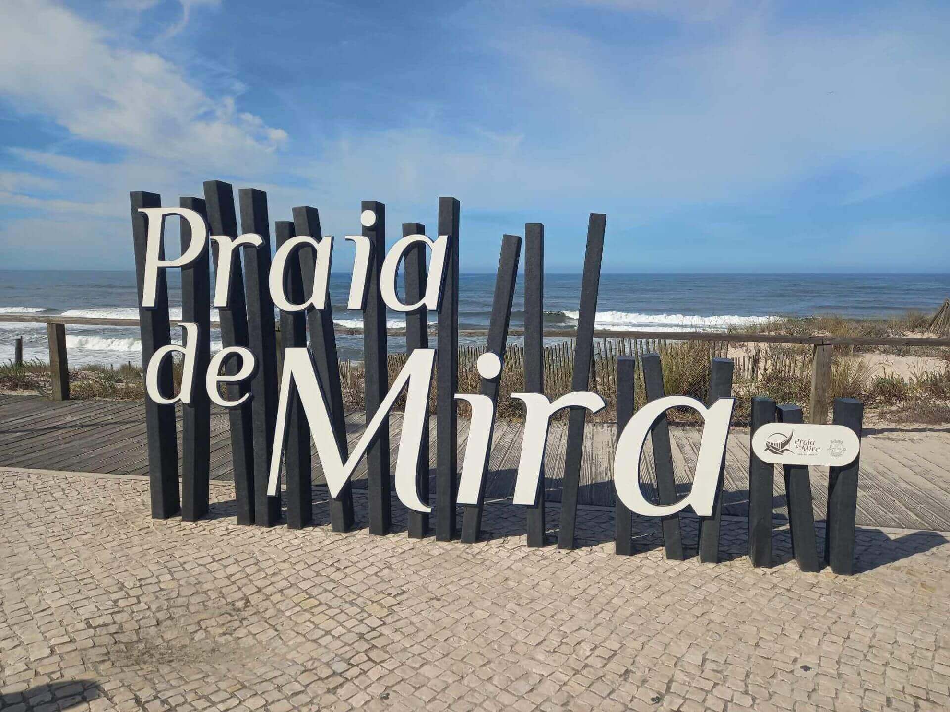
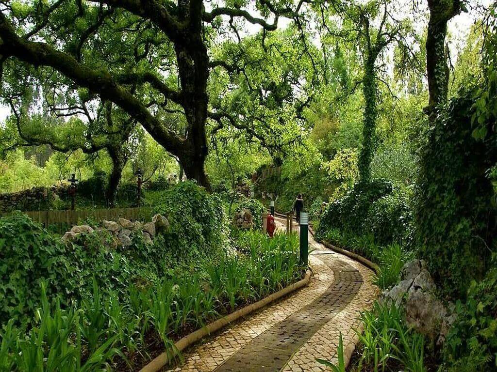
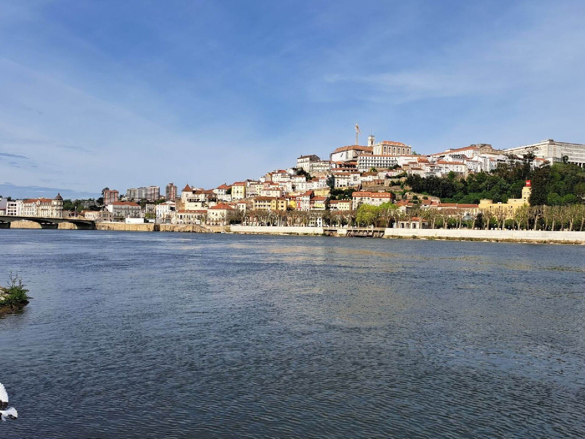

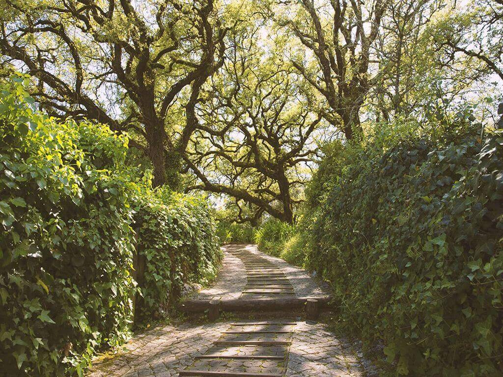
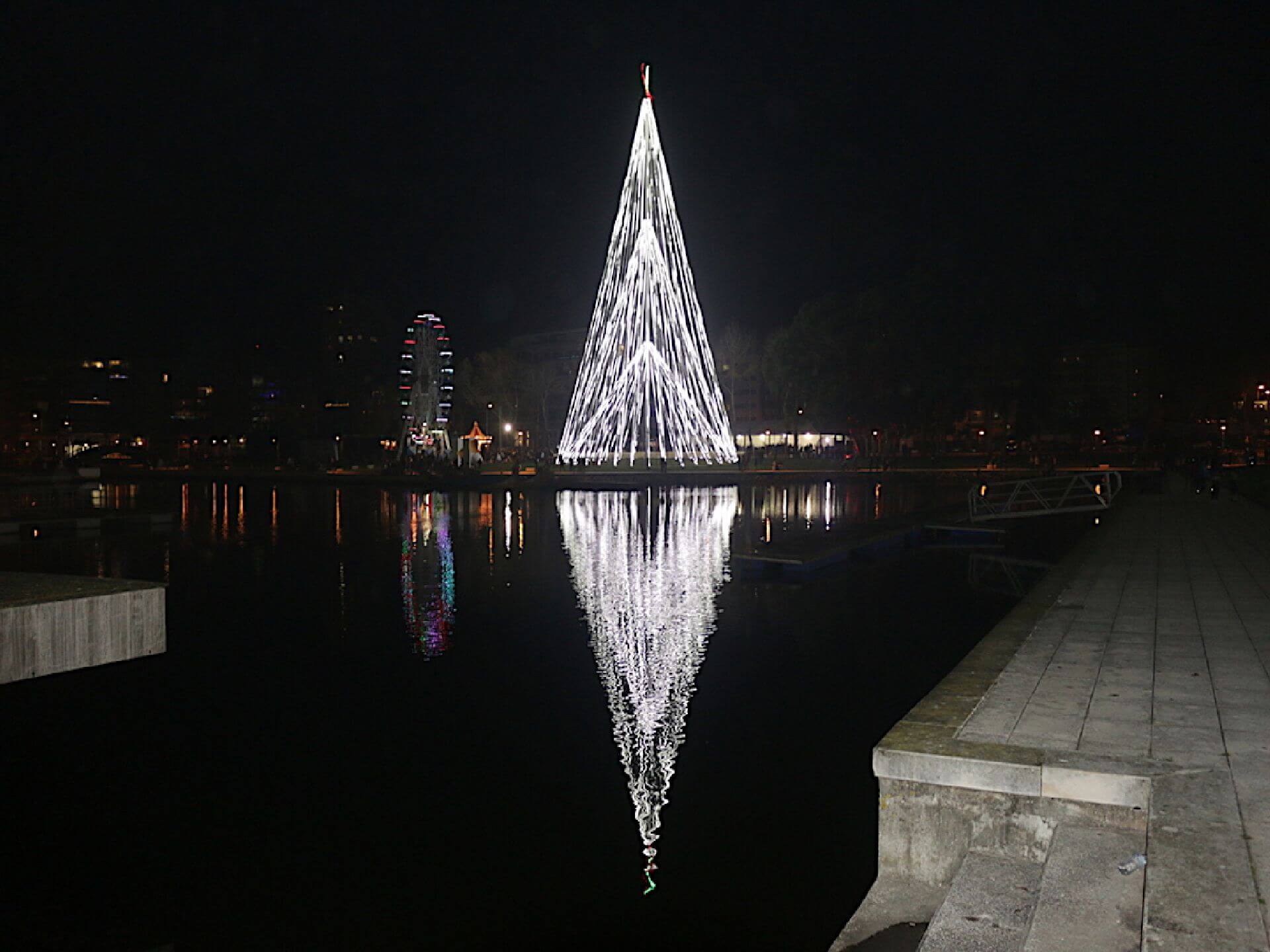
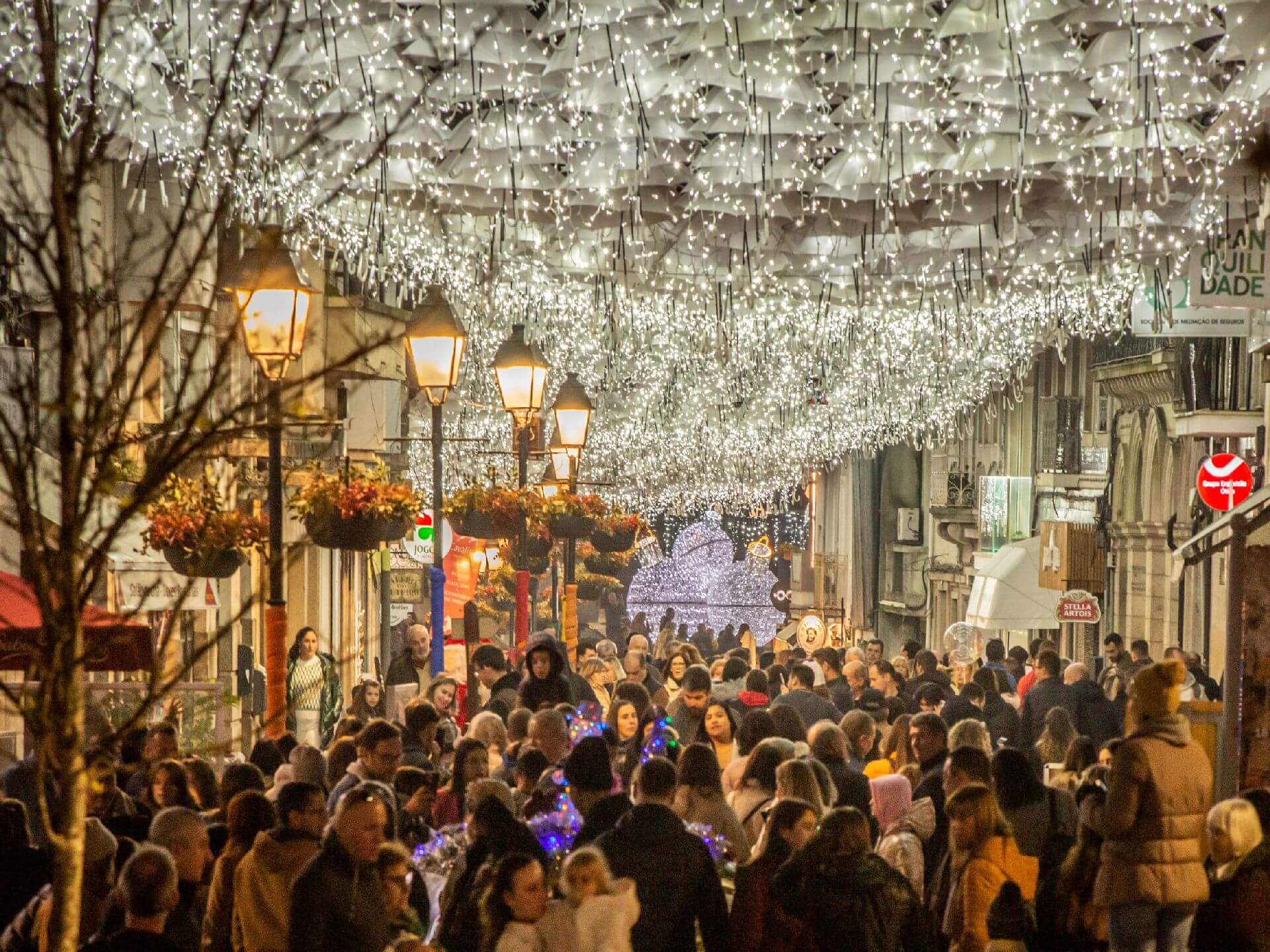
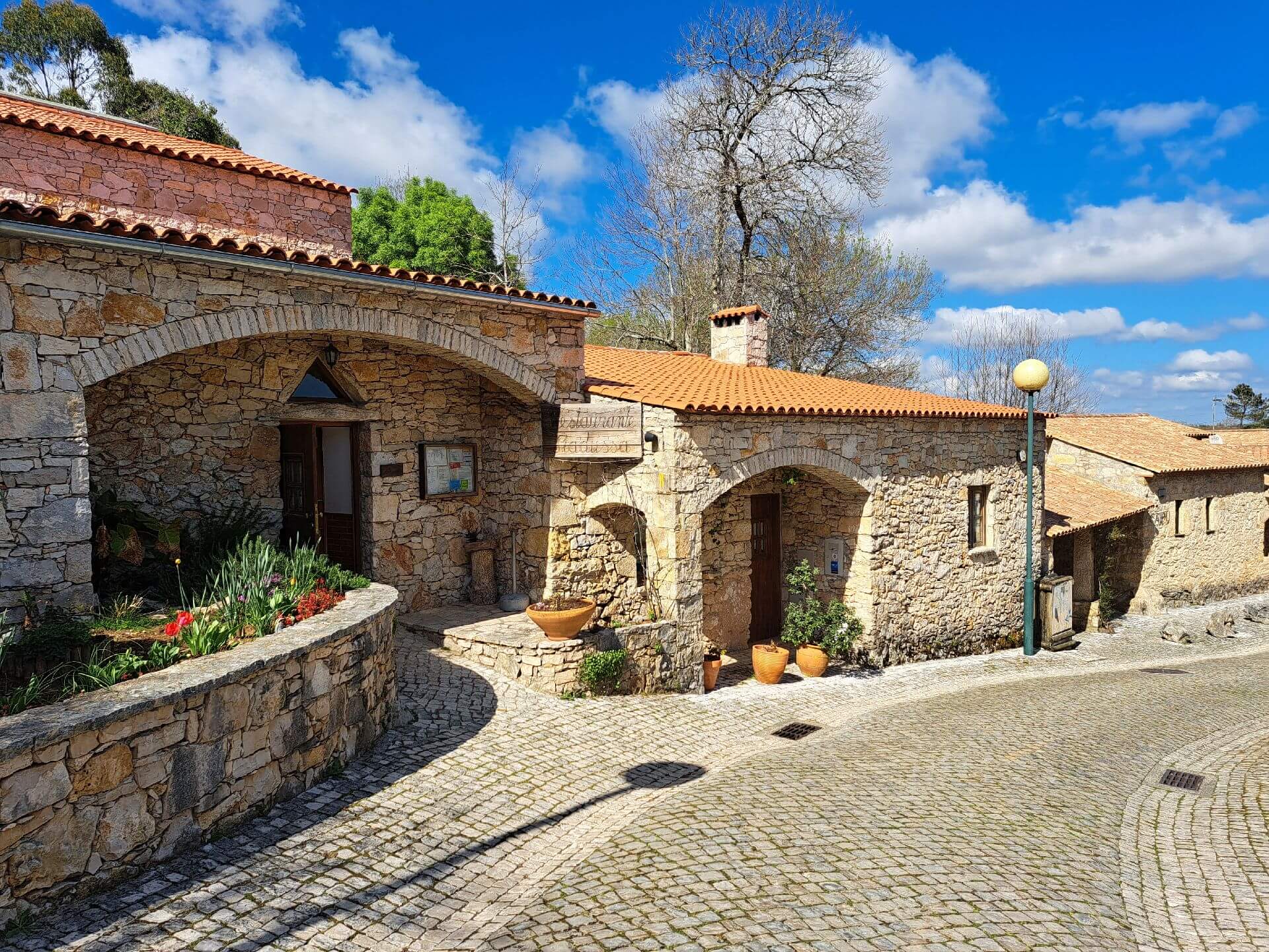

Event Description
EVENT: Fim-de-semana nas Luzes de Natal de Águeda e Aveiro
DATE OF REALISATION: 12 e 13 Dezembro 2026
DATA LIMITE DE INSCRIÇÕES: 31 OUTUBRO
DESCRIÇÃO DO EVENTO: “Fim-de-semana nas Luzes de Natal de Águeda e Aveiro”
Nesta proposta de atividade da Caminhando iremos caminhar (Pia do Urso e Barrinha de Mira) e visitar as famosas Luzes de Natal de Águeda e Aveiro . Venha daí conosco e não se irá arrepender com toda a certeza!
These will be some of the most important places we'll visit along the various hikes:
- Bear Sink
- Moinhos de Vento (Moinhos do Cassaca e do Zé Cuco)
- Vértice Geodésico de São Mamede
- Estrada Romana
- Parque sensorial da Pia do Urso
- Passeio em Coimbra (zona ribeirinha e zona histórica)
- Passeio em Águeda
- Iluminações de Natal em Águeda
- Iluminações de Natal em Aveiro
- Passeio e caminhada na Barrinha de Mira
- Natural landscapes
TIME: Departure from Lisbon at 7.30am
RETURN: Arrival in Lisbon at 7.30pm
Dia 12 de Dezembro (sábado)
Caminhando na Pia do Urso
Pia de Urso é uma pequena aldeia turística completamente renovada e recuperada. Vamos descobrir a magia dos moinhos e das paisagens naturais num percurso inesquecível pela Bear Sink, na Batalha. Esta caminhada leva-nos por florestas densas, colinas panorâmicas e antigos moinhos de vento, alguns ainda em funcionamento, que contam histórias de tempos passados. Este percurso fará as delícias de todos quantos apreciam este tipo de paisagem e com muitos motivos para umas belas fotografias.
Estimated time for the start of the walk: 9h00
Level of difficulty of the route: 3 (Scale from 1 to 5)
Route length: 7 kms
Expected duration: 2h30
12h45 – Passeio em Coimbra (tempo para pic-nic)
16h00 – Passeio de Barco no rio Mondego com a duração de 1h
18h30 – Passeio em Águeda
20h00 – Check-in no Hotel em Aveiro
20h30 – Sugestão de Jantar de grupo em restaurante
21h30 – Passeio em Aveiro
Dia 13 de Dezembro (domingo)
Walking in Lagoa da Barrinha and Praia de Mira
The route starts at Barrinha, next to Praia de Mira, and in an easy walk you'll find various points of interest with fantastic views over both Barrinha and Praia de Mira, where the element of water is always present. From the "Palheiros" (haystacks) to the typical boats, this short route will delight all those who appreciate this type of landscape and will provide plenty of reasons for some beautiful photographs.
Estimated time for the start of the walk: 9h45
Level of difficulty of the route: 1 (Scale from 1 to 5)
Route length: 4 kilometres
Expected duration: 1h15
9h45 - Walk in Praia da Barra (Lighthouse, Beach and Ria de Aveiro)
11h30 – Passeio na Lagoa de Mira
13h – Sugestão de Almoço de grupo em restaurante
3pm - End of activity and return to Lisbon
Equipment: Footwear and clothing suitable for hiking
Registration fee:
215€ (Preço por pessoa em quarto duplo)
245€ (Price per person in single room)
Price includes:
– Transporte em Carrinha de Turismo desde Lisboa até cada um dos locais descritos anteriormente
– Alojamento em Hotel de 3 estrelas com pequeno-almoço incluído
- The proposed accommodation option includes various room types
– Caminhadas e Passeios com Guia e Acompanhamento
- Compulsory insurance
Notes:
a) Registrations are limited and accommodation options are limited to availability at the time of booking.
b) The routes may be altered according to weather conditions.
c) If you have a group interested in this trip, contact us, we have personalised solutions.
Some of the points of interest of this event:
- Poço do Inferno - Ribeira de Leandres - Manteigas - Covão da Ponte - Rota das Faias - Cruz das Jogadas - Vale Glaciar Interpretive Centre - Bosque de S. Lourenço - Mondeguinho - Natural landscapes -
Location
Meeting Point
Rua Lateral Oeste da Gare do Oriente
Orient Bus Terminal
Latitude: 38°46'3.02″N
Longitude: 9° 6'7.03″W
Timetable: Departure from Lisbon at 7.30am
Return: Arrival in Lisbon at 7.30pm
Route Features and Equipment
Circular
Circuit
Equipment
Footwear and clothing suitable for hiking
RESERVE
REGISTER NOW
215€ per person
- 245€ in a single room
Includes:
- Transport by coach/bus/tourist van from Lisbon to each of the places described above
• Alojamento em Hotel de 3 estrelas com pequeno-almoço incluído
- The proposed accommodation option includes various room types
- Guidance and support
- Personal accident insurance
- Civil liability insurance
Not included:
- All items not mentioned.
Comments:
- Only registrations made by 4.30pm on the day before the event will be eligible for Personal Accident Insurance.
- PLACES WILL BE FILLED WHEN PROOF OF PAYMENT IS RECEIVED
Data collection:
Personal information Name, date of birth and VAT number are required for personal accident insurance purposes.
Book:
After successfully submitting the bookingYou will be redirected to a confirmation page. If you have any difficulties making a booking, please contact contact us.
Registration Form
"*" indicates required fields
Timetable
(Sunday) 9:50 - 13:30
Meeting Point
At the entrance to Salinas do Samouco
Event details
[fusion_builder_container admin_label="" hundred_percent="no" equal_height_columns="no" menu_anchor="" hide_on_mobile="small-visibility,medium-visibility,large-visibility" class="" id="" background_color="" background_image="" background_position="center center" background_repeat="no-repeat" fade="no" background_parallax="none" enable_mobile="no" parallax_speed="0.3" video_mp4="" video_webm="" video_ogv="" video_url="" video_aspect_ratio="16:9" video_loop="yes" video_mute="yes" video_preview_image="" border_color="#ea1717" border_style="solid" margin_top="10px" margin_bottom="10px" padding_top="25px"
Event details


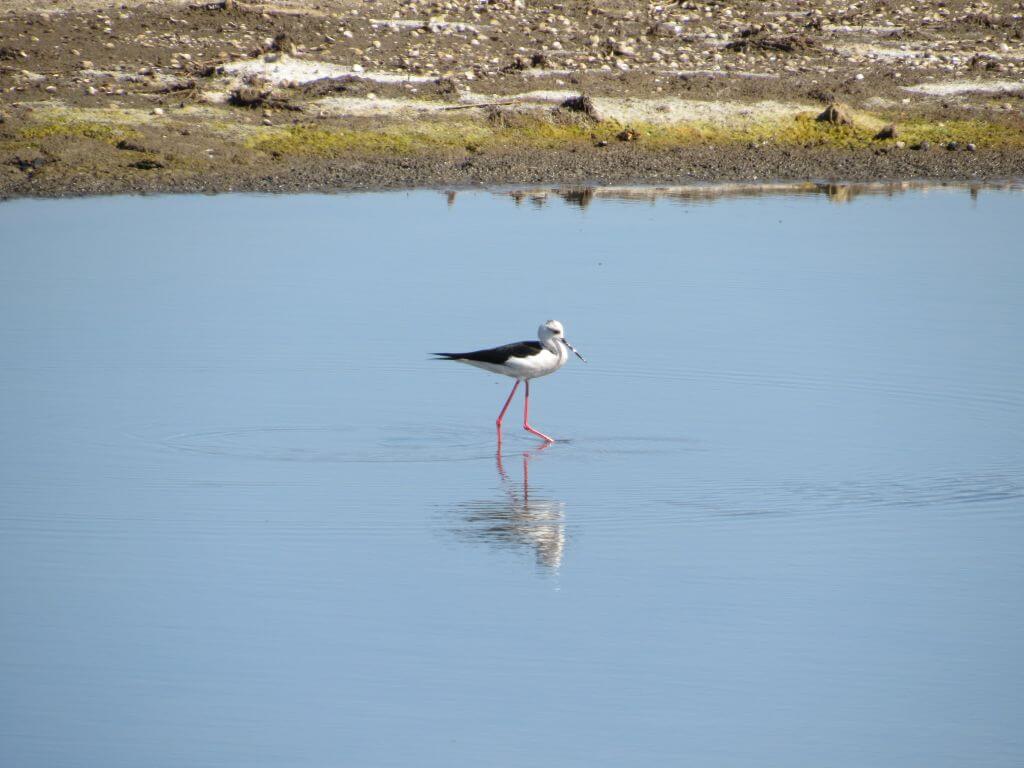


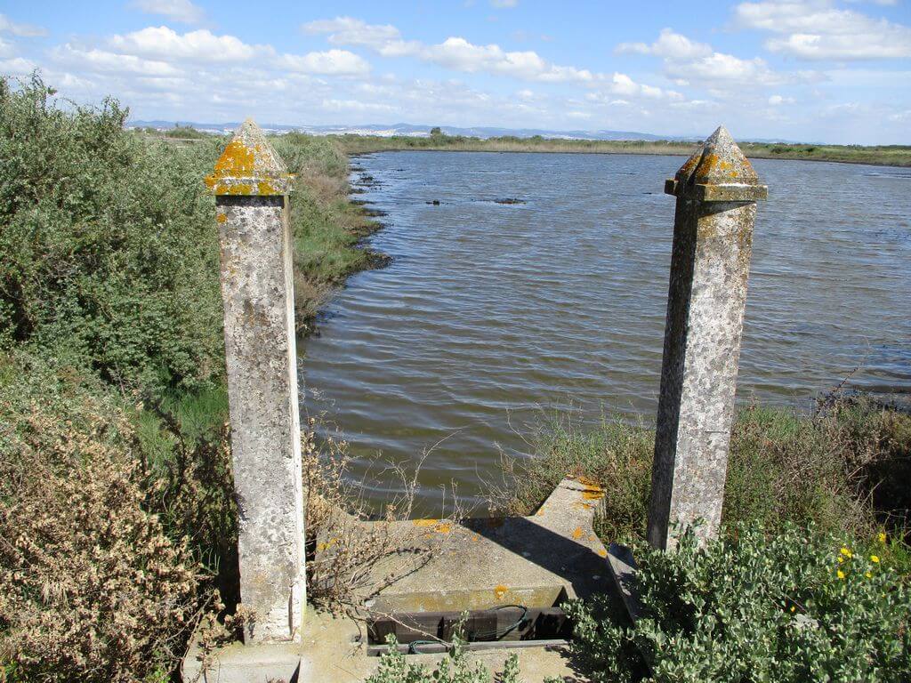


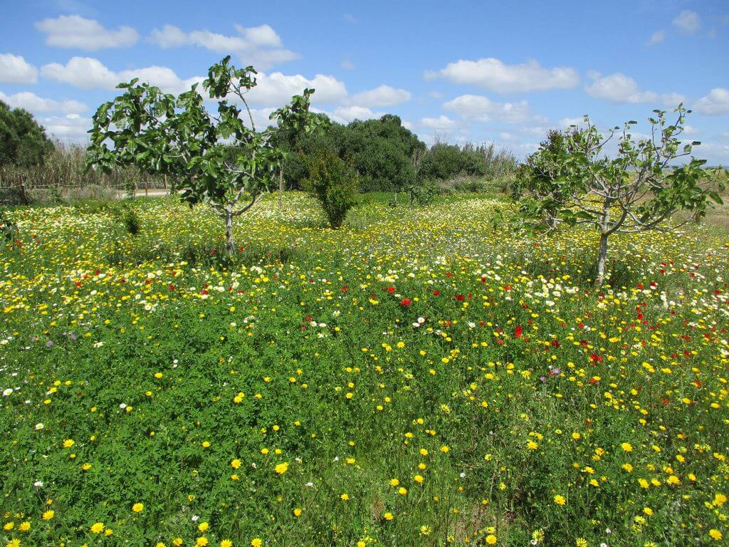

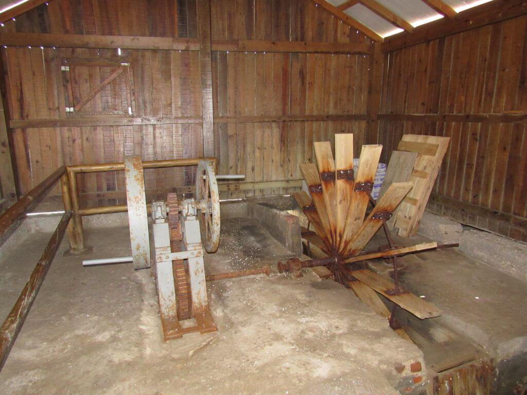


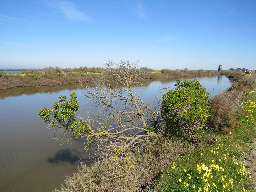


Event Description
This event will include a guided tour of the Samouco salt pans, with an emphasis on identifying the flora and fauna, especially the countless birds that inhabit this area. We will also learn about the culture and history linked to the salt pans.
Salinas do Samouco:
The salt pans complex, as the name suggests, is made up of several salt pans and their respective tanks, which decrease in size as you move inland, also increasing the complexity of the accesses. In addition to the tanks, there is an intricate system of ditches that supply the tanks with water from the river. The abandonment and degradation of some salt pans has led to the invasion of allophytic vegetation, which is subject to the tides, giving rise to patches of salt marsh.
Within its 360 hectares, which comprise the Salinas do Samouco complex, 170 species of birds have been detected to date. You can also see some Mirandese donkeys, which have their own space within the reserve.
The salt pans are highly eroded structures that require regular maintenance, which consists of maintaining the protective walls and partitions of the salt pans, cleaning the ditches and cisterns and preserving the sluice gates. Management allows this salt marsh to be one of the richest in water birds in the entire Tagus estuary and at the same time enables the development of some economic activities associated with the salt marshes.
The Tagus salt pans were once the largest salt producers in the country, but today only two produce salt, both in the Samouco salt pan: the semi-mechanised Brito salt pan and the Canto salt pan, which produces salt in the traditional way. At the Canto saltworks, traced salt, coarse salt and fleur-de-sal are produced; these products can be purchased at the Foundation's reception.
In some of these salt pans, water reservoirs, the water level allows some species of commercially valuable fish to grow, such as eel, sea bass, sea bream and sole, as well as a highly sought-after small shrimp, the prawn.
The walls of the salt pans have always been used for vegetable production as a way of supplementing the livelihood of the mariners. Some of the walls of the Samouco salt pans contain organically grown vegetables and fodder, as well as an orchard. Visitors can buy some of the produce from the garden and orchard during the harvest season.
In the Samouco salt pans, the salt pans are managed so that they can be used by the greatest number of water birds. In order to do this, it is essential to control the water levels suitable for birdlife, halt the spread of invasive vegetation and maintain favourable resting and nesting sites for waterfowl.
Note: This event/tour takes place in Portuguese.
Location
Meeting Point
At the entrance to Salinas do Samouco
Samouco salt pans complex 2890-532 Alcochete
Latitude: 38°44'36.77″N
Longitude: 8°58'52.79″W
Meeting time: 9h50
Estimated end time: 13h30
Route Features and Equipment
Circular
Circuit
Equipment
Footwear and clothing suitable for hiking
RESERVE
REGISTER NOW
215€ per person
- 245€ in a single room
Includes:
- Transport by coach/bus/tourist van from Lisbon to each of the places described above
• Alojamento em Hotel de 3 estrelas com pequeno-almoço incluído
- The proposed accommodation option includes various room types
- Guidance and support
- Personal accident insurance
- Civil liability insurance
Not included:
- All items not mentioned.
Comments:
- Only registrations made by 4.30pm on the day before the event will be eligible for Personal Accident Insurance.
- PLACES WILL BE FILLED WHEN PROOF OF PAYMENT IS RECEIVED
Data collection:
Personal information Name, date of birth and VAT number are required for personal accident insurance purposes.
Book:
After successfully submitting the bookingYou will be redirected to a confirmation page. If you have any difficulties making a booking, please contact contact us.
Registration Form
"*" indicates required fields
February
Timetable
(Saturday) 9:20 - 13:30
Meeting Point
Car park next to the Clube de Canoagem do Jamor restaurant
Event details
[fusion_builder_container admin_label="" hundred_percent="no" equal_height_columns="no" menu_anchor="" hide_on_mobile="small-visibility,medium-visibility,large-visibility" class="" id="" background_color="" background_image="" background_position="center center" background_repeat="no-repeat" fade="no" background_parallax="none" enable_mobile="no" parallax_speed="0.3" video_mp4="" video_webm="" video_ogv="" video_url="" video_aspect_ratio="16:9" video_loop="yes" video_mute="yes" video_preview_image="" border_color="#ea1717" border_style="solid" margin_top="10px" margin_bottom="10px" padding_top="25px"
Event details


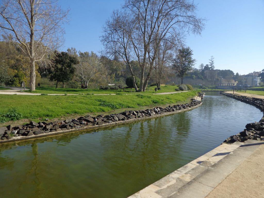


Event Description
In this event we'll be walking in the Jamor Valley area. We'll start our walk in the centre of this beautiful valley, through which the Jamor stream passes, and we'll follow trails that will take us to some points with excellent panoramic views of the ocean and the mouth of the Tagus, continuing on to the riverside area. Another event not to be missed!
These are some of the strengths of our journey:
- Jamor Valley;
- Esteiro Lighthouse;
- Chapel of Our Lady of Good Voyage;
- Mouth of the Jamor Stream;
- Riverside area;
- Jamor Urban Park;
- Natural landscapes;
Jamor Sports Complex:
In the 365 hectares of nature surrounding the Jamor National Sports Centre, four walking routes have been created (A, B, C and D), with varying degrees of difficulty, which can be walked informally or under the guidance of specialised technicians.
The degree of difficulty of the routes is determined by the accumulated gradient and the type of terrain.
The Jamor River:
The Jamor River is a river that rises in the Carregueira mountain range in the municipality of Sintra and flows into the Tagus River at Cruz Quebrada. It takes the name of Ribeira de Belas in the initial stretch upstream of the intersection with the Ribeira de Venda Seca.
The river runs through the gardens of the Palace of Queluz. Its course is channelled there, and there is a section about 130 metres long, delimited by gates and with tiled walls - the Canal dos Azulejos. When the canal's gates were closed, a plane of water was created where you could take a boat ride between representations of harbours, palaces and other themes.
Some of the points of interest on the walk
- Jamor Sports Complex - Mouth of the Jamor Stream - Riverside area - Esteiro Lighthouse - Chapel of Our Lady of Good Voyage - Jamor Urban Park - Natural landscapes -
Location
Meeting Point
Car park next to the Clube de Canoagem do Jamor restaurant
Latitude: 38°42'15.91″N
Longitude: 9°15'20.88″W
Jamor Sports Complex
Departure time: 9h20
Estimated end time: 13h30
Route Features and Equipment
Circular
Circuit
Equipment
Footwear and clothing suitable for hiking
RESERVE
REGISTER NOW
215€ per person
- 245€ in a single room
Includes:
- Transport by coach/bus/tourist van from Lisbon to each of the places described above
• Alojamento em Hotel de 3 estrelas com pequeno-almoço incluído
- The proposed accommodation option includes various room types
- Guidance and support
- Personal accident insurance
- Civil liability insurance
Not included:
- All items not mentioned.
Comments:
- Only registrations made by 4.30pm on the day before the event will be eligible for Personal Accident Insurance.
- PLACES WILL BE FILLED WHEN PROOF OF PAYMENT IS RECEIVED
Data collection:
Personal information Name, date of birth and VAT number are required for personal accident insurance purposes.
Book:
After successfully submitting the bookingYou will be redirected to a confirmation page. If you have any difficulties making a booking, please contact contact us.
Registration Form
"*" indicates required fields